
Daggett in San Bernardino County, California — The American West (Pacific Coastal)
C-Block
Right-Of-Way Marker

Photographed by Craig Baker, September 21, 2025
1. C-Block Marker
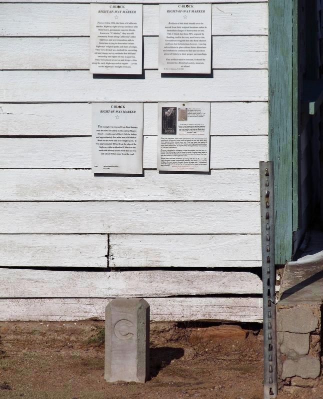
From 1914 to 1934, the State of California marked highway right-of-way corridors with these heavy, permanent concrete blocks. Known as "C-blocks," they are still commonly found along California's older highways and are tremendous aids to historians trying to determine various highways' original paths and dates of origin. They were devised as a method for correcting old and sloppy survey methods that left land ownership and rights-of-way in question. They were placed at curves and irregularities along the early highways and at regular ervals on the highways' straight stretches.
This example was rescued from flood damage near the town of Amboy in the central Mojave Desert .6 miles east of Roy's Cafe in Amboy and approximately five miles west of Kelbaker Road on the north side of US Highway 66. It was approximately 80 feet from the edge of the highway while an identical C-block on the south side directly across from this one was only about 50 feet away from the road.
Artifacts of this kind should never be moved from their original locations unless in immediate danger of destruction or
this page online
If an artifact must be rescued, it should be donated to a historical society, museum, or school.
Over the decades since their placement, the monuments have weathered differently. Some look the same as they did when they were placed while others have not. This has been the result of climatic conditions, forces of nature, and highway construction have either destroyed, or significantly damaged these monuments of highway trailblazing.
Anyone interested in following an older alignment can use the C blocks like following a trail of bread crumbs. Finding them takes a certain amount of detective work, but once you find your first one, the rest seem to come right into view.
Single slab concrete roadways go along with the C Blocks with their elevated curves, contractors stamps, and many beautiful
Photographed by Craig Baker, September 21, 2025
2. C-Block and Marker
photo captions:
· Left is a photo of a C-block on the Ridge Route US-99 in Los Angeles County. It is above a beautiful stretch of twin two-lane concrete, right along side I-5 near the town of Gorman.
· To the left you will find a blueprint of a C Block. In this blueprint you will see measurements for height, width, how long the bevel was, also exactly how long the copper wire was, along with exactly where and how tall the letter C was.
Erected 2001 by Daggett Historical Society.
Topics. This historical marker is listed in this topic list: Roads & Vehicles. A significant historical year for this entry is 1914.
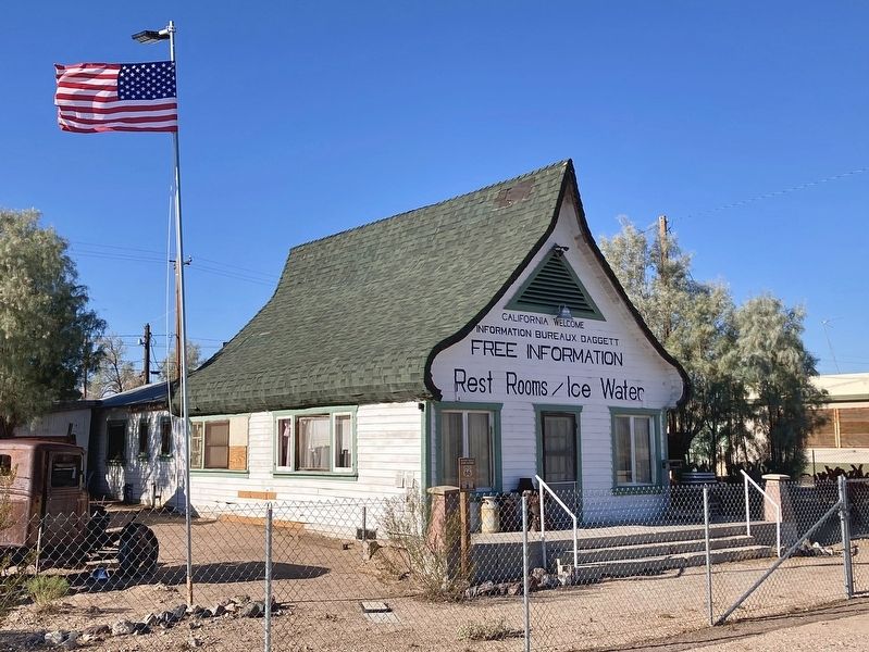
Location. 34° 51.749′ N, 116° 53.319′ W. Marker is in Daggett, California, in San Bernardino County. It is at the intersection of A Street and National Trails Highway (County Route 66), on the left when traveling north on A Street. Located at the historic “Russian House”. Touch for map. Marker is at or near this postal address: 35421 National Trails Hwy,

Photographed by Craig Baker, September 21, 2025
3. C-Block Marker

Regionally, this marker is in Greater Los Angeles, in the Mojave Desert, in the Peninsular Ranges, and specifically in the Transverse Ranges. It is also in the American Southwest. Globally, it is in North America, on the Ring of Fire, in the Pacific Rim, in the Western Hemisphere, in the Western World, and in the Anglosphere. Historically, it finds itself in what was once New Spain and also Mexico’s Alta California.
Other nearby markers. At least 8 other markers are within 4 miles of this marker, measured as the crow flies: The Russian House (here, next to this marker); 1956 Seagrave Pumper (a few steps from this marker); Alf’s Blacksmith Shop (approx. 0.2 miles away); The Stone Hotel (approx. ¼ mile away); Daggett (approx. ¼ mile away); The Daggett Ditch (approx. 0.3 miles away); Daggett Garage (approx. 0.3 miles away); Liberty Sculpture Park (approx. 4.1 miles away). Touch for a list and map of all markers in Daggett.
Photographed by Craig Baker, September 21, 2025
4. C-Block Marker
On the corner of the historic “Russian House“
Credits. This page was last revised on October 9, 2025. It was originally submitted on September 24, 2025, by Craig Baker of Sylmar, California. This page has been viewed 144 times since then and 67 times this year. Photos: 1, 2, 3, 4. submitted on September 24, 2025, by Craig Baker of Sylmar, California.
