Near Sanger in Oliver County, North Dakota — The American Midwest (Upper Plains)
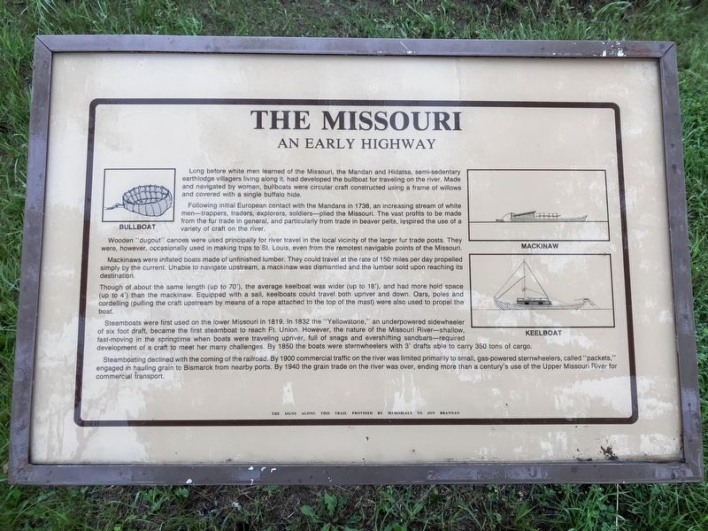
The Missouri: An Early Highway
Photographed by Barry Swackhamer, July 22, 2025
1. The Missouri: An Early Highway Marker
Following initial European contact with the Mandans in 1738, an increasing stream of white men--trappers, traders, explorers, soldiers--plied the Missouri. The vast profits to be made from the fur trade in general, and particularly from trade in beaver pelts, inspired the use of variety of craft on the river.
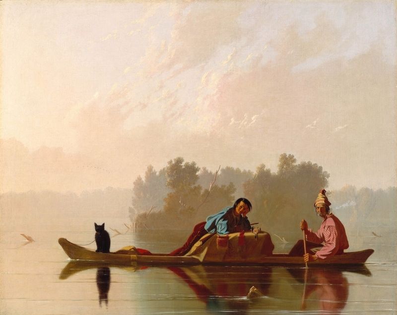
Wooden "dugout" canoes were used principally for river travel in the local vicinity of the larger fur trade posts. They were, however, occasionally used to make trips to St. Louis, even from the remote navigable points of the Missouri.
Mackinaws were inflated boats make of unfinished lumber, The could travel at the rate of 150 miles per day propelled simply by the current. Unable to navigate upstream, a mackinaw was dismantled and the lumber sold upon reaching its destination.
Though of
this page online
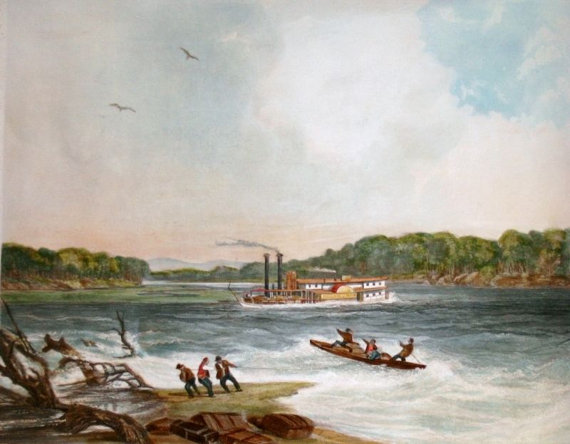
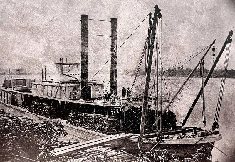
Steamboat were first used on the lower Missouri in 1819, In 1832 the "Yellowstone," an underpowered side-wheeler of six foot draft, became the first steamboat to reach Fort Union, However, the nature of the Missouri River --shallow, fast moving in the springtime when boats were traveling upriver, full of snags and ever shifting sand bars-- required development of a craft to meet her many challenges. By 1850 the boats were sternwheelers with 3' drafts able to carry 350 tons of cargo.
Steamboating declined with the coming of the railroad. By 1900 commercial traffic on the river was limited primarily to small gas-powered sternwheeler, called "packets,"engaged in hauling grain to Bismarck from nearby ports. By 1940 the grain trade on the river was over, ending more than a century's use

Photographed by Barry Swackhamer, July 22, 2025
2. The Missouri: An Early Highway Marker
Erected by North Dakota Parks and Recreation.
Topics. This historical marker is listed in this topic list: Waterways & Vessels. A significant historical year for this entry is 1738.
Location. 47° 13.15′ N, 100° 59.419′ W. Marker is near Sanger, North Dakota, in Oliver County. It can be reached from 22nd Avenue SouthWest (aka River Road) near 16th Street SouthWest. The maker is located in Cross Ranch State Park where the campground fronts the Missouri River. Touch for map. Marker is in this post office area: Center ND 58530, United States of America. Touch for directions.

Regionally, this marker is in the Standing Rock Sioux Tribe, on the Missouri Plateau, and in Greater Bismarck Area. It is also in the American Lewis & Clark Corridor, on the prairies, and on the Northern Plains. Globally, it is in North America, the Western Hemisphere, the Western World, and the Anglosphere. Historically, it finds itself in what was once Rupert’s Land and also the Louisiana Purchase.
Other nearby markers. At least 8 other markers are within 5 miles of this marker, measured as the
Photographed by Barry Swackhamer, July 23, 2025
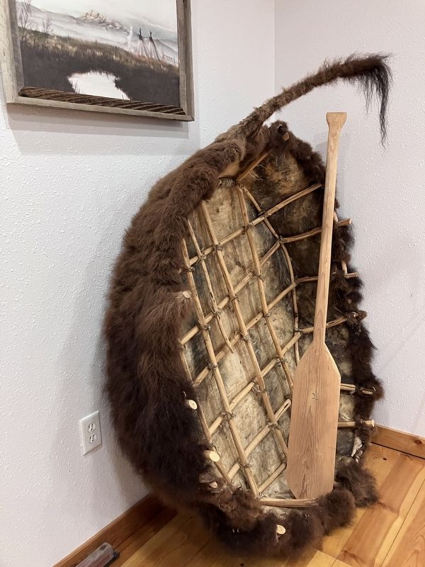
3. A bullboat
Photographed by George Caleb Bingham
4. dugout: from Fur Traders Descending the Missouri
Photographed by Barry Swackhamer, February 2, 2011
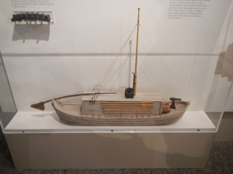
5. kellboat (model)
November 27, 2012
6. The steamboat "Yellowstone" after Karl Bodmer
Photographed by Barry Swackhamer, July 23, 2025
7. Upper-Missouri "Mountain" steamboat "Far West"
Credits. This page was last revised on September 27, 2025. It was originally submitted on September 27, 2025, by Barry Swackhamer of Brentwood, California. This page has been viewed 44 times since then and 13 times this year. Photos: 1, 2, 3, 4, 5, 6, 7. submitted on September 27, 2025, by Barry Swackhamer of Brentwood, California.
