Uniondale in Nassau County, New York — The American Northeast (Mid-Atlantic)
First Blind Takeoff, Flight and Landing, 1929
| — | IEEE Milestone in Electrical Engineering and Computing | — |

Photographed by Ian Lefkowitz, September 27, 2025
1. First Blind Takeoff, Flight and Landing, 1929 Marker
On 24 September 1929, the first blind takeoff, flight, and landing occurred at Mitchel Field, Garden City, NY in a Consolidated NY-2 biplane piloted by Lt. James Doolittle. Equipped with specially designed radio and aeronautical instrumentation, it represented the cooperative efforts of many organizations, mainly the Guggenheim Fund's Full Flight Laboratory, U.S. Army Air Corps, U.S. Dept. of Commerce, Sperry Gyroscope Company, Kollsman Instrument Company and Radio Frequency Laboratories.
September 2014
Erected 2014 by Institute of Electrical and Electronics Engineers.
Topics and series. This historical marker is listed in these topic lists: Air & Space • Science & Medicine. In addition, it is included in the IEEE Milestones in Electrical Engineering and Computing series list. A significant historical date for this entry is September 24, 1929.
Location. 40° 43.696′ N, 73° 35.862′ W. Marker is in Uniondale, New York, in Nassau County. It can be reached from Charles Lindbergh Boulevard west of Library Road West. Touch for map. Marker is at or near this postal address: Charles Lindbergh Boulevard, Uniondale NY 11553, United States
this page online

Regionally, this marker is in the New York City Metropolitan Area and on Long Island. It is also in the American Northeast, in the Mid-Atlantic, and on the Eastern Seaboard. Globally, it is in the North Atlantic Region, North America, the Western Hemisphere, the Western World, and the Anglosphere. Historically, it finds itself in what was once New Netherland and also one of the original Thirteen Colonies.
Other nearby markers. At least 8 other markers are within walking distance of this marker: Mitchel Field (a few steps from this marker); Lindbergh's Flight (within shouting distance of this marker); Sally Ride (within shouting distance of this marker); Mitchel Field Air Force Base (within shouting distance of this marker); Aviation Field No. 2 (within shouting distance of this marker); Grumman OV-1B Mohawk (within shouting distance of this marker); The Ninety-Nines (within shouting distance of this marker); F-14 Tomcat (about 300 feet away, measured in a direct line). Touch for a list and map of all markers in Uniondale.
Also see . . .
1. Plaque Dedication Ceremony of the First Blind Takeoff, Flight and Landing.
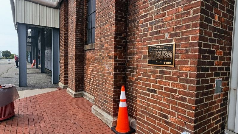
Photographed by Ian Lefkowitz, September 27, 2025
2. First Blind Takeoff, Flight and Landing, 1929 Marker
The milestone plaque will be installed in the Mitchel Field Flight Safety exhibit at the Cradle just a few hundred feet from where the flight’s takeoff and landing originated.(Submitted on September 28, 2025, by Ian Lefkowitz of New York, New York.)
2. First Blind Takeoff, Flight and Landing, 1929.
In Doolittle’s own words, “We both got into the plane, and the hood over my cockpit was tightly closed. I taxied out and took off toward the west in a gradual climb. At about 1,000 feet, I leveled off and made a 180-degree turn to the left, flew several miles, then made another left turn. The airplane was now properly lined up on the west leg of the Mitchel range, so I started a gradual descent, I leveled off at 200 feet and flew level until I passed the fan marker on the east end of the field. From this point I flew the plane down to the ground using the instrument landing procedure we had developed. The whole flight lasted only 15 minutes. So far as I know, this was the first time an airplane had taken off, flown over a set course, and landed by instruments alone.”(Submitted on September 28, 2025, by Ian Lefkowitz of New York, New York.)
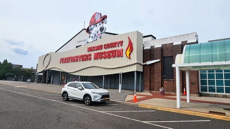
Photographed by Ian Lefkowitz, September 27, 2025
3. Nassau County Firefighters Museum
The plaque is located on a former building at Mitchel Field that is now home to the Cradle of Aviation Museum, adjacent to this museum on Museum Row.
Credits. This page was last revised on October 1, 2025. It was originally submitted on September 28, 2025, by Ian Lefkowitz of New York, New York. This page has been viewed 69 times since then and 33 times this year. Photos: 1, 2, 3. submitted on September 28, 2025, by Ian Lefkowitz of New York, New York. • Andrew Ruppenstein was the editor who published this page.
