Klamath in Del Norte County, California — The American West (Pacific Coastal)
River on the Rampage
Photographed by William Thievon, July 20, 2025
1. River on the Rampage Marker
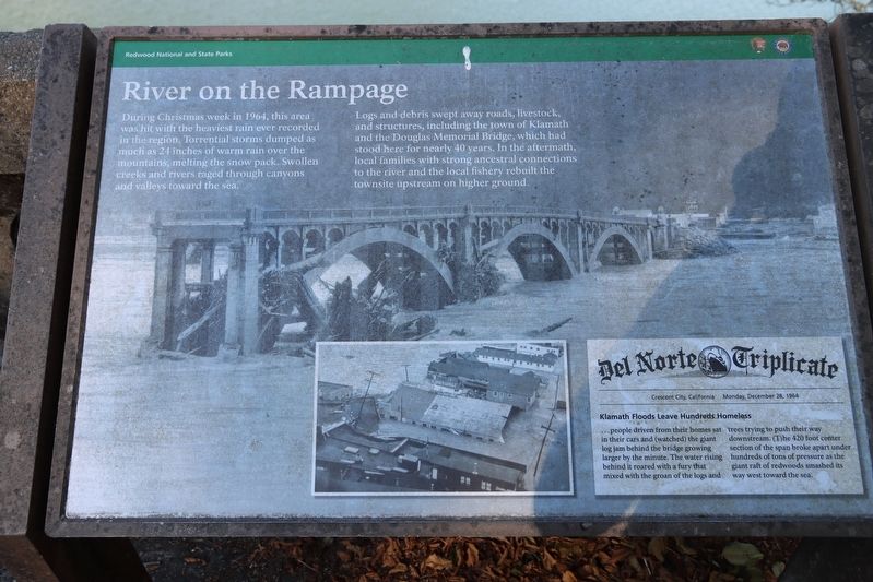
During Christmas week in 1964, this area) was hit with the heaviest rain ever recorded in the region, Torrential storms dumped as much as 21 inches of warm rain over the mountains, melting the snow pack. Swollen creeks and rivers raged through canyons and valleys toward the sea.
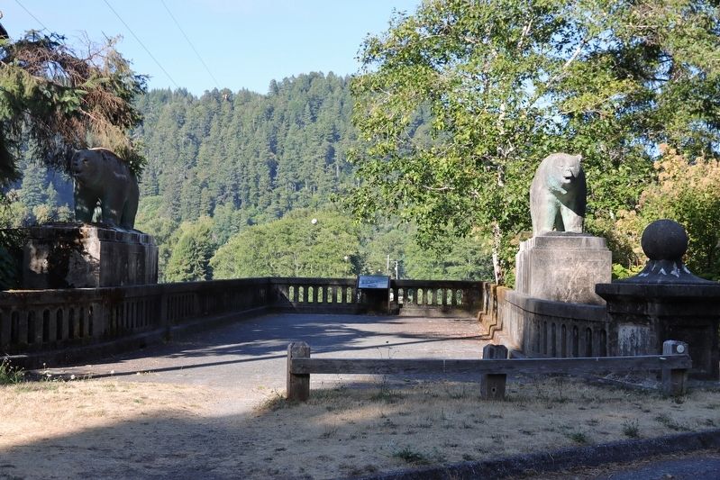
Logs and debris swept away roads, livestock, and structures, including the town of Klamath and the Douglas Memorial Bridge, which had stood here for nearly 40 years. In the aftermath, local families with strong ancestral connections to the river and the local fishery rebuilt the townsite upstream on higher ground.
Erected by National Park Service.
Topics. This historical marker is listed in these topic lists: Bridges & Viaducts • Disasters • Waterways & Vessels. A significant historical date for this entry is December 28, 1964.
Location. 41° 31.445′ N, 124° 2.708′ W. Marker is in Klamath, California, in Del Norte County. It can be reached from the intersection of Klamath Beach Road and Coastal Drive, on the right when traveling north.
Del Norte Triplicate
Crescent City California Monday, December 28, 1964
Klamath Floods Leave Hundreds Homeless
…people
this page online

Regionally, this marker is in the North Coast, specifically on the Coast Ranges, and in the Klamath Mountains. It is also on the American Pacific Coast and in the Pacific Northwest. Globally, it is in North America, on the Ring of Fire, on the Pacific Rim, in the Western Hemisphere, in the Western World, and in the Anglosphere. Historically, it finds itself in what was once New Spain and also Mexico’s Alta California.
Other nearby markers. At least 8 other markers are within 12 miles of this marker, measured as the crow flies: Captain Courageous (approx. half a mile away); Disguised to Protect (approx.
Photographed by William Thievon, July 20, 2025
2. Remainder of Bridge and Marker
Credits. This page was last revised on September 28, 2025. It was originally submitted on September 28, 2025, by William Thievon of Hofheim am Taunus, Germany. This page has been viewed 60 times since then and 31 times this year. Photos: 1, 2. submitted on September 28, 2025, by William Thievon of Hofheim am Taunus, Germany. • Andrew Ruppenstein was the editor who published this page.
