Mille Lacs Kathio State Park near Onamia in Mille Lacs County, Minnesota — The American Midwest (Upper Plains)
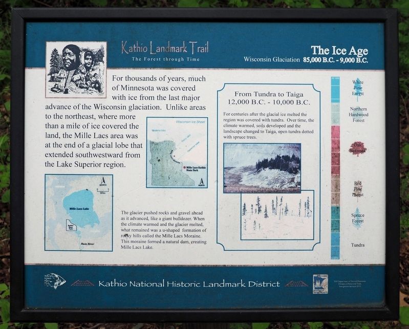
The Ice Age
Wisconsin Glaciation 85,000 B.C. – 9,000 B.C.
| — | Kathio National Historic Landmark District | — |
Photographed by McGhiever, May 29, 2025
1. The Ice Age Marker
For thousands of years, much of Minnesota was covered with ice from the last major advance of the Wisconsin glaciation. Unlike areas to the northeast, where more than a mile of ice covered the land, the Mille Lacs area was at the end of a glacial lobe that extended southwestward from the Lake Superior region.
The glacier pushed rocks and gravel ahead as it advanced, like a giant bulldozer. When the climate warmed and the glacier melted, what remained was a u-shaped formation of rocky hills called the Mille Lacs Moraine. This moraine formed a natural dam, creating Mille Lacs Lake.
From Tundra to Taiga
12,000 B.C. - 10,000 B.C.
For centuries after the glacial ice melted the region was covered with tundra. Over time, the climate warmed, soils developed and the landscape changed to Taiga, open tundra dotted with spruce trees.
Erected by Minnesota Department of Natural Resources.
Topics. This historical marker is listed in this topic list: Environment.
Location. 46° 8.932′ N, 93° 46.107′ W. Marker is near Onamia, Minnesota, in Mille Lacs County. It is in
this page online

Regionally, this marker is in Central Minnesota. It is also in the American Midwest and in the Corn Belt. Globally, it is in North America, the Western Hemisphere, the Western World, and the Anglosphere. Historically, it finds itself in what was once Rupert’s Land, the territory of the Mississippian Culture, and the Northwest Territory.
Other nearby markers. At least 8 other markers are within walking distance of this marker: Removal, Restoration, Reuse (here, next to this marker); The Forest through Time (a few steps from this marker); Spruce Forest (within shouting distance of this marker); Red Pine & Jack Pine Forest (within shouting distance of this marker); Reading the Cultural Landscape (within shouting distance of this marker); Family Homesteads (about 300 feet away, measured in a direct line); Oak Savanna (about 400 feet away); The Wilford Site (about 400 feet away).

Photographed by McGhiever, May 29, 2025
2. The Ice Age Marker (left) on the Kathio Landmark Trail
Credits. This page was last revised on September 28, 2025. It was originally submitted on September 28, 2025, by McGhiever of Minneapolis, Minnesota. This page has been viewed 70 times since then and 27 times this year. Photos: 1, 2. submitted on September 28, 2025, by McGhiever of Minneapolis, Minnesota.
