Lake Ridge in Prince William County, Virginia — The American South (Mid-Atlantic)
Washington’s First Journey to the Frontier
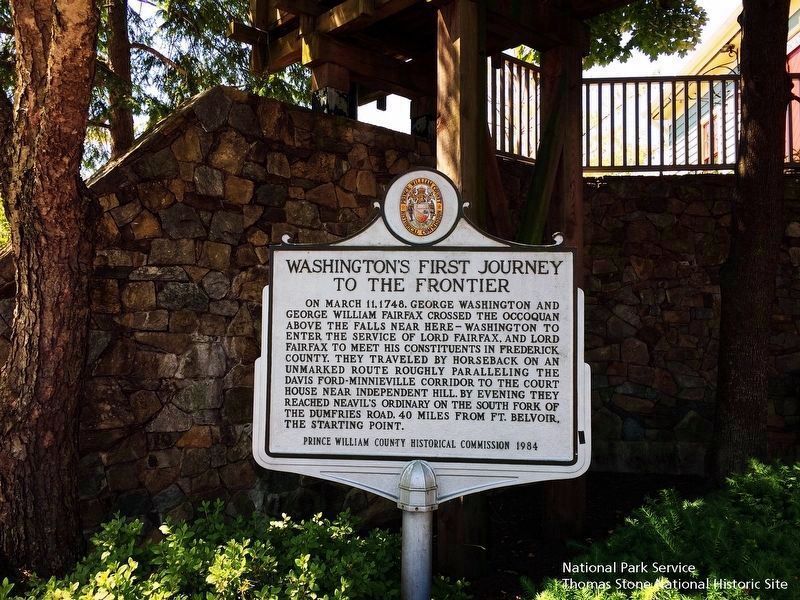
National Park Service, Thomas Stone National Historic Site, June 4, 2019
1. Washington’s First Journey to the Frontier Marker
Erected 1984 by Prince William County Historical Commission. (Marker Number 29.)
Topics and series. This historical marker is listed in these topic lists: Colonial Era • Exploration. In addition, it is included in the Virginia, Prince William County Historical Commission series list. A significant historical date for this entry is March 11, 1748.
Location. 38° 40.491′ N, 77° 16.87′ W. Marker is in Lake Ridge, Virginia, in Prince William County. It can be reached from Tacketts Mill Drive. The marker is located in Tackett’s Mill Shopping Center, next to The Old Mill. To reach it, enter the shopping center via Tackett’s Mill Drive by
this page online

Regionally, this marker is in the Washington Metropolitan Area, in Northern Virginia, and in the Piedmont. It is also in the American South, specifically in the Upper South, in the Mid-Atlantic, and on the Eastern Seaboard. Globally, it is in the North Atlantic Region, North America, the Western Hemisphere, the Western World, and the Anglosphere. Historically, it finds itself in what was once the territory of the Mississippian Culture, one of the original Thirteen Colonies, one of the Confederate States of America, and the Antebellum South.
Other nearby markers. At least 8 other markers are within walking distance of this marker: K. Jack Kooyoomian, Ph.D. (within shouting distance of this marker); Donna Randall "Randi" Reid (within shouting distance of this marker); Trevor Blake (within shouting distance of this marker); Deloris Hampton (within shouting distance of this marker); Lillie Gallman Jessie (within shouting distance
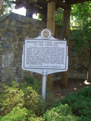
Photographed by Kevin White, September 6, 2007
2. Washington’s First Journey to the Frontier Marker
That's The Old Mill sluice above it.
More about this marker. The Marker is located in Tackett’s Mill Shopping Center. Tackett’s Mill is named after an old 18th Century grist mill which was reconstructed on the north shore of the lake. The old remains were donated by Mrs. Ursula Ermert and the remains were reassembled as The Old Mill to recreate a part of our American heritage for the benefit of residents and visitors who come to Tackett’s Mill.
The mill is powered by a 4 foot wide by 14 foot diameter overshot waterwheel which transmits power to an 8 foor diameter giant cog wheel mounted on 24" diameter oak shafts. Steel gudgeons are forced into the ends of the wooden waterwheel and gear shafts held in place by gudgeon bands which are made fast to the wood shafts by gudgeon band bolts. Bearings are mated to the gudgeon shafts and fastened to bearing mounts bolted to the stone foundation. A mill pond supplies the water fed to the waterwheel
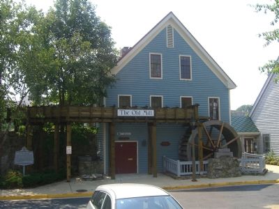
Photographed by Kevin White, September 6, 2007
3. Washington’s First Journey to the Frontier Marker, in front of The Old Mill
The Marker and The Old Mill can be seen in picture 2.
Regarding Washington’s First Journey to the Frontier. “...the Court House near Independent Hill...” refers to the second Prince William County Court House, located on Cedar Run.
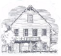
4. Artist's Rendition of Tackett's Mill
Illustration obtained from the Tackett's Mill Shopping Center website, http://www.tackettsmill.com
Credits. This page was last revised on October 1, 2025. It was originally submitted on September 6, 2007, by Kevin W. of Stafford, Virginia. This page has been viewed 2,536 times since then and 51 times this year. Last updated on September 30, 2025, by N. Jozsa of Woodbridge, Virginia. Photos: 1. submitted on September 21, 2019. 2, 3, 4. submitted on September 6, 2007, by Kevin W. of Stafford, Virginia. • J. Makali Bruton was the editor who published this page.
