Irving in Dallas County, Texas — The American South (West South Central)
The Iron Bridge at Eagle Ford Crossing

Photographed by Mansfieldphoto.com, August 27, 2025
1. The Iron Bridge at Eagle Ford Crossing Marker
During the 1930s, Bonnie Parker, of the notorious Barrow Gang, wrote a poem about this crossing. The 13th stanza from the poem "The Trail's End" reads:
"From Irving to West Dallas Viaduct, is known as the great divide. Where the women are kin; and the men are men, and they won't "stool" on Bonnie and Clyde." - Bonnie Parker
"The great divide" that Bonnie refers to in her poem is the area from the former bridge here at Eagle Ford Crossing to the viaduct bridge in Dallas, now called the Continental Avenue Bridge. Bonnie Parker, Clyde Barrow and their gang used the iron bridge at Eagle Ford Crossing to make their getaways from Dallas police into the mostly rural Irving countryside. Today, when standing on the bank, you can still see a concrete piling from the old iron bridge on the opposite side of the West Fork.
Erected 2015 by City of Irving.
Topics. This historical marker is
this page online
Location. 32° 47.233′ N, 96° 54.936′ W. Marker is in Irving, Texas, in Dallas County. It is on South Loop 12 one mile south of E Shady Grove Rd. The marker is located on the north side of the bridge along the Champion Hiking Trail. Touch for map. Marker is at or near this postal address: 2244 S Loop 12, Irving TX 75060, United States of America. Touch for directions.

Regionally, this marker is in the Prairies & Lakes Region and in the Dallas-Fort Worth Metropolitan Area. Globally, it is in North America, a Gulf of Mexico state, the Western Hemisphere, the Western World, and the Anglosphere. Historically, it finds itself in what was once New Spain, the Republic of Texas, one of the Confederate States of America, and the Antebellum South.
Other nearby markers. At least 8 other markers are within 3 miles of this marker, measured as the crow flies: El Camposanto de Cemento Grande de la Compania Trinity Portland (approx. 0.7 miles away); General Ignacio Zaragoza (approx. ¾ mile away); Eagle Ford Community (approx.
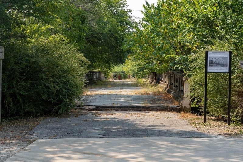
Photographed by Mansfieldphoto.com, August 27, 2025
2. The Iron Bridge at Eagle Ford Crossing and Marker
Credits. This page was last revised on October 2, 2025. It was originally submitted on October 2, 2025, by James Hulse of Medina, Texas. This page has been viewed 353 times since then and 260 times this year. Photos: 1, 2. submitted on October 2, 2025, by James Hulse of Medina, Texas.
