Greenville in Hunt County, Texas — The American South (West South Central)
Transportation
Railroads, Highways, Interstate
⎯⎯⎯
Blackland Prairie
Rich Black Soil

Photographed by James Hulse, July 28, 2025
1. Transportation / Blackland Prairie Marker
Although it took a while for the surrounding communities to get paved streets (Commerce, 1920; Celeste, 1935) the first paved U.S. transcontinental highway passed through Greenville. Started in 1916 and named Bankhead Highway after U.S. Senator John Bankhead, the highway extended from Washington, D.C. to San Diego by way of Alabama, home of Senator Bankhead. Its path crossed approximately 850 miles of Texas, from Texarkana to El Paso. It was designated Texas State Highway 1 in 1917 by the Texas Highway Department and roughly followed what became U.S. 67 and U.S. 80. It was an engineered roadway for local and regional traffic, as well as military use. It brought a new industry, highway tourism, to Texas. State Highway 1 came through downtown Greenville on what is now U.S. 67.
The Jefferson Highway, established in 1915, was named for President Thomas Jefferson. It was a result of the early twentieth century's Good Roads movement. Its route followed existing roads that extended from Winnipeg to New Orleans. In this way it passed through Minnesota, lowa, Missouri, Arkansas, Kansas, Oklahoma, Texas, and Louisiana on different routes. It came through Greenville on what is now Hwy 69.
Interstate
this page online
Captions
(Photo #1) Groundbreaking ceremony for first hard-paved road out of Greenville
(Photo #2) Groundbreaking ceremony of new paved road leading into Greenville, 1920
(Photo #3) Aerial view of I-30, Wesley St., and downtown Greenville
Reverse Side
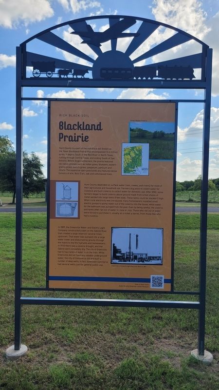
Hunt County is a part of the rich black soil known as the Texas Blackland Prairie that encompassed 12.6 million acres. It begins South of the Red River in North Texas, cutting through Central Texas, and ending South of San Antonio. Before Anglo settlement, the prairie featured tall native grasses such as Indian grass, bluestem,
Photographed by James Hulse, July 28, 2025
2. Transportation / Blackland Prairie Marker - Reverse Side
Hunt County depended on surface water (rain, creeks, and rivers) for most of their agricultural and household use. Farmers dug pools to collect water for livestock and built cisterns to collect water for domestic use. After WWI, some farmers began to build cisterns above ground made from 4-foot sheets of metal welded into large tanks 8 feet wide. These tanks could be stacked 3 high. When rural electricity was introduced, many homeowners installed small electric pumps to pump water out of the cisterns into the house, while water for the bathroom was pumped from the pool. Even by being careful, the cisterns and tanks often ran out of water in June or July. Those who ran out of water were forced to purchase it, usually at a nickel a barrel, from those few who had a surplus.
In 1889, the Greenville Water and Electric Light Company constructed a dam on the Sabine River that created a large reservoir several miles upstream. That water was pumped into a large water tower
Photographed by James Hulse, July 28, 2025
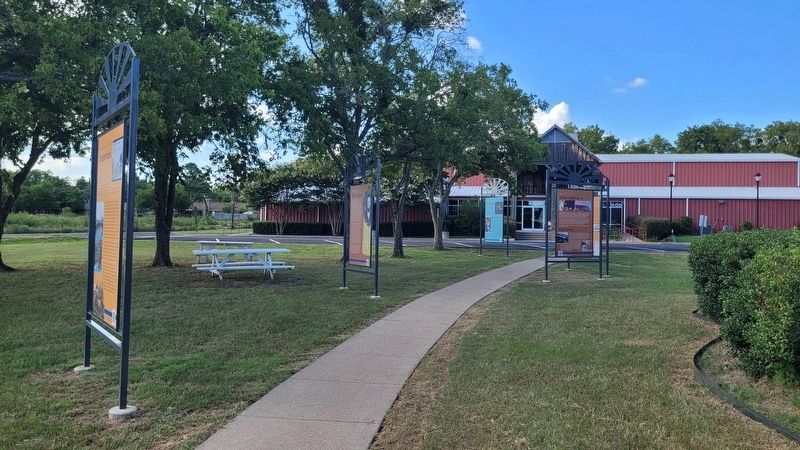
3. The view of the marker on the left of the walkway
Captions
(Photo #1) Clymer Meadow Preserve
(Photo #2) Greenville's first electric light plant, built March 4, 1891
Erected by Audie Murphy / American Cotton Museum.
Topics. This historical marker is listed in these topic lists: Horticulture & Forestry • Industry & Commerce • Roads & Vehicles. A significant historical year for this entry is 1880.
Location. 33° 7.523′ N, 96° 5.373′ W. Marker is in Greenville, Texas, in Hunt County. It is on Interstate 30 Frontage Road ¼ mile west of Division Street, on the right when traveling west. The marker is located on the grounds of the Audie Murphy / American Cotton Museum. Touch for map. Marker is at or near this postal address: 600 I-30 Frontage Rd, Greenville TX 75401, United States of America. Touch for directions.

Regionally, this marker is in the Prairies & Lakes Region and in the Dallas-Fort Worth Metropolitan Area. It is also in the American South. Globally, it is in North America, a Gulf of Mexico state, the Western Hemisphere, the Western World, and the Anglosphere. Historically, it finds itself in what was once New Spain, the Republic of Texas, one of the Confederate States of America, and the Antebellum South.
Other nearby markers. At least 8 other markers are within walking distance of this marker: Early Settlers / Mercer Colony (here, next to this marker); Ende-Gaillard House (a few steps from this marker); Industry & Businesses (a few steps from this marker); Industry & Business (a few steps from this marker); Hometown Musicians (a few steps from this marker); The Sixties (within shouting distance of this marker); Sports (within shouting distance of this marker); Early Industry & Business (within shouting distance of this marker). Touch for a list and map of all markers in Greenville.
Credits. This page was last revised on October 3, 2025. It was originally submitted on October 2, 2025, by James Hulse of Medina, Texas. This page has been viewed 73 times since then and 24 times this year. Photos: 1, 2, 3. submitted on October 3, 2025, by James Hulse of Medina, Texas.
