Russellville in Franklin County, Alabama — The American South (East South Central)
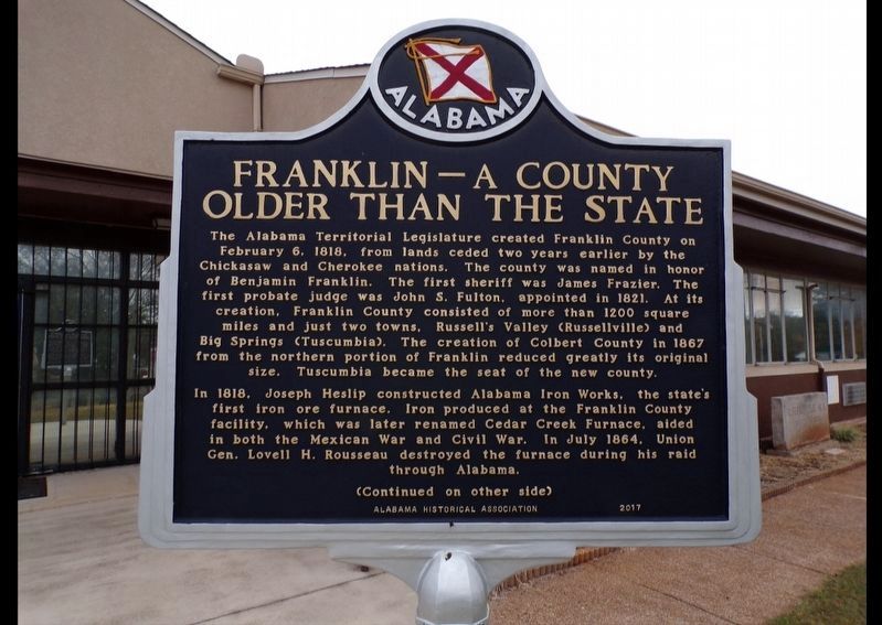
Franklin -- A County Older than the State
Photographed by Jimmy Emerson, 2022
1. Franklin -- A County Older than the State Marker
In 1818, Joseph Heslip constructed Alabama Iron Works, the state's first iron ore furnace. Iron produced at the Franklin County facility, which was later renamed Cedar Creek Furnace, aided in both the Mexican War and Civil War. In July 1864, Union Gen. Lovell H. Rousseau destroyed the furnace during his raid through Alabama.
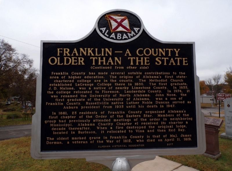
Reverse Side
Franklin County has made several notable contributions to the area of higher education. The origins of Alabama's first state- chartered college are in the
this page online
In 1881, 25 residents of Franklin County organized Alabama's first chapter of the Order of the Eastern Star. Members of the group had previously attended meetings of the order in neighboring Mississippi. Alabama Charity Chapter 1 received its charter a decade thereafter. When a fire destroyed the original lodge, located in Burleson, it relocated to Vina and then Red Bay. The oldest marked grave in Franklin County is that of Maj. James Dorman, a veteran of the War of 1812, who died on April 11, 1819.
Erected 2017 by Alabama Historical Association.
Topics. This historical marker is listed in these topic lists: Industry & Commerce • Settlements & Settlers
Photographed by Jimmy Emerson, 2022
2. Franklin -- A County Older than the State Marker - Reverse Side
Location. 34° 30.46′ N, 87° 43.532′ W. Marker is in Russellville, Alabama, in Franklin County. It is at the intersection of East Limestone Street and Carroll Ave N, on the right when traveling west on East Limestone Street. Marker is located in front of the Franklin County Archives. Touch for map. Marker is at or near this postal address: 300 East Limestone Street, Russellville AL 35653, United States of America. Touch for directions.

Regionally, this marker is in North Alabama. It is also in the American South, specifically in the Deep South, in Appalachia, and specifically in Southern Appalachia. Globally, it is in North America, a Gulf of Mexico state, the Western Hemisphere, the Western World, and the Anglosphere. Historically, it finds itself in what was once the territory of the Mississippian Culture, one of the Confederate States of America, and the Antebellum South.
Other nearby markers. At least 8 other markers are within 3 miles of this marker, measured as the crow flies: History of Russellville (approx. 0.2 miles away); Russellville First Baptist Church (approx. ¼ mile away); Historic Roxy Theatre (approx. ¼ mile away); Russellville (approx. 0.3 miles away); Reedtown High School (approx. one mile away); Ascension (approx. 1.2 miles away); Birth of a Town (approx. 1.9 miles away); Cedar Creek Furnace (approx. 2.9 miles away). Touch for a list and map of all markers in Russellville.
Credits. This page was last revised on October 3, 2025. It was originally submitted on October 3, 2025, by Jimmy Emerson of Dalton, Georgia. This page has been viewed 164 times since then and 103 times this year. Photos: 1, 2. submitted on October 3, 2025, by Jimmy Emerson of Dalton, Georgia. • James Hulse was the editor who published this page.
Editor’s want-list for this marker. A wide view photo of the marker and the surrounding area together in context. • Can you help?
