
Near Sharpsburg in Washington County, Maryland — The American Northeast (Mid-Atlantic)
D. H. Hill’s Division, Jackson’s Command

Photographed by Mike McKeown, October 11, 2025
1. D. H. Hill’s Division, Jackson’s Command Marker
D. H. Hill’s Division, Jackson’s Command.
Maj. Gen. Daniel H. Hill, Commanding.
September 17, 1862.
Early on the 17th the Brigades of Ripley, Colquitt and Garland advanced across the Smoketown Road in support of Hood’s Division. After heavy losses they were obliged to retire, Ripley to the West Woods, Colquitt and Garland to the western end of the Bloody Lane. Rodes and G. R. Anderson’s Brigades took position in the Bloody Lane, farther east, and, supported by R. H. Anderson’s Division, withstood several assaults of French’s and Richardson’s Divisions of Sumner’s Corps. Early in the afternoon the Division retired to a position in Piper’s Lane extending to and along this road and into the fields west of the Hagerstown Pike.
No. 333.
Erected by Antietam Battlefield Board. (Marker Number 333.)
Topics and series. This historical marker is listed in this topic list: War, US Civil. In addition, it is included in the Antietam Campaign War Department Markers series list. A significant historical date for this entry is September 17, 1862.
Location. 39° 28.075′ N, 77° 44.703′ W. Marker is near Sharpsburg, Maryland, in Washington
this page online

Regionally, this marker is in Western Maryland. It is also in the American Mid-Atlantic, in Appalachia, and specifically in Northern Appalachia. Globally, it is in North America, the Western Hemisphere, the Western World, and the Anglosphere. Historically, it finds itself in what was once one of the original Thirteen Colonies.
Other nearby markers. At least 8 other markers are within walking distance of this marker: Anderson’s Division, Longstreet’s Command (here, next to this marker); A.N.V. (here, next to this marker); D.H. Hill's Division, Jackson's Command (about 600 feet away, measured in a direct line); Longstreet's Command (approx. 0.2 miles away); a different marker also named Longstreet's Command (approx. 0.2 miles away); Colquitt's and Garland's Brigades (approx. 0.2 miles away); a different marker also named Longstreet's Command (approx. ¼ mile away); Sixth Army Corps (approx.

Photographed by Mike McKeown, October 5, 2025
2. D. H. Hill’s Division, Jackson’s Command Marker
Also see . . .
1. D. H. Hill’s Division, Jackson’s Command (Antietman on the web). (Submitted on October 5, 2025, by Mike McKeown of Baltimore, Maryland.)
2. Antietman National Battlefield (National Park Service). (Submitted on October 5, 2025, by Mike McKeown of Baltimore, Maryland.)
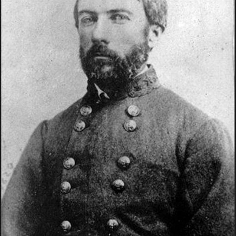
Library of Congress
3. Confederate Gen. D.H. Hill
Credits. This page was last revised on October 20, 2025. It was originally submitted on October 5, 2025, by Mike McKeown of Baltimore, Maryland. This page has been viewed 63 times since then and 18 times this year. Photos: 1, 2. submitted on October 5, 2025, by Mike McKeown of Baltimore, Maryland. 3. submitted on October 6, 2025, by Mike McKeown of Baltimore, Maryland. • Bernard Fisher was the editor who published this page.
