Near Rowe in San Miguel County, New Mexico — The American Mountains (Southwest)
Pecos National Historical Park
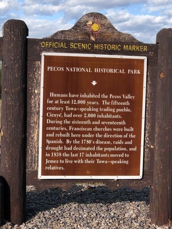
Photographed by Duane and Tracy Marsteller, September 24, 2025
1. Pecos National Historical Park Marker, Side One
Within the boundaries of Pecos National Historic Park are ruts from the Santa Fe Trail, the site of the 1862 Civil War Battle at Glorieta Pass, and the 20th century cattle ranching operation of the Forked Lightning Ranch, where movie actress Greer Garson once lived. Today the valley is home to long-time residents and attracts many visitors.
Erected by New Mexico Historic Preservation Division. (Marker Number 203.)
Topics. This historical marker is listed in this topic list: Indigenous Peoples and Communities. A significant historical year for this entry is 1838.
Location. 35° 30.901′ N, 105° 40.753′ W. Marker is near Rowe, New Mexico, in San Miguel County. It
this page online

Regionally, this marker is in Northern New Mexico. It is also in the American Southwest, in the Mountain West, and on the Santa Fe Trail Corridor. Globally, it is in North America, the Rocky Mountains, the Western Hemisphere, the Western World, and the Anglosphere. Historically, it finds itself in what was once New Spain and also the territory of the Ancestral Puebloans.
Other nearby markers. At least 8 other markers are within 3 miles of this marker, measured as the crow flies: Kosloski's Historic Stagecoach Stop and Trading Post (approx. 1.7 miles away); Architecture as Artifact (approx. 2.4 miles away); Practical Adaptations (approx. 2.4 miles away); Last Church (approx. 2½ miles away); Pueblo Revolt (approx. 2½ miles away); Pecos Pueblo Mission (approx. 2½ miles away); Mission Churches (approx. 2½ miles away); Mighty Pueblo (approx. 2½ miles
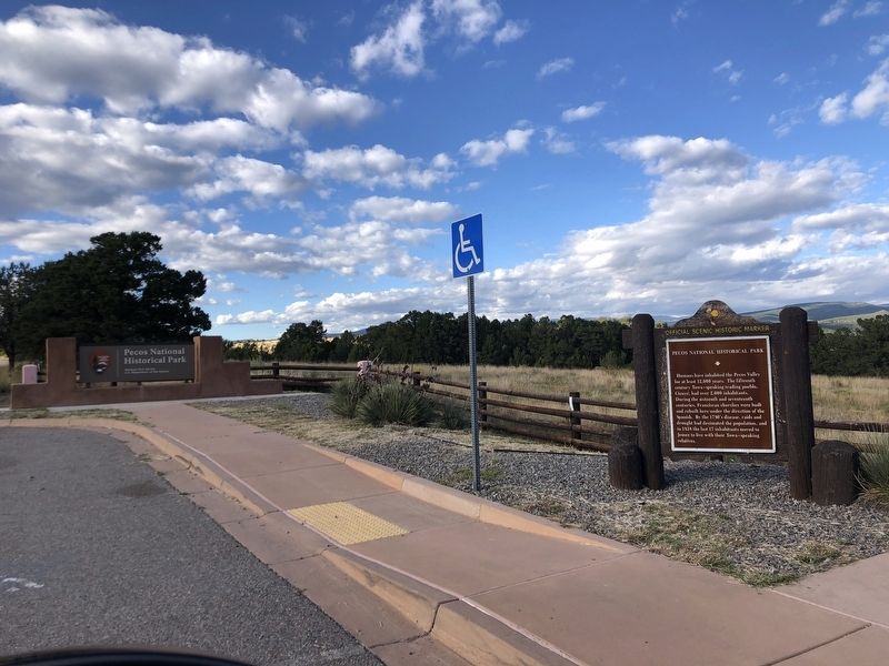
Photographed by Duane and Tracy Marsteller, September 24, 2025
2. Pecos National Historical Park Marker
More about this marker. Side two inscription (unverified) taken from undated New Mexico Historic Preservation Division historical marker database.
Also see . . . History & Culture: The Human Stories of a Southwestern Gateway. Glorieta Pass drew us here. This low passage between the Sangre de Cristo Mountains and the high tableland of Glorieta Mesa invited people. Local stories of human culture began with nomadic hunters, followed by Indigenous peoples of the Pueblos and Plains. In their footsteps came the Spanish colonists, the Mexican and Anglo armies, Santa Fe Trail travelers, and tourists on the railroad. Route 66 and Interstate 25 follow these familiar paths too. (National Park Service) (Submitted on October 7, 2025, by Duane and Tracy Marsteller of Murfreesboro, Tennessee.)
Credits. This page was last revised on October 7, 2025. It was originally submitted on October 7, 2025, by Duane and Tracy Marsteller of Murfreesboro, Tennessee. This page has been viewed 70 times since then and 21 times this year. Photos: 1, 2. submitted on October 7, 2025, by Duane and Tracy Marsteller of Murfreesboro, Tennessee.
Editor’s want-list for this marker. Closeup photograph of side 2 of marker • Can you help?
