Near Glorieta in Santa Fe County, New Mexico — The American Mountains (Southwest)
Glorieta Pass Battlefield
National Historic Landmark, 1961
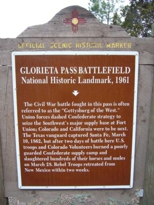
Photographed by Bill Kirchner, April 16, 2012
1. Glorieta Pass Battlefield Marker
Erected by New Mexico Historic Preservation Division. (Marker Number 116.)
Topics. This historical marker is listed in this topic list: War, US Civil. A significant historical date for this entry is March 28, 1862.
Location. 35° 34.471′ N, 105° 45.533′ W. Marker is near Glorieta, New Mexico, in Santa Fe County. It is on State Highway 50 0.8 miles east of Interstate 25, on the right when traveling east. Marker is located east of Exit 299 off I-25. Touch for map. Marker is in this post office area: Glorieta NM 87535, United States of America. Touch for directions.

Regionally, this marker is in Northern New Mexico.
this page online
Other nearby markers. At least 8 other markers are within 5 miles of this marker, measured as the crow flies: A different marker also named Glorieta Pass Battlefield (here, next to this marker); The Battle of Glorieta Pass (approx. 0.9 miles away); Colorado Volunteers at the Battles of Glorieta Pass (approx. 0.9 miles away); New Mexico Volunteers at Battle of Glorieta Pass (approx. 0.9 miles away); Sibley's Brigade Memorial (approx. 0.9 miles away); Trash is Treasure (approx. 4.1 miles away); A Day in Pueblo Life (approx. 4.1 miles away); Precious Water (approx. 4.1 miles away). Touch for a list and map of all markers in Glorieta.
Another marker is no longer nearby. Glorieta Battlefield (was a few steps from this marker but has been permanently removed).
More about this marker. The Official Scenic Historic Marker
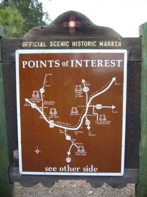
Photographed by Bill Kirchner, April 16, 2012
2. Rear of: Glorieta Pass Battlefield Marker
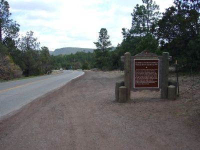
Photographed by Bill Kirchner, April 16, 2012
3. Glorieta Pass Battlefield Marker
Credits. This page was last revised on October 22, 2025. It was originally submitted on May 8, 2012, by Bill Kirchner of Tucson, Arizona. This page has been viewed 4,616 times since then and 458 times this year. Last updated on October 7, 2025. Photos: 1, 2, 3. submitted on May 8, 2012, by Bill Kirchner of Tucson, Arizona. • Bernard Fisher was the editor who published this page.
