Minnetonka in Hennepin County, Minnesota — The American Midwest (Upper Plains)
The Burwell Barn
Burwell Park
Photographed by McGhiever, September 7, 2025
1. The Burwell Barn Marker
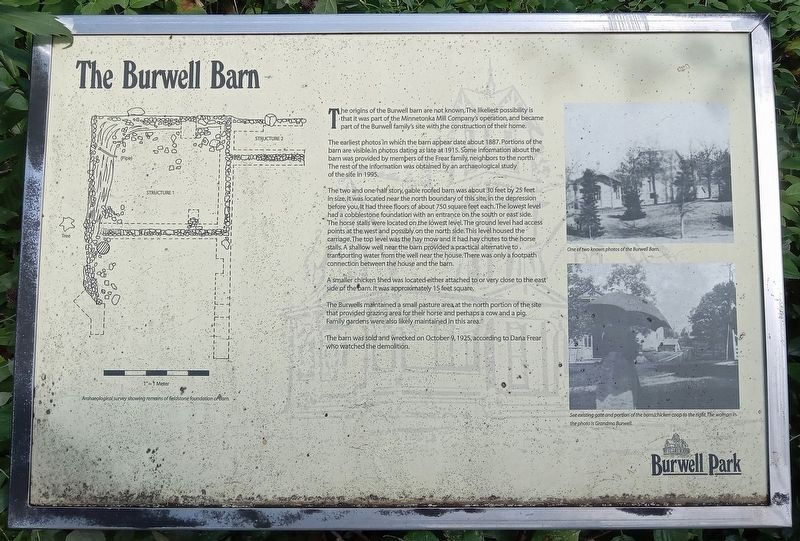
Archaeological survey showing remains of fieldstone foundation of barn.
The origins of the Burwell barn are not known. The likeliest possibility is that it was part of the Minnetonka Mill Company's operation, and became part of the Burwell family's site with the construction of their home.
The earliest photos in which the barn appear date about 1887. Portions of the barn are visible in photos dating as late at [sic] 1915. Some information about the barn was provided by members of the Frear family, neighbors to the north. The rest of the information was obtained by an archaeological study of the site in 1995.
The two and one-half story, gable roofed barn was about 30 feet by 25 feet in size. It was located near the north boundary of this site, in the depression before you. It had three floors of about 750 square feet each. The lowest level had a cobblestone foundation with an entrance on the south or east side. The horse stalls were located on the lowest level. The ground level had access points at the west and possibly on the north side. This level housed the carriage. The top level was the hay mow and it had
this page online
A smaller chicken shed was located either attached to or very close to the east side of the barn. It was approximately 15 feet square.
The Burwells maintained a small pasture area at the north portion of the site that provided grazing area for their horse and perhaps a cow and a pig. Family gardens were also likely maintained in this area.
The barn was sold and wrecked on October 9, 1925, according to Dana Frear who watched the demolition.
One of two known photos of the Burwell Barn.
See existing gate and portion of the barn/chicken coop to the right. The woman in the photo is Grandma Burwell.
Topics. This historical marker is listed in these topic lists: Agriculture • Settlements & Settlers. A significant historical year for this entry is 1887.
Location. 44° 56.532′ N, 93° 26.895′ W. Marker is in Minnetonka, Minnesota, in Hennepin County. It can be reached from McGinty Road E. near Plymouth Road. The marker
Photographed by McGhiever, September 7, 2025
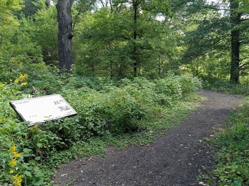
2. The Burwell Barn Marker on a path in Burwell Park

Regionally, this marker is in the Twin Cities Metropolitan Area. It is also in the American Midwest, in the Corn Belt, and in the Great River Road Region. Globally, it is in North America, the Western Hemisphere, the Western World, and the Anglosphere. Historically, it finds itself in what was once Rupert’s Land, the territory of the Mississippian Culture, and the Louisiana Purchase.
Other nearby markers. At least 8 other markers are within walking distance of this marker: Cottage (within shouting distance of this marker); Mill Office & Workshop (within shouting distance of this marker); Welcome to Burwell Park (within shouting distance of this marker); Woodshed (within shouting distance of this marker); Ice House (within shouting distance of this marker); The Burwell House and Family (within shouting distance of this marker); The Millpond (about 300 feet away, measured in a direct line); Minnetonka Mill: Intersection Of River, Roads and Rails (about 700 feet away). Touch for a list and map of all markers in Minnetonka.
Credits. This page was last revised on October 8, 2025. It was originally submitted on October 8, 2025, by McGhiever of Minneapolis, Minnesota. This page has been viewed 54 times since then and 19 times this year. Photos: 1, 2. submitted on October 8, 2025, by McGhiever of Minneapolis, Minnesota.
