
Nisqually Delta in Olympia in Thurston County, Washington — The American West (Northwest)
Site of the Medicine Creek Treaty
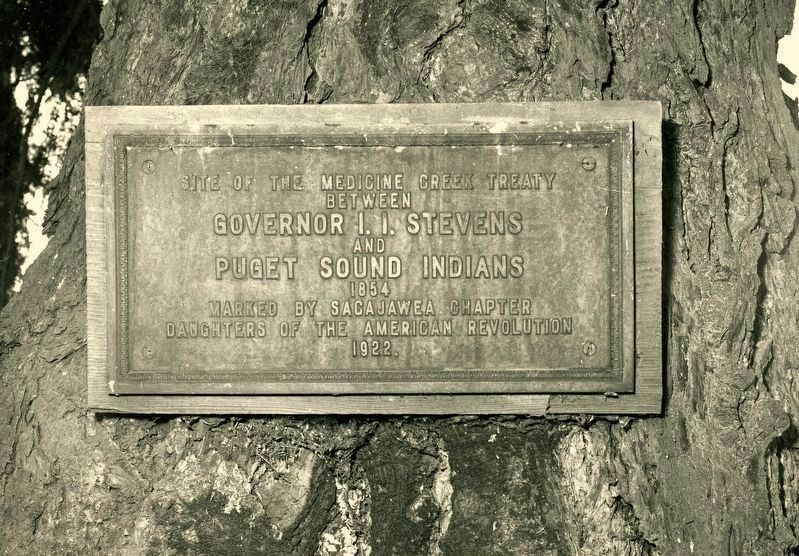
Sacajawea Chapter DAR archives
1. Medicine Creek Treaty Tree Marker
Erected 1922 by Sacajawea Chapter Daughters of the American Revolution.
Topics and series. This historical marker is listed in this topic list: Indigenous Peoples and Communities. In addition, it is included in the Daughters of the American Revolution (DAR) series list. A significant historical year for this entry is 1854.
Location. Marker has been reported permanently removed. It was located near 47° 4.53′ N, 122° 42.804′ W. Marker was in Olympia, Washington, in Thurston County. It was in Nisqually Delta. It could be reached from Nisqually National Wildlife Refuge Service Trail. Approximately 8 miles northeast of Olympia at the Billy Frank Jr. National Wildlife Refuge, Nisqually Delta. Public use of the extensive refuge trails is encouraged; however, the site of the Treaty is within a sacred area accessible only to tribal members. Touch for map. Marker was in this post office area: Olympia WA 98516, United States of America.
We have been informed that
this page online
Regionally, this marker was in the Puget Sound Region and in Greater Seattle. It was also on the American Pacific Coast, in the Pacific Northwest, and in the Lewis & Clark Corridor. Globally, it was in North America, in the Inside Passage, on the Ring of Fire, in the Pacific Rim, in the Western Hemisphere, in the Western World, and in the Anglosphere.

Other nearby markers. At least 8 other markers are within 5 miles of this location, measured as the crow flies: She-Nah-Nam (approx. 1.6 miles away); Global War on Terrorism Memorial (approx. 3½ miles away); Ross Memorial (approx. 3½ miles away); Going Native with Kinnikinnick (approx. 3.8 miles away); Chloe Aurelia Clark (Wilson) (approx. 3.8 miles away); Jackson Family/Goose Pond History (approx. 4.8 miles away); Boulevard of Remembrance (approx. 4.8 miles away); Lacey Women's Club (approx. 5.1 miles away).
More about this marker. The bronze tablet was originally mounted on the historic “Treaty Tree,” an ancient Douglas fir that stood witness to the signing of the Medicine

Sacajawea Chapter DAR archives
2. 1922 Medicine Creek Treaty Marker dedication
During or shortly after the construction of the I-5 freeway around in the 1960s, the tablet disappeared. For decades, its disappearance remained a mystery to the public and to the Washington State Highway Department.
In December 2006, a windstorm blew it down, leaving only 20 feet of the trunk standing.
Thanks to inquiries led by Shirley Stirling, regent of the Sacajawea Chapter of the DAR, the lost tablet was eventually located, having been deposited, uncatalogued, and forgotten in a storage area of the Washington State Historical Society (WSHS) archives. WSHS retains the tablet - in storage.
Regarding Site of the Medicine Creek Treaty. The Medicine Creek Treaty of 1854 was an agreement between representatives of the United States government and leaders of the Nisqually, Puyallup, Squaxin Island, and other Coastal Salish tribes. While the treaty secured tribal rights to fish, hunt, and gather in their “usual and accustomed places,” it also forced the cession of

Sacajawea Chapter DAR archives, 1914
3. 1914 Remains of the Treaty Tree grove
In 1965 the Olympian newspaper reported that the tree was dying, “Soon it will fall, carrying with it the bronze plaque the Daughters of the American Revolution bolted to it in 1922 to commemorate the treaty.” The tablet disappeared, as reported by WA Highway News of 1973: “Since this photo was taken, recently unknown persons have removed the plaque and its whereabouts is an apparent mystery.” Seedlings were collected from the tree in 1974 and planted into a grove. The tree died and fell in a winter storm in 2007. Seedlings were planted on the original site, in a grove elsewhere, and on the grounds of the Thurston County Courthouse.
On July 4, 1976 the Timberline High School placed a monument and time capsule on Nisqually Hill above the Treaty Tree to give hope for the future.
Dec. 8, 2015: Public Law 114-101
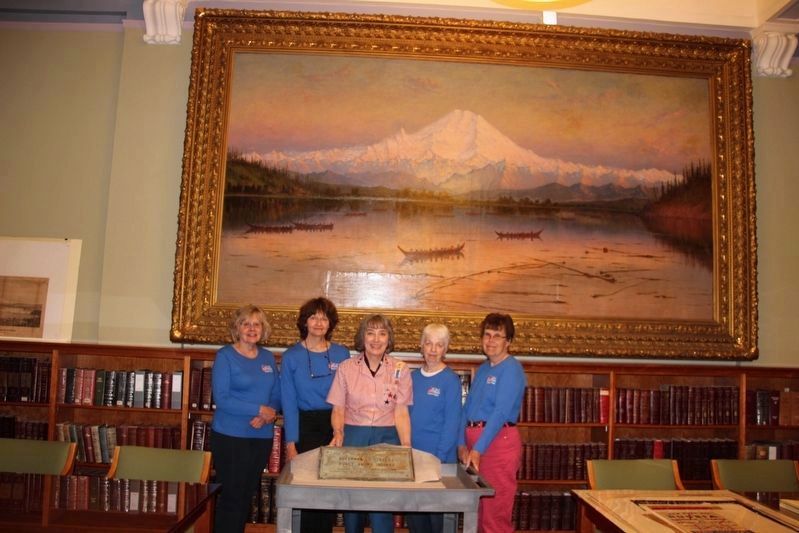
Courtesy of Shirley Stirling, June 16, 2017
4. Medicine Creek Treaty Marker
The marker, placed in 1922 by the Sacajawea Chapter DAR, is now held by the Washington State Historical Society... but they allow visitors (by appointment). Pictured are Jeanne Pittenger, Diane Smith, Shirley Stirling, Della Stenstrom, and Ann Shipley.
References: "History and Register 1924 Washington State Society Daughters of the American Revolution", p.80; 114 Congress Report House of Representatives; DAR Magazine Volume LVI (56) September, 1922 No. 9; Washington Highway News of 1973; Treaty Time Capsule, http://www.panoramio.com/photo/88341908; "After 153 years, Treaty Tree lost to winter storm" By Lynda Mapes February 12, 2007.

Photographed by Courtesey of Shirley Stirling, June 16, 2017
5. Medicine Creek Treaty Marker
Found after almost 50 years, safe and sound in the archives of the Washington State Historical Society.
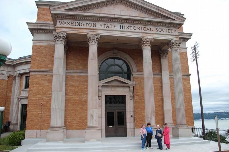
Photographed by Shirley A Stirling, June 16, 2017
6. New home of the Medicine Creek Treaty Marker, WSHS, 315 North Stadium Way, Tacoma.
Credits. This page was last revised on June 30, 2026. It was originally submitted on October 11, 2025, by Shirley A Stirling of Lacey, Washington. This page has been viewed 165 times since then and 83 times this year. Photos: 1, 2, 3, 4, 5, 6. submitted on October 11, 2025, by Shirley A Stirling of Lacey, Washington. • James Hulse was the editor who published this page.
