
Dudley in Wayne County, North Carolina — The American South (South Atlantic)
Earthwork Cross-Section
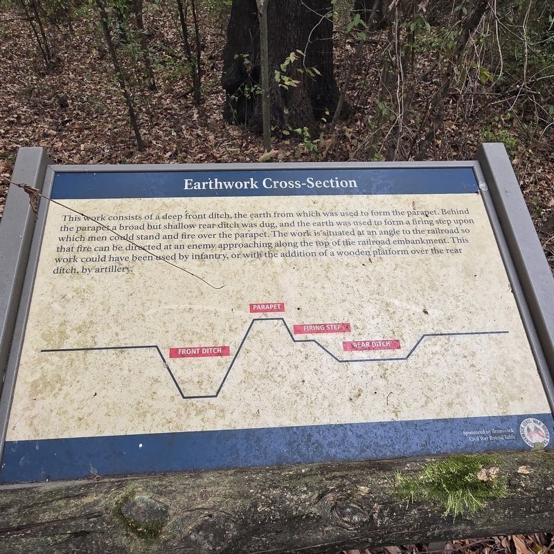
Photographed by Mike McKeown, October 11, 2025
1. Earthwork Cross-Section Marker
Erected by Brunswick Civil War Roundtable.
Topics. This historical marker is listed in these topic lists: Forts and Castles • War, US Civil.
Location. 35° 20.363′ N, 78° 1.497′ W. Marker is in Dudley, North Carolina, in Wayne County. It can be reached from Old Mt Olive Highway east of U.S. 13/117, on the left when traveling east. On the walking trail of the Goldsborough Bridge Battlefield. Touch for map. Marker is at or near this postal address: 303 Old Mt Olive Hwy, Dudley NC 28333, United States of America. Touch for directions.

Regionally, this marker is in North
this page online
Other nearby markers. At least 8 other markers are within walking distance of this marker: A different marker also named Union Assault on the Bridge (within shouting distance of this marker); Attack of the 17th Massachusetts (about 400 feet away, measured in a direct line); Confederate Earthworks (about 500 feet away); Confederate Counterattack (about 500 feet away); Confederate and Union Earthworks (about 500 feet away); Defense of the Bridge (about 700 feet away); River Road and Pontoon Bridges (about 700 feet away); Battle of Goldsborough Bridge (approx. 0.2 miles away). Touch for a list and map of all markers in Dudley.
Another marker is no longer nearby. Union Assault on the Bridge (was within shouting

Photographed by Mike McKeown, October 11, 2025
2. Earthwork Cross-Section Marker
Also see . . .
1. Goldsborough Bridge Battlefield. (Submitted on October 11, 2025, by Mike McKeown of Baltimore, Maryland.)
2. Goldsborough Bridge (American Battlefield Trust). (Submitted on October 11, 2025, by Mike McKeown of Baltimore, Maryland.)

Photographed by Mike McKeown, October 11, 2025
3. Earthworks at the Goldsborough Bridge Battlefield
Credits. This page was last revised on October 14, 2025. It was originally submitted on October 11, 2025, by Mike McKeown of Baltimore, Maryland. This page has been viewed 50 times since then and 24 times this year. Photos: 1, 2, 3. submitted on October 11, 2025, by Mike McKeown of Baltimore, Maryland. • Bernard Fisher was the editor who published this page.
