Near Goldsboro in Wayne County, North Carolina — The American South (South Atlantic)
REPLACED
CHECK OTHERS NEARBY
Union Assault on the Bridge
—
Battle of Goldsborough Bridge
—
Photographed by J. J. Prats, February 27, 2010
1. Union Assault on the Bridge Marker
Inscription.
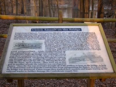
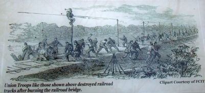
Union Assault on the Bridge. . Union General John G. Foster’s prime objective, the wooden covered Wilmington and Weldon railroad bridge, crossed the Neuse River here. After the 51st and 52nd North Carolina regiments were pushed back by the Union advance coming through the fields on the other side of the tracks and from atop the railroad embankment, Union volunteers rushed forward to burn the bridge. Five enlisted men from the 17th Massachusetts and 9th New Jersey, led by two officers, Lieutenant George Graham of the 23rd New York Artillery and Lieutenant Barnabas Mann of the 17th Massachusetts, made their way to the bridge. Mann was severely wounded in the assault, but the others continued forward. One witness described the assault: “The Confederates on the bridge, and those nearby, plainly seeing the object upon which these men were bent, directed their fire upon them with terrible fury.” One of the volunteers “crept down the embankment into the edge of the woods and, gathering an armful of dried leaves and light wood, scampered back....While clambering back up the embankment....was discovered by a party of Confederates under the bridge, who with bitter curses sent their compliments in the shape of a shower of bullets and buckshot, one passing through his canteen one through his cup, another through his coat, and still another through his old cap. Placing the leaves, with the fuses, upon a beam....they were set on fire and in another minute the interior was enveloped in flames.” Once the fire was set Foster brought all of his artillery to bear on the bridge, to help in its destruction and to keep the Confederates from extinguishing the flames. In a short time, the bridge was destroyed. Union troops then stacked their muskets and began tearing up the railroad tracks to further damage the Confederate supply line., (captions) , Union Troops like those shown above destroyed railroad tracks after burning the railroad bridge. Clipart Courtesy of FCIT, The burning of the Wilmington and Weldon railroad bridge. Courtesy of Randy Sauls
Union General John G. Foster’s prime objective, the wooden covered Wilmington & Weldon railroad bridge, crossed the Neuse River here. After the 51st and 52nd North Carolina regiments were pushed back by the Union advance coming through the fields on the other side of the tracks and from atop the railroad embankment, Union volunteers rushed forward to burn the bridge. Five enlisted men from the 17th Massachusetts and 9th New Jersey, led by two officers, Lieutenant George Graham of the 23rd New York Artillery and Lieutenant Barnabas Mann of the 17th Massachusetts, made their way to the bridge. Mann was severely wounded in the assault, but the others continued forward. One witness described the assault: “The Confederates on the bridge, and those nearby, plainly seeing the object upon which these men were bent, directed their fire upon them with terrible fury.” One of the volunteers “crept down the embankment into the edge of the woods and, gathering an armful of dried leaves and light wood, scampered back....While clambering back up the embankment....was discovered by a party of Confederates under the bridge, who with bitter
Click or scan to see this page online
curses sent their compliments in the shape of a shower of bullets and buckshot, one passing through his canteen one through his cup, another through his coat, and still another through his old cap. Placing the leaves, with the fuses, upon a beam....they were set on fire and in another minute the interior was enveloped in flames.” Once the fire was set Foster brought all of his artillery to bear on the bridge, to help in its destruction and to keep the Confederates from extinguishing the flames. In a short time, the bridge was destroyed. Union troops then stacked their muskets and began tearing up the railroad tracks to further damage the Confederate supply line.
(captions)
Union Troops like those shown above destroyed railroad tracks after burning the railroad bridge. Clipart Courtesy of FCIT
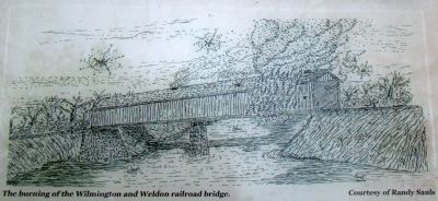
The burning of the Wilmington and Weldon railroad bridge. Courtesy of Randy Sauls
Erected by the Goldsborough Bridge Battlefield Association.
Topics. This historical marker is listed in these topic lists: Bridges & Viaducts • War, US Civil. A significant historical date for this entry is December 17, 1862.
Location. This marker has been replaced by another marker nearby. It was located
Photographed by J. J. Prats, February 27, 2010
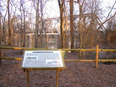
2. Union Assault on the Bridge Marker and Present-Day Railroad Bridge
near 35° 20.382′ N, 78° 1.464′ W. Marker was near Goldsboro, North Carolina, in Wayne County. It was on Old Mt. Olive Highway south of Route 117, on the left when traveling south. Touch for map. Marker was in this post office area: Goldsboro NC 27530, United States of America. Touch for directions.
Regionally, this marker was in North Carolina’s Coastal Plain and in the Piedmont. It was also in the American South and specifically in the Upper South. Globally, it was in North America, the Western Hemisphere, the Western World, and the Anglosphere. Historically, it found itself in what was once the territory of the Mississippian Culture, one of the original Thirteen Colonies, one of the Confederate States of America, and the Antebellum South.
More about this marker. This is stop 3 on The Battle of Goldsborough Bridge Battlefield walking tour.
Related marker. Click here for another marker that is related to this marker. New Replacement Marker At This Location also titled "Union Assault on the Bridge".
Also see . . . Goldsborough Bridge Battlefield. Goldsborough Bridge Battlefield Association (Submitted on October 13, 2025.)
4. Detail from the Marker
“The burning of the Wilmington and Weldon railroad bridge.” Illustration by Randy Sauls
February 27, 2010
5. Detail from the Marker
“Union Troops like those shown above destroyed railroad tracks after burning bridge.” Florida Center for Instructional Technology illustration.
Photographed by J. J. Prats, February 27, 2010
6. Earthworks In Sight of the Bridge
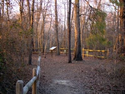
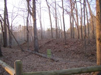
These are on the left behind the fence in the foreground on photograph 3.
Credits. This page was last revised on October 13, 2025. It was originally submitted on March 13, 2010, by J. J. Prats of Powell, Ohio. This page has been viewed 1,502 times since then and 41 times this year. Last updated on October 13, 2025, by Mike McKeown of Baltimore, Maryland. Photos:1, 2, 3, 4, 5, 6. submitted on March 13, 2010, by J. J. Prats of Powell, Ohio. • Bernard Fisher was the editor who published this page.