Four Oaks in Johnston County, North Carolina — The American South (South Atlantic)
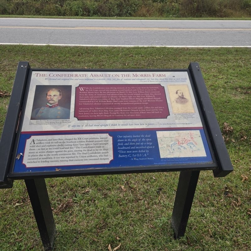
The Confederate Assault On The Morris Farm
Photographed by Mike McKeown, October 11, 2025
1. The Confederate Assault on the Morris Farm Marker
While the Confederates were driving elements of the XIV Corps from the battlefield, the XX Corps moved into position several hundred yards in front of you on the Reddick Morris farm. By late afternoon on March 19, Maj. Gen. William Bate's command from the Army of Tennessee had advanced into the woods behind you while they dressed their ranks and awaited orders to advance. On Bate's right was Maj. Gen. William B. Taliaferro's division consisting of Brig. Gen. Stephen Elliott's Brigade and Rhett's Brigade commanded by Col. William Butler. Bate's men were veterans of the war's Western Theater but Taliaferro's division consisted of mostly inexperienced garrison troops.
Advancing first, Taliaferro's division emerged from the woods under artillery fire and into a hailstorm of bullets from Brig. Gen. James Robinson's Brigade in their front and the 13th New Jersey on their right flank. Facing fire from two directions,
this page online
If any one of us had stood upright I think he would have been torn to pieces... - Lt. John Porter Fort 1st Georgia Regulars
As Taliaferro, and later Bate, charged the XX Corps positions, massed artillery took its toll on the Southern soldiers. Federal gunners used solid shot and explosive shells, cutting fuses "just right to burst amongst them...as fast as we could load and fire." The Confederates made many as seven charges against the guns, causing the dead to lay six deep in places due to the nearly continuous fire. The final Confederate assault occurred at sundown. It too was repulsed by Union artillerists, who switched to loading canister, turning their cannons into oversized shotguns.
Our infantry buried the dead down in the angle of the open field, and there put up a large headboard and inscribed upon it "These men were killed by Battery C, 1st O.V.A." - R. King, Stephen's Battery
(captions)
Lt. Col. James Welsman Brown attempted to rally Elliott's Brigade when it retreated in disorder from the Morris Farm. Image courtesy of William H. Rutledge Jr., Lt. Col. (Ret.) U.S.A.F.
Maj. John A. Reynolds, XX Corps chief of artillery, commanded Union guns on the Morris Farm. Image courtesy of Scott D. Hann
Map by Mark Anderson Moore from "The old North State at War: The North Carolina Civil War Atlas, North Carolina Historical Publications, 2013
Erected by Johson
Photographed by Mike McKeown, October 11, 2025
2. The Confederate Assault on the Morris Farm Marker
Topics. This historical marker is listed in this topic list: War, US Civil. A significant historical date for this entry is March 19, 1865.
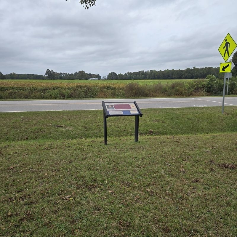
Location. 35° 18.711′ N, 78° 18.497′ W. Marker is in Four Oaks, North Carolina, in Johnston County. It is on Battlefield Road west of Harper House Road, on the right when traveling west. Touch for map. Marker is at or near this postal address: 174 Battlefield Rd, Four Oaks NC 27524, United States of America. Touch for directions.

Regionally, this marker is in the Piedmont. It is also in the American South and specifically in the Upper South. Globally, it is in North America, the Western Hemisphere, the Western World, and the Anglosphere. Historically, it finds itself in what was once the territory of the Mississippian Culture, one of the original Thirteen Colonies, one of the Confederate States of America, and the Antebellum South.
Other nearby markers. At least 8 other markers are within walking distance of this marker: The Battle Begins: Confederate Cavalry Blocks The Goldsboro Road (about 300 feet away, measured in a direct line); Confederate Main Charge (approx. 0.2 miles away); Confederate High Tide (approx. 0.2 miles away); Confederate Attacks (approx. ¼ mile away); Heavy Thunder (approx. ¼ mile away); Union Artillery at the Morris Farm (approx. ¼ mile away); Fighting Below the Road (approx. 0.4 miles away); Federal Artillery (approx. half a mile away). Touch for a list and map of all markers in Four Oaks.
More about this marker. Marker isn't listed on the Battle of Bentonville Driving Map. Next to where Mountains-to-Sea Trail crosses Battlefield Road.
Also see . . .
1. Bentonville Battlefield (North Carolina Historic Sites). (Submitted on October 13, 2025, by Mike McKeown of Baltimore, Maryland.)
2. Battle of Bentonville (American Battlefield Trust). (Submitted on October 13, 2025, by Mike McKeown of Baltimore, Maryland.)
Credits. This page was last revised on October 15, 2025. It was originally submitted on October 13, 2025, by Mike McKeown of Baltimore, Maryland. This page has been viewed 90 times since then and 47 times this year. Photos: 1, 2. submitted on October 13, 2025, by Mike McKeown of Baltimore, Maryland. • Bernard Fisher was the editor who published this page.
