Four Oaks in Johnston County, North Carolina — The American South (South Atlantic)
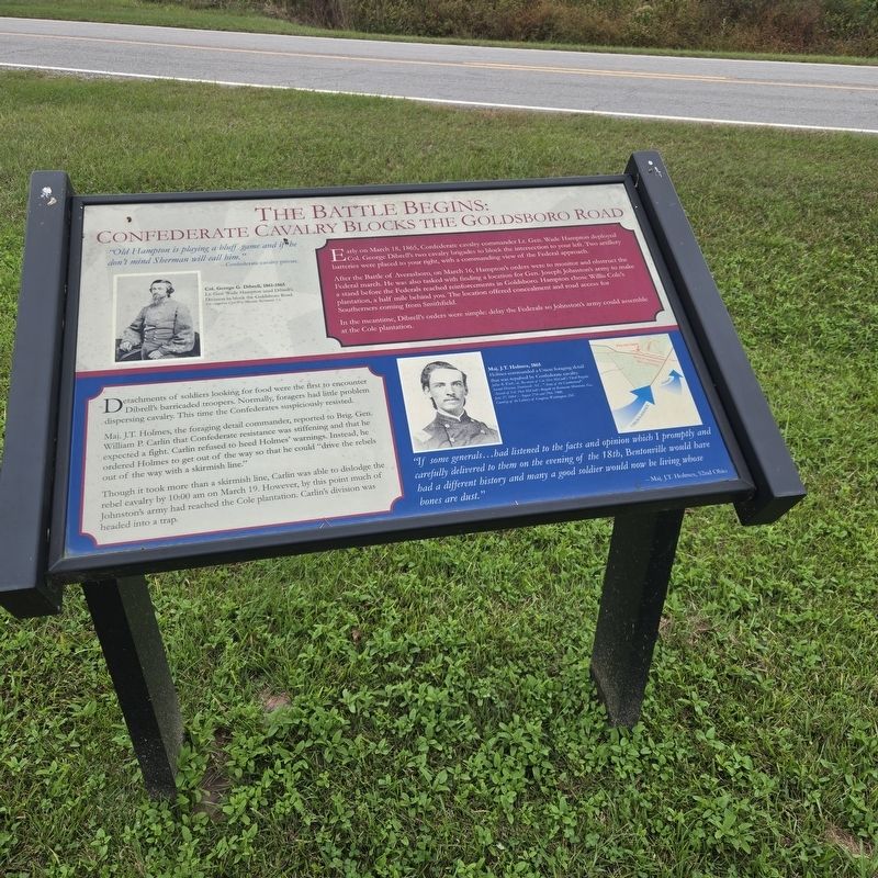
The Battle Begins: Confederate Cavalry Blocks The Goldsboro Road
Photographed by Mike McKeown, October 11, 2025
1. The Battle Begins: Confederate Cavalry Blocks Marker
Early on March 18, 1865, Confederate cavalry commander Lt. Gen. Wade Hampton deployed Col. George Dibrell's two cavalry brigades to block the intersection to your left. Two artillery batteries were placed to your right, with a commanding view of the Federal approach.
After the Battle of Averasboro, on March 16, Hampton's orders were to monitor and obstruct the Federal march. He was also tasked with finding a location for Gen. Joseph Johnston's army to make a stand before the Federals reached reinforcements in Goldsboro. Hampton chose Willis Cole's plantation, a half mile behind you. The location offered concealment and road access for Southerners coming from Smithfield.
In the meantime, Dibrell's orders were simple: delay the Federals so Johnston's army could assemble at the Cole plantation.
Detachments of soldiers looking for food were the first to encounter Dibrell's barricaded troopers. Normally, foragers had little problem dispersing cavalry. This time the Confederates suspiciously resisted.
Maj.
this page online
Though it took more than a skirmish line, Carlin was able to dislodge the rebel cavalry by 10:00 am on March 19. However, by this point much of Johnston's army had reached the Cole plantation. Carlin's division was headed into a trap.
"If some generals...had listened to the facts and opinion which I promptly and carefully delivered to them on the evening of the 18th, Bentonville would have had a different history and many a good soldier would now be living whose bones are dust." - Maj. J.T. Holmes, 52nd Ohio
(captions)
Col. George G. Dibrell, 1861-1865 Lt. Gen. Wade Hampton used Dibrell's Division to block the Goldsboro Road. The American Civil War Museum, Richmond, Va.
Maj. J.T. Holmes, 1865 Holmes commanded a Union foraging detail that was repulsed by Confederate cavalry. Julius B. Work, ed., Re-union of Col. Dan McCook's Third Brigade, Second Division, Fourteenth A.C., "Army of the Cumberland": Assault of Col. Dan McCook's Brigade on Kennesaw Mountain, Ga., June 27, 1864 / August 27th and 29th, 1900. Courtesy of the Library of Congress, Washington, D.C.
Topics.

Photographed by Mike McKeown, October 11, 2025
2. The Battle Begins: Confederate Cavalry Blocks the Goldsboro Road Marker
Location. 35° 18.668′ N, 78° 18.518′ W. Marker is in Four Oaks, North Carolina, in Johnston County. It is on Battlefield Road west of Harper House Road, on the right when traveling west. Touch for map. Marker is at or near this postal address: 174 Battlefield Rd, Four Oaks NC 27524, United States of America. Touch for directions.

Regionally, this marker is in the Piedmont. It is also in the American South and specifically in the Upper South. Globally, it is in North America, the Western Hemisphere, the Western World, and the Anglosphere. Historically, it finds itself in what was once the territory of the Mississippian Culture, one of the original Thirteen Colonies, one of the Confederate States of America, and the Antebellum South.
Other nearby markers. At least 8 other markers are within walking distance of this marker: The Confederate Assault On The Morris Farm (about 300 feet away, measured in a direct line); Confederate High Tide (approx. 0.2 miles away); Confederate Main Charge (approx. 0.2 miles away);
Library of Congress
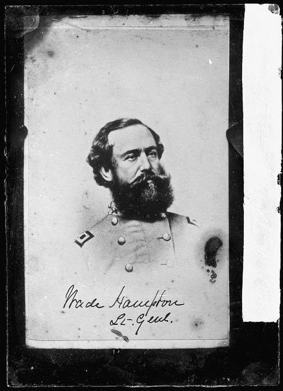
3. Confederate Gen. Wade Hampton
More about this marker. Marker isn't listed on the Battle of Bentonville Driving Map. Next to where Mountains-to-Sea Trail crosses Battlefield Road.
Also see . . .
1. Bentonville Battlefield (North Carolina Historic Sites). (Submitted on October 13, 2025, by Mike McKeown of Baltimore, Maryland.)
2. Battle of Bentonville (American Battlefield Trust). (Submitted on October 13, 2025, by Mike McKeown of Baltimore, Maryland.)
Credits. This page was last revised on October 15, 2025. It was originally submitted on October 13, 2025, by Mike McKeown of Baltimore, Maryland. This page has been viewed 89 times since then and 45 times this year. Photos: 1, 2, 3. submitted on October 13, 2025, by Mike McKeown of Baltimore, Maryland. • Bernard Fisher was the editor who published this page.
