
Vernal in Uintah County, Utah — The American Mountains (Southwest)
Manfred and Ethel Martin House
Utah Historic Site
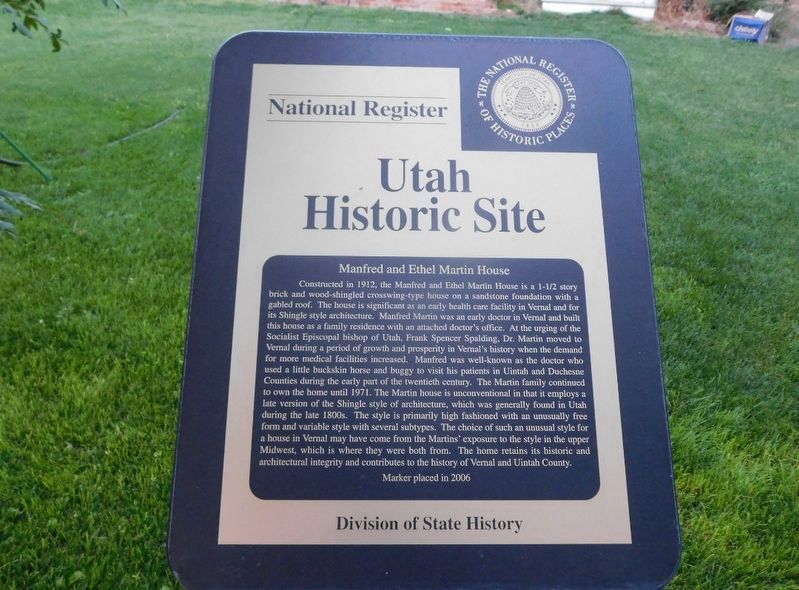
Photographed by Jimmy Emerson, September 4, 2025
1. Manfred and Ethel Martin House Marker
this page online
Erected 2006 by Division of State History.
Topics and series. This historical marker is listed in these topic lists: Architecture • Religion & Religious Structures • Science & Medicine. In addition, it is included in the Utah Historic Sites (NRHP) series list. A significant historical year for this entry is 1912.
Location. 40° 27.48′ N, 109° 31.729′ W. Marker is in Vernal, Utah, in Uintah County. It is on North Vernal Avenue (National Route 191), on the left when traveling north. Touch for map. Marker is at or near this postal address: 163 North Vernal Avenue, Vernal UT 84078, United States of America. Touch for directions.

Regionally, this marker is in Utah’s Uinta Basin. It is also in the American Mountain West and on the Colorado Plateau. Globally, it is in North America,
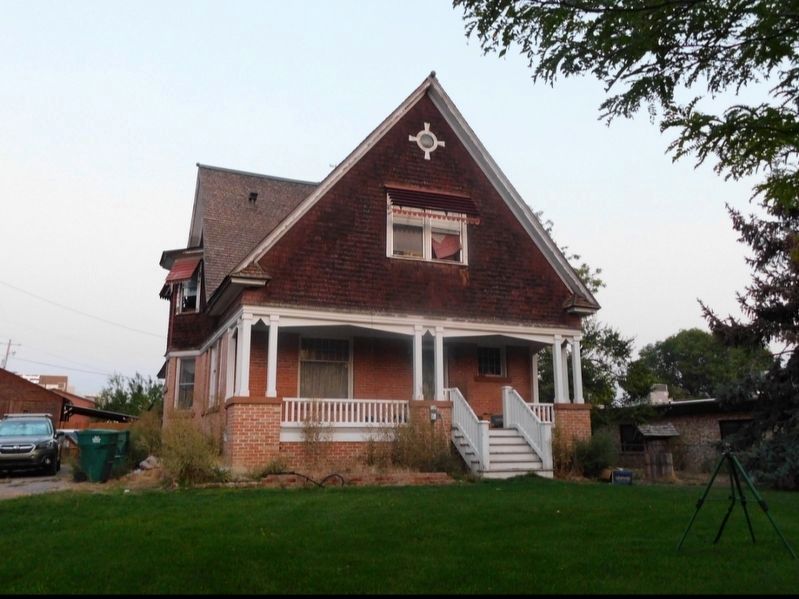
Photographed by Jimmy Emerson, September 4, 2025
2. Manfred and Ethel Martin House Marker
Marker is in a post in the front yard just out of frame.
Other nearby markers. At least 8 other markers are within walking distance of this marker: Cobble Rock Gas Station (about 800 feet away, measured in a direct line); How Far Would You Carry a Brick for Seven Cents? (approx. 0.2 miles away); Where the Dollar has More Cents (approx. 0.2 miles away); Now Playing at the Vernal Theater... (approx. 0.2 miles away); Do Religion and Money Mix? (approx. 0.2 miles away); Parcel Post Bank (approx. 0.2 miles away); Fort Ashley Center (approx. 0.2 miles away); The Bank of Vernal (approx. 0.2 miles away). Touch for a list and map of all markers in Vernal.
Credits. This page was last revised on October 15, 2025. It was originally submitted on October 13, 2025, by Jimmy Emerson of Dalton, Georgia. This page has been viewed 71 times since then and 44 times this year. Photos: 1, 2. submitted on October 13, 2025, by Jimmy Emerson of Dalton, Georgia. • Andrew Ruppenstein was the editor who published this page.
