Londonderry in Rockingham County, New Hampshire — The American Northeast (New England)
Londonderry Town Pound

Photographed by Jimmy Emerson, July 23, 2010
1. Londonderry Town Pound Marker
Stray farm animals were confined here by elected pounders or reeves until ransomed by their owners. In 1730, David Dickey kept the first pound in the West Parish. When the current boundaries of Londonderry were established in 1836, David Gilcreast contracted to build a free-laid pound of stones to the Selectmen's specifications. For $30.00 Gilcreast supplied both land and materials and constructed this pound in a "workmanlike manner," tapering from base to top. This pound faces the Mammoth Road, built in 1831, and has its back to the intersection of the Old Stage Road.
Erected 1991 by State of New Hampshire. (Marker Number 166.)
Topics. This historical marker is listed in this topic list: Agriculture.
Location. 42° 52.706′ N, 71° 22.853′ W. Marker is in Londonderry, New Hampshire, in Rockingham County. It is on Mammoth Road (New Hampshire Route 128) north of Otterson Road, on the right when traveling north. Touch for map. Marker is in this post office area: Londonderry NH 03053, United States of America. Touch for directions.

Regionally, this marker is on New Hampshire’s
this page online
Other nearby markers. At least 8 other markers are within 9 miles of this marker, measured as the crow flies: Lowell Memorial Library (approx. 5.8 miles away); Old Dunstable (approx. 5.8 miles away); War Memorial (approx. 5.8 miles away); Veterans and War Memorial (approx. 5.9 miles away); Matthew Thornton (approx. 6.2 miles away); Colonel John Goffe (approx. 7.3 miles away); Stevens Memorial Hall (approx. 8.3 miles away); Chester Persian Gulf Veterans Memorial (approx. 8.3 miles away).
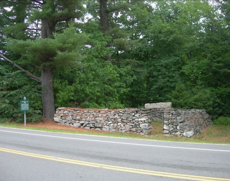
Photographed by Jimmy Emerson, July 23, 2010
2. Londonderry Town Pound & Marker
Credits. This page was last revised on July 9, 2026. It was originally submitted on October 15, 2025, by Brad Greenland of Londonderry, New Hampshire. This page has been viewed 166 times since then and 112 times this year. Photos: 1. submitted on October 15, 2025, by Brad Greenland of Londonderry, New Hampshire. 2. submitted on June 3, 2026, by Jimmy Emerson of Dalton, Georgia. • Michael Herrick was the editor who published this page.
