Bardstown in Nelson County, Kentucky — The American South (East South Central)
Tannery Hill Hiking Trail
Welcome!
Photographed by Jason Voigt, September 29, 2025
1. Tannery Hill Hiking Trail Marker
About the Trail
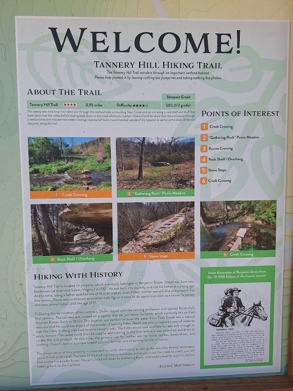
This nearly one-mile loop trail takes you through the wetland area surrounding Town Creek and up and along a rock shelf and bluff that looks down into the valley before leafing back down to the creek where you started. Hikers should be aware that this trail passes through a wetland area and includes two creek crossings (waterproof boots recommended outside of dry seasons) as well as some steep climbs and descents along the trail.
Hiking with History
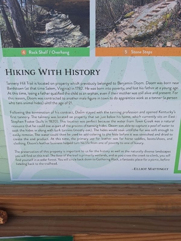
Tannery Hill Trail is located on property which previously belonged to Benjamin Doom. Doom was born near Bardstown (at that time Salem, Virginia) in 1782. He was born into poverty, and lost his father at a young age. At this time, losing a father qualified the child as an orphan, even if their mother was still alive and present. For this reason, Doom was contracted to another male figure in town to do apprentice work as a tanner (a person who tans animal hides) until the age of 21. Following the termination of his contract, Doom stayed with the tanning profession and opened Kentucky's first tannery. The tannery was located on property that sat just below
this page online
(aside:)
Artist Illustration of Benjamin Doom from Dec 19 1948 Edition of The Courier Journal.
Benjamin
Photographed by Jason Voigt, September 29, 2025
2. Tannery Hill Hiking Trail Marker
On the day preceding his marriage he quit work at 4 o'clock, and on the same evening borrowed a pair of shoes and a pair of hose, and rode on horseback to his bride's residence, near the mouth of Harrod's Creek. He was married on Sunday morning, and in the afternoon returned to his home on horseback with his bride behind him. She prepared breakfast for his hired help before 6 o'clock Monday morning, then washed out the hose, which Ben returned to the owner during the dinner hour. -
Topics. This historical marker is listed in these topic lists: Industry & Commerce • Parks & Recreational Areas. A significant historical year for this entry is 1782.
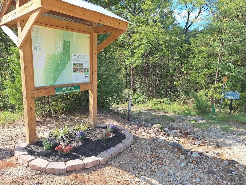
Location. 37° 48.422′ N, 85° 27.658′ W. Marker is in Bardstown, Kentucky, in Nelson County. It is on County Route 8005A south of East Stephen Foster Avenue (U.S. 62). Marker is at the Tannery Hill trailhead. Touch for map. Marker is at or near this postal address: 417 E Stephen
Photographed by Jason Voigt, September 29, 2025
3. Tannery Hill Hiking Trail Marker

Regionally, this marker is in Greater Louisville Area. It is also in the American South and specifically in the Upper South. Globally, it is in North America, the Western Hemisphere, the Western World, and the Anglosphere. Historically, it finds itself in what was once the territory of the Mississippian Culture and also the Antebellum South.
Other nearby markers. At least 8 other markers are within walking distance of this marker: Tannery Hill (here, next to this marker); Austin Hubbard (Narcissa) House (approx. 0.2 miles away); Cistern (approx. ¼ mile away); The Cobblestone Path (approx. ¼ mile away); Federal Hill (approx. 0.3 miles away); My Old Kentucky Home (approx. 0.3 miles away); Mack Rowan (approx. 0.3 miles away); Adam Anthony House (approx. 0.3 miles away). Touch for a list and map of all markers in Bardstown.
Credits. This page was last revised on October 17, 2025. It was originally submitted on October 16, 2025, by Jason Voigt of Glen Carbon, Illinois. This page has been viewed 115 times since then and 43 times this year. Photos: 1. submitted on October 16, 2025, by Jason Voigt of Glen Carbon, Illinois. 2, 3. submitted on October 17, 2025, by Jason Voigt of Glen Carbon, Illinois.
