Township of Trescott near Lubec in Washington County, Maine — The American Northeast (New England)
Morrison Cove
Photographed by Steve Stoessel, October 4, 2025
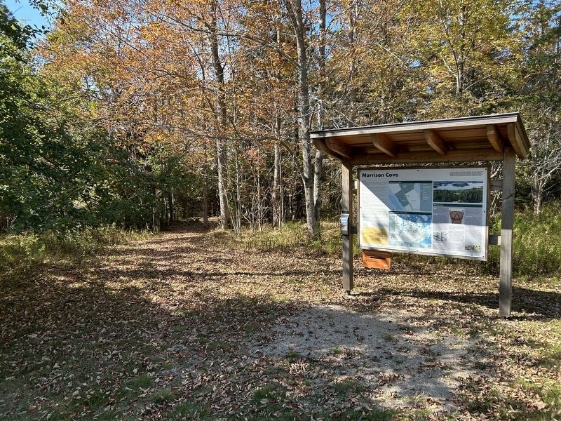
1. Morrison Cove Marker
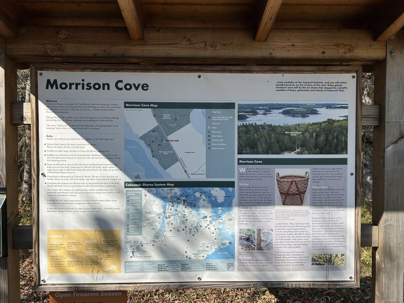
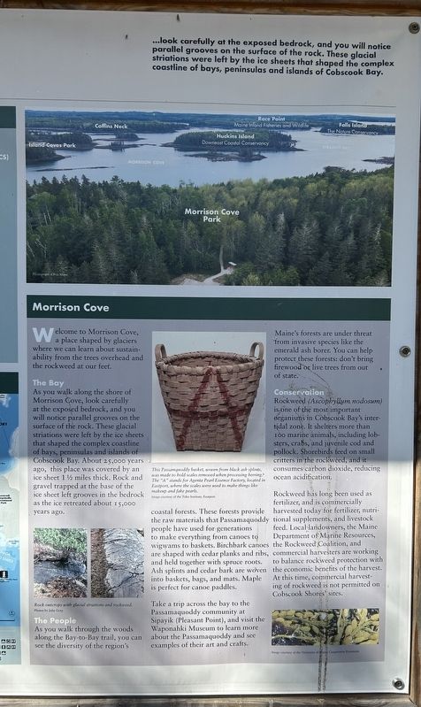
...look carefully at the exposed bedrock, and you will notice parallel grooves on the surface of the rock. These glacial striations were left by the ice sheets that shaped the complex coastline of bays, peninsulas and islands of Cobscook Bay.
Welcome
Cobscook Shores is a system of 15 parklands dispersed along the southern and western shores of Cobscook Bay from Whiting to Lubec. The parklands are privately owned by Cobscook Shores Inc., a family funded Maine charitable foundation.
The parklands offer public access and recreational use including walking, picnicking, hiking, biking, camping, and paddling in Cobscook Bay.
The name "Cobscook" is derived from Kapskuk, a Passamaquoddy word meaning "place where the water looks like it is boiling."
Welcome to Morrison Cove, a place shaped by glaciers where we can learn about sustainability from the trees overhead and the rockweed at our feet.
The Bay
As you walk along the shore of Morrison Cove, look carefully at the exposed bedrock, and you will notice parallel grooves on the surface of the rock. These glacial striations were left by the ice sheets that shaped the
this page online
The People
As you walk through the woods along the Bay-to-Bay trail, you can see the diversity of the region's coastal forests. These forests provide the raw materials that Passamaquoddy people have used for generations to make everything from canoes to wigwams to baskets. Birchbark canoes are shaped with cedar planks and ribs. and held together with spruce roots. Ash splints and cedar bark are woven into baskets, bags, and mats. Maple is perfect for canoe paddles. Take a trip across the bay to the Passamaquoddy community at Sipayik (Pleasant Point), and visit the Waponahki Museum to learn more about the Passamaquoddy and see examples of their art and crafts.
Maine's forests are under threat from invasive species like the emerald ash borer. You can help protect these forests: don't bring firewood or live trees from out of state.
Conservation
Rockweed (Ascophyllum nodosum)
Photographed by Steve Stoessel, October 4, 2025
2. Morrison Cove Marker
Rockweed has long been used as fertilizer, and is commercially harvested today for fertilizer, nutrtional supplements, and livestock feed. Local landowners, the Maine Department of Marine Resources, the Rockweed Coalition, and commercial harvesters are working to balance rockweed protection with the economic benefits of the harvest. At this time, commercial harvesting of rockweed is not permitted on Cobscook Shores sites.
[ Photo Captions, left to right ]
- Rock outcrops with glacial striations and rockweed.
- This Passamquoddy basket, woven from black ash splints, was made to bold scales removed when processing herring. The "A" stands for Agenta Pearl Essence Factory located in Eastport, where the scales were used to make things like makeup and fake pearls
-[Rockweed]
[Rules and Map Legends were not transcribed ]
Erected by Cobscook
Photographed by Steve Stoessel, October 4, 2025
3. Morrison Cove Marker Close Up
Topics. This historical marker is listed in these topic lists: Animals • Environment • Industry & Commerce.
Location. 44° 52.675′ N, 67° 5.69′ W. Marker is near Lubec, Maine, in Washington County. It is in Township of Trescott. It can be reached from Straight Bay Road 0.3 miles north of Estes Point Road, on the left when traveling north. Touch for map. Marker is in this post office area: Lubec ME 04652, United States of America. Touch for directions.

Regionally, this marker is in Downeast Maine. It is also in the American Northeast, in New England, and on the Eastern Seaboard. Globally, it is in the North Atlantic Region, North America, the Great North Woods, the Western Hemisphere, the Western World, and the Anglosphere. Historically, it finds itself in what was once the Viceroyalty of New France and also Acadia.
Other nearby markers. At least 8 other markers are within 5 miles of this marker, measured as the crow flies: Arthur Smallidge Campground (approx. half a mile away); Huckins Beach and Trail (approx. half a mile away); Pike Lands Cove (approx. 2.6 miles away); Black Duck Cove (approx. 3.9 miles away); Klondike Mountain Preserve (approx. 4 miles away); Old Farm Point Shorefront Park (approx. 4.4 miles away); U.S.S. Richmond (approx. 4½ miles away); USS Wabash / USS Franklin (approx. 4½ miles away). Touch for a list and map of all markers in Lubec.
Credits. This page was last revised on October 17, 2025. It was originally submitted on October 16, 2025, by Steve Stoessel of Niskayuna, New York. This page has been viewed 50 times since then and 19 times this year. Photos: 1. submitted on October 16, 2025, by Steve Stoessel of Niskayuna, New York. 2, 3. submitted on October 17, 2025, by Steve Stoessel of Niskayuna, New York.
