Kidder Township near White Haven in Carbon County, Pennsylvania — The American Northeast (Mid-Atlantic)
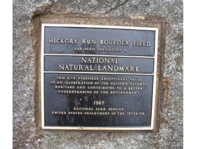
Hickory Run Boulder Field
Hickory Run State Park
Photographed by Dorine Ruth Emery, March 14, 2010
1. Hickory Run Boulder Field Marker
has been designated a
National Natural Landmark
Erected 1967 by National Park Service.
Topics and series. This historical marker is listed in this topic list: Natural Features. In addition, it is included in the National Historic Landmarks, and the National Natural Landmarks series lists.
Location. 41° 3.027′ N, 75° 38.717′ W. Marker is near White Haven, Pennsylvania, in Carbon County. It is in Kidder Township. It can be reached from Pennsylvania Route 534. This marker is at the site of the boulder field within, and at a remote section of Hickory Run State Park, Carbon County, Pa. Entrance to park is from route 534, SE of White Haven. Touch for map. Marker is in this post office area: Lake Harmony PA 18624, United States of America. Touch for directions.

Regionally, this marker is in Pennsylvania’s Anthracite Coal Region and in the Pocono Mountains. It is also in the American
this page online
Other nearby markers. At least 8 other markers are within 5 miles of this marker, measured as the crow flies: Harrison Amusement Park (approx. 3.9 miles away); Easton and Wilkes-Barre Turnpike (approx. 4 miles away); Blakeslee Community Center (approx. 4 miles away); Blakeslee United Methodist Church (approx. 4 miles away); The First Schoolhouse (approx. 4.1 miles away); Jacob Blakeslee, Jr. (approx. 4½ miles away); Agriculture (approx. 4.7 miles away); The Great Swamp (approx. 5.1 miles away).
Regarding Hickory Run Boulder Field. Boulder Field Natural Area.
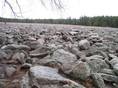
The Boulder Field is an unusual formation of glacial origin, striking due to its flatness and relatively large size. The field is approximately 400 by 1,800 feet and is at least 12 feet deep, making it the largest formation of its kind in the Appalachian
Photographed by Craig Doda, October 19, 2019
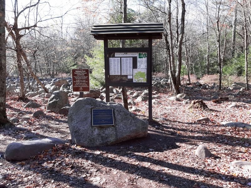
2. Hickory Run Boulder Field Marker
The Boulder Field is registered as a National Natural Landmark and has been set aside for protection as a State Park Natural Area under State Parks 2000.
To be designated a scenic wonder, an area must be deemed one of the best examples of its kind and have national significance. Geologists from across the world visit this site. It's the best example of a boulder field in this eastern United States and is exceptional because it is so large and flat.
Photographed by Dorine Ruth Emery, March 14, 2010
3. Hickory Run Boulder Field
Credits. This page was last revised on July 24, 2024. It was originally submitted on March 15, 2010, by Dorine Ruth Emery of Washington, New Jersey. This page has been viewed 2,088 times since then and 41 times this year. Photos: 1. submitted on March 15, 2010, by Dorine Ruth Emery of Washington, New Jersey. 2. submitted on December 27, 2020, by Craig Doda of Napoleon, Ohio. 3. submitted on March 15, 2010, by Dorine Ruth Emery of Washington, New Jersey. • Bill Pfingsten was the editor who published this page.
