Chelsea in Outaouais, Québec — Central Canada (French-Canadian)
First Geodetic Survey Station
⎯⎯⎯
La Première-Station-Geodésique
Photographed by Robert Rusaw, October 17, 2025
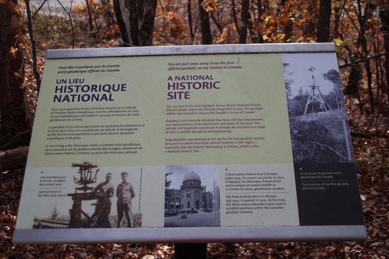
1. First Geodetic Survey Station Marker

You are close to the First Geodetic Survey Station National Historic Site of Canada, which was officially designated in 1929. This geodetic station was erected in 1909 by the Geodetic Survey of Canada.
Geodesy is the scientific discipline that deals with the measurement and representation of the dimensions and shape of the Earth. The latitude and longitude coordinates it provides are essential to a range of other scientific disciplines and engineering.
King Mountain was selected as the site for the first geodetic station, because it could be seen from several locations in the region-especially from the federal observatory in Ottawa, which is also a National Historic Site.
Vous vous approcher du lieu historique national du Canada de La Première-Station-Geodésique, reconnu officiellement en 1929.
Ce point geodésique a été établi en spog par la Division des levés grodésiques du Canada La geodésie est la science qui mesure et représente les dimensions et la forme de la Terre. Les coordonnées de latitude et de longitude qu'elle fournit sont essentielles
this page online
Le mont King a été choisi pour établir ce premier point géodésique, car on pouvait le voir de plusieurs endroits dans la région, notamment de l'observatoire federal, à Ottawa, un autre site historique national.
Erected by National Capital Commission.
Topics. This historical marker is listed in these topic lists: Exploration • Science & Medicine. A significant historical year for this entry is 1909.
Location. 45° 29.345′ N, 75° 51.758′ W. Marker is in Chelsea, Québec, in Outaouais. It can be reached from Sentier Mont King. This marker is found along the King's Mountain Trail in Gatineau Parc. Touch for map. Marker is in this post office area: Chelsea QC J9B 1A3, Canada. Touch for directions.

Regionally, this marker is in the Ottawa Metropolitan Area and in the Outaouais & Eastern Townships. It is also in Central Canada. Globally, it is in North America, the Great North Woods, the Western Hemisphere, and the Western World. Historically, it finds itself in what was once a British colony, the Viceroyalty of New France, the Haudenosaunee (Iroquois) Confederacy,
Photographed by Robert Rusaw, October 17, 2025
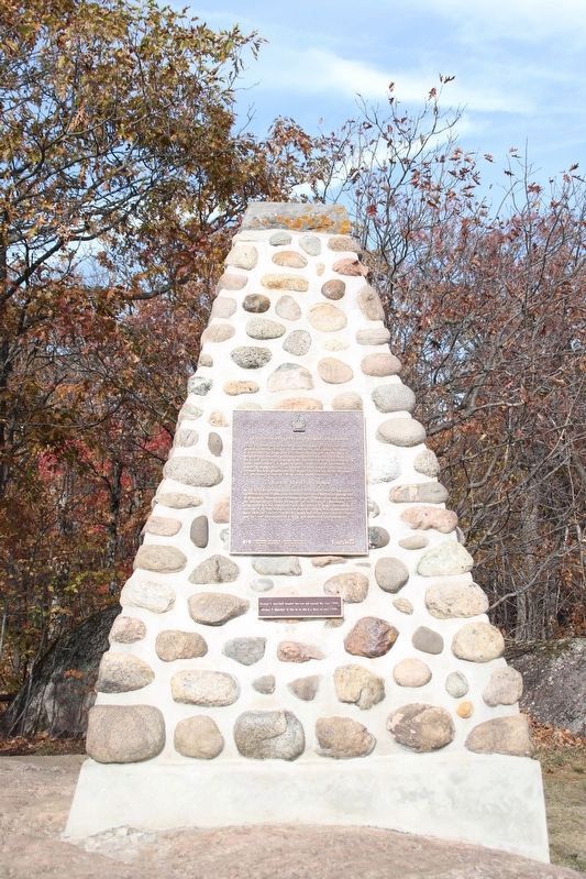
2. Geodetic Survey of Canada - cairn with related marker
Other nearby markers. At least 8 other markers are within 13 kilometers of this marker, measured as the crow flies: Geodetic Survey of Canada / La Division des Levés Géodésiques du Canada (here, next to this marker); The Birth of Gatineau Park (about 150 meters away, measured in a direct line); Le sentier récréatif du boulevard Fournier (approx. 12.6 kilometers away); La Rue Hanson : témoin d'une famille d'industriels (approx. 12.8 kilometers away); La Maison Wright-Scott : Un environnement pittoresque au cœur de la ville (approx. 12.8 kilometers away); Le village d'Argentine, dernier témoin d'une époque (approx. 12.8 kilometers away); Le ruisseau de la Brasserie (approx. 12.9 kilometers away); Place de la Francophonie (approx. 12.9 kilometers away). Touch for a list and map of all markers in Chelsea.

Photographed by Robert Rusaw, October 17, 2025
3. A National Historic Site
Credits. This page was last revised on October 24, 2025. It was originally submitted on October 19, 2025, by Robert Rusaw of Massena, New York. This page has been viewed 118 times since then and 71 times this year. Photos: 1, 2, 3. submitted on October 19, 2025, by Robert Rusaw of Massena, New York. • Andrew Ruppenstein was the editor who published this page.
