Kure Beach in New Hanover County, North Carolina — The American South (South Atlantic)
Blockade-Running
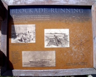
The agricultural South imported many things from Europe, particularly Great Britain. The North blockaded southern ports to stop this trade. In response, the Confederates used fast ships for blockade-running.
Erected by Fort Fisher State Historic Site. (Marker Number 2.)
Topics. This historical marker is listed in these topic lists: Forts and Castles • War, US Civil • Waterways & Vessels.
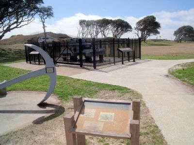
Location. 33° 58.284′ N, 77° 55.081′ W. Marker is in Kure Beach, North Carolina, in New Hanover County. Marker can be reached from Fort Fisher Boulevard South (U.S. 421) near Battle Acre Road. This marker is located along the quarter-mile tour trail at Fort Fisher State Historic Site. Touch for map. Marker is at or near this postal address: 1610 Fort Fisher Boulevard South, Kure Beach NC 28449, United States of America. Touch for directions.
Other nearby markers. At least 8 other markers are within walking distance of this marker. A Trophy of War (a few steps from this marker); Fort Fisher’s Armstrong Cannon (a few steps from this marker); History Trail (within shouting distance of this marker); Growth of Fort Fisher, 1861-1862 (within shouting distance of this marker); Fort Fisher Since 1865 (about 300 feet away, measured in a direct line); Lamb Expands the Fort, 1862-1865 (about 300 feet away); Fort Fisher (about 300 feet away); Capture! (about 400 feet away). Touch for a list and map of all markers in Kure Beach.
More about this marker. On the upper left is a an illustration with the caption, "Cotton exports helped finance the war."
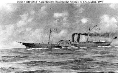
On the lower left is a drawing of a blockade-runner with the caption, "Ships such as the steamer Advance brought most of the weapons, a majority of material for uniforms, and much civilian cargo to the South."
On the right is a faded map with the captions, "Railroads carried vital supplies from Wilmington to southern armies in Virginia" and "European ships took supplies to the Bahamas and Bermuda, where blockade runners picked them up."
Also see . . .
1. Fort Fisher. North Carolina Historic Sites (Submitted on March 15, 2010, by Bernard Fisher of Richmond, Virginia.)
2. The Blockade Runners Race of 1864. Cape Fear Historical Institute (Submitted on March 18, 2010, by Bernard Fisher of Richmond, Virginia.)

Photographed By R.G. Skerrett, 1899
3. Advance (Blockade Running Steamer, 1863-1864)
Advance, a 902-ton side-wheel steamer, was built at Greenock, Scotland, in 1862 for use as a River Clyde packet. Purchased by the State of North Carolina under the name Lord Clyde in 1863, she was renamed Advance (a name frequently given as A.D. Vance), and put to work running the Federal blockade. She was one of the most successful Confederate blockade runners, making more than twenty voyages before her capture by USS Santiago de Cuba off Wilmington, North Carolina, on 10 September 1864. Taken into the United States Navy soon thereafter, she served as USS Advance until June 1865, when she was renamed Frolic. Sepia wash drawing courtesy of the U.S. Navy Art Collection, Washington, D.C., U.S. Naval Historical Center Photograph [NH 61882].
Credits. This page was last revised on February 27, 2021. It was originally submitted on March 15, 2010, by Bernard Fisher of Richmond, Virginia. This page has been viewed 703 times since then and 10 times this year. Photos: 1, 2. submitted on March 15, 2010, by Bernard Fisher of Richmond, Virginia. 3. submitted on March 16, 2010, by Bernard Fisher of Richmond, Virginia.

