Fergus in Centre Wellington in Wellington County, Ontario — Central Canada (North America)
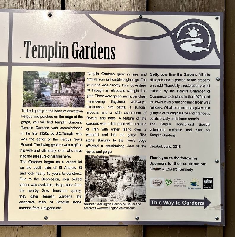
Templin Gardens
Photographed by Tim Boyd, October 18, 2025
1. Templin Gardens Marker
The Gardens began as a vacant lot on the south side of St Andrew St and took nearly 10 years to construct. Due to the Depression, local skilled labour was available, Using stone from the nearby Gow limestone quarry, they gave Templin Gardens the distinctive mark of Scottish stone masons from a bygone era.
Templin Gardens grew in size and stature from its humble beginnings. The entrance was directly from St Andrew St through an elaborate wrought iron gate. There were green lawns, benches, meandering flagstone walkways, birdhouses, bird baths, a sundial, arbours, and a wide assortment of flowers and trees. A feature of the gardens was a fish pond with a statue of Pan with water falling over a waterfall and into the gorge. The stone stairway to the river's edge afforded
this page online
Sadly, over time the Gardens fell into disrepair and a portion of the property was sold. Thankfully, a restoration project initiated by the Fergus Chamber of Commerce took place in the 1970s and the lower level of the original garden was restored. What remains today gives us a glimpse of its original size and grandeur, but its beauty and charm remain.
The Fergus Horticultural Society volunteers maintain and Gardens.
Erected 2015.
Topics. This historical marker is listed in this topic list: Parks & Recreational Areas.
Location. 43° 42.274′ N, 80° 22.721′ W. Marker is in Centre Wellington, Ontario, in Wellington County. It is in Fergus. It is at the intersection of Saint Andrew Street West and Menzies Lane, on the right when traveling east on Saint Andrew Street West. Touch for map. Marker is at or near this postal address: 208 St Andrew Street W, Centre Wellington ON N1M 1N7, Canada. Touch for directions.

Regionally, this marker is in the Huron-Perth-Waterloo-Wellington Area and in Southwestern Ontario. It is also

Photographed by Tim Boyd, October 18, 2025
2. Templin Gardens Marker
The right of the two markers
Other nearby markers. At least 8 other markers are within walking distance of this marker: 212 St. Andrew Street W (here, next to this marker); Weigh Scale Building (within shouting distance of this marker); The Founders of Fergus (within shouting distance of this marker); St. David Street Bridge (about 180 meters away, measured in a direct line); Fergus Swimming Pool (about 210 meters away); The Kissing Stane (about 210 meters away); The Fergus Curling Club / Club de Curling de Fergus (about 210 meters away); St. Andrew’s Presbyterian Church (approx. 0.3 kilometers away). Touch for a list and map of all markers in Centre Wellington.
Photographed by Tim Boyd, October 18, 2025
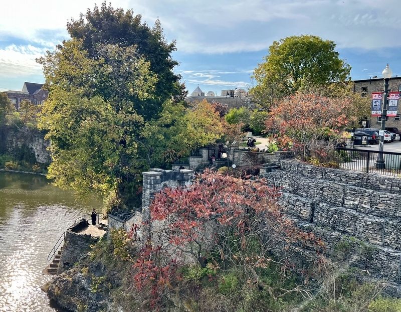
3. Templin Gardens from St. David Street, 2025
Photographed by Tim Boyd, October 18, 2025
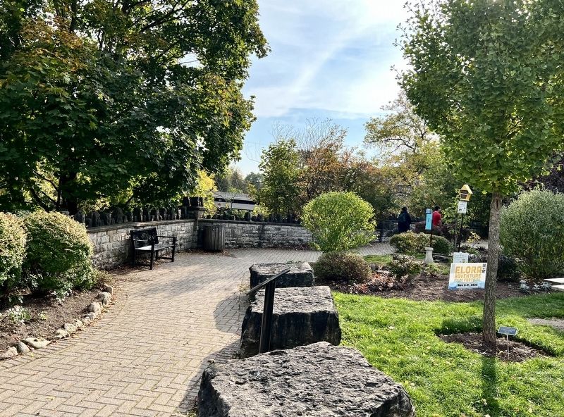
4. Templin Gardens, 2025
Credits. This page was last revised on October 22, 2025. It was originally submitted on October 20, 2025, by Tim Boyd of Hamilton, Ontario. This page has been viewed 47 times since then and 21 times this year. Photos: 1, 2, 3, 4. submitted on October 20, 2025, by Tim Boyd of Hamilton, Ontario. • Andrew Ruppenstein was the editor who published this page.
