
Chelsea in Outaouais, Québec — Central Canada (French-Canadian)
Geodetic Survey of Canada
⎯⎯⎯
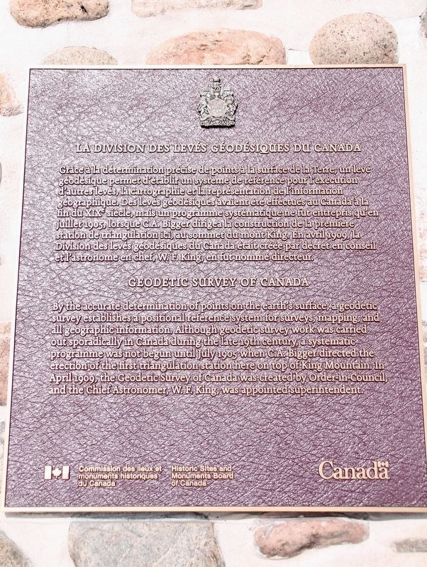
La Division des Levés Géodésiques du Canada
Photographed by Robert Rusaw, October 17, 2025
1. Geodetic Survey of Canada Marker

By the accurate determination of points on the earth's surface, a geodetic survey establishes a positional reference system for surveys, mapping, and all geographic information. Although geodetic survey work was carried out sporadically in Canada during the late 19th century, a systematic programme was not begun until July 1905 when C.A. Bigger directed the erection of the first triangulation station here on top of King Mountain. In April 1909, the Geodetic Survey of Canada was created by Order-in-Council and the Chief Astronomer, W.F. King, was appointed superintendent.
La Division des Levés Géodésiques du Canada
Grace à la détermination précise de points à la surface de la Terre, un leve géodésique permet d'établir un système de référence pour l'exécution d'autres levés, la cartographie et la représentation de l'information geographique. Des levés géodésiques avaient été effectués au Canada à la fin du XIX steele, mais un programme systématique ne fut entrepris qu'en juillet 1905, lorsque C.A. Bigger dirigea la construction de la première station de triangulation ici, au sommet du mont King. En avril 1909, la Division des levés géodésiques du Canada était créée par décret en conseil et l'astronome en chef, W. E. King, en fut nommé directeur.
Erected by Historic
this page online
Topics and series. This historical marker is listed in this topic list: Science & Medicine. In addition, it is included in the Canada, Historic Sites and Monuments Board series list. A significant historical year for this entry is 1909.
Location. 45° 29.344′ N, 75° 51.757′ W. Marker is in Chelsea, Québec, in Outaouais. It can be reached from Sentier Mont King. This marker is located on the King's Mountain Trail in Gatineau Parc. Touch for map. Marker is in this post office area: Chelsea QC J9B 1A3, Canada. Touch for directions.

Regionally, this marker is in the Ottawa Metropolitan Area and in the Outaouais & Eastern Townships. It is also in Central Canada. Globally, it is in North America, the Great North Woods, the Western Hemisphere, and the Western World. Historically, it finds itself in what was once a British colony, the Viceroyalty of New France, the Haudenosaunee (Iroquois) Confederacy, and Rupert’s Land.
Other nearby markers. At least 8 other markers are within 13 kilometers of this marker, measured as the crow flies: First Geodetic Survey Station / La Première-Station-Geodésique
Photographed by Robert Rusaw, October 17, 2025
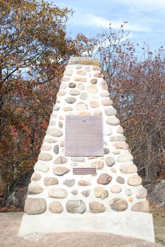
2. Geodetic Survey of Canada Marker
Credits. This page was last revised on October 23, 2025. It was originally submitted on October 21, 2025, by Robert Rusaw of Massena, New York. This page has been viewed 46 times since then and 25 times this year. Photos: 1, 2. submitted on October 21, 2025, by Robert Rusaw of Massena, New York. • Andrew Ruppenstein was the editor who published this page.
