
Plymouth, England, United Kingdom — Northwestern Europe (the British Isles)
The Name "Briton Side"
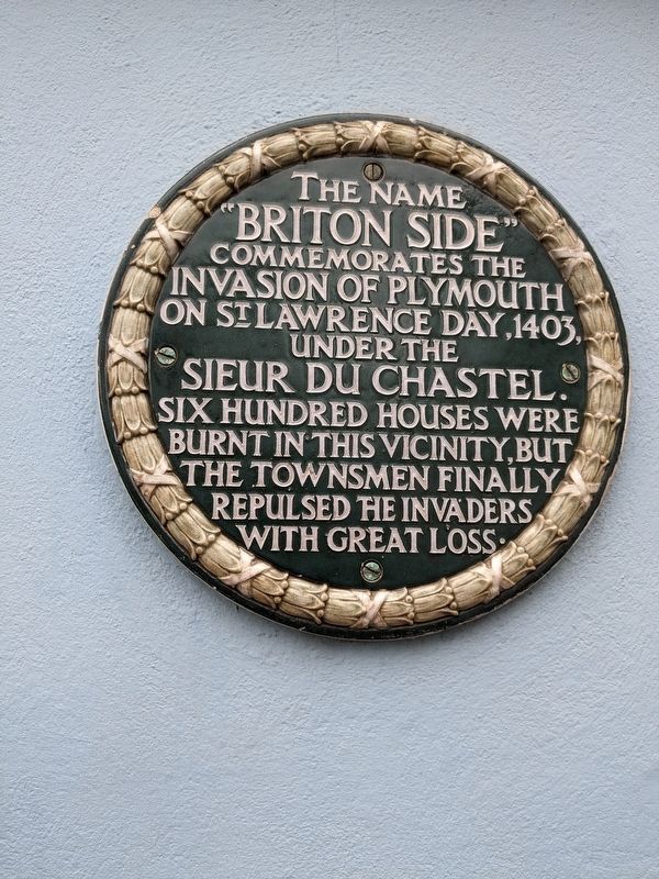
Photographed by Josh Pletcher, April 5, 2023
1. The Name "Briton Side" Marker
Topics. This historical marker is listed in this topic list: Wars, Non-US. A significant historical date for this entry is August 10, 1403.
Location. 50° 22.248′ N, 4° 8.023′ W. Marker is in Plymouth, England. It is at the intersection of Bretonside and Hawkers Avenue, on the right when traveling east on Bretonside. On wall on corner of Mayflower House. Touch for map. Marker is at or near this postal address: 50-54 Bretonside, Plymouth, England PL4 0AF, United Kingdom. Touch for directions.

Regionally, this marker is in South West England. Globally, it is on the Atlantic Ocean, in the North Atlantic Region, in Europe, in Atlantic Europe, on one of the British Isles, in the Western World, and in the Anglosphere. Historically, it finds itself in what was once the Roman Empire.
Other nearby markers. At least 8 other markers are within walking distance of this marker: William Cookworthy (approx. 0.4
this page online
Credits. This page was last revised on October 22, 2025. It was originally submitted on October 22, 2025, by Josh Pletcher of Wellington, Colorado. This page has been viewed 61 times since then and 40 times this year. Photo 1. submitted on October 22, 2025, by Josh Pletcher of Wellington, Colorado. • Andrew Ruppenstein was the editor who published this page.
