
Centre Wellington in Wellington County, Ontario — Central Canada (North America)
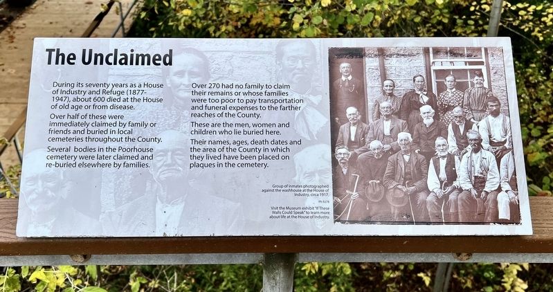
The Unclaimed
Photographed by Tim Boyd, October 18, 2025
1. The Unclaimed Marker
Over half of these were immediately claimed by family or friends and buried in local cemeteries throughout the County.
Several bodies in the Poorhouse cemetery were later claimed and re-buried elsewhere by families.
Over 270 had no family to claim their remains or whose families were too poor to pay transportation and funeral expenses to the farther reaches of the County.
These are the men, women and children who lie buried here.
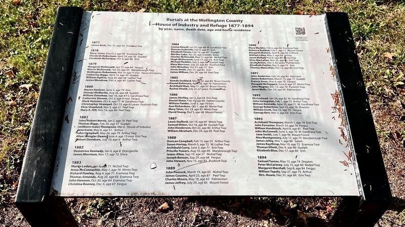
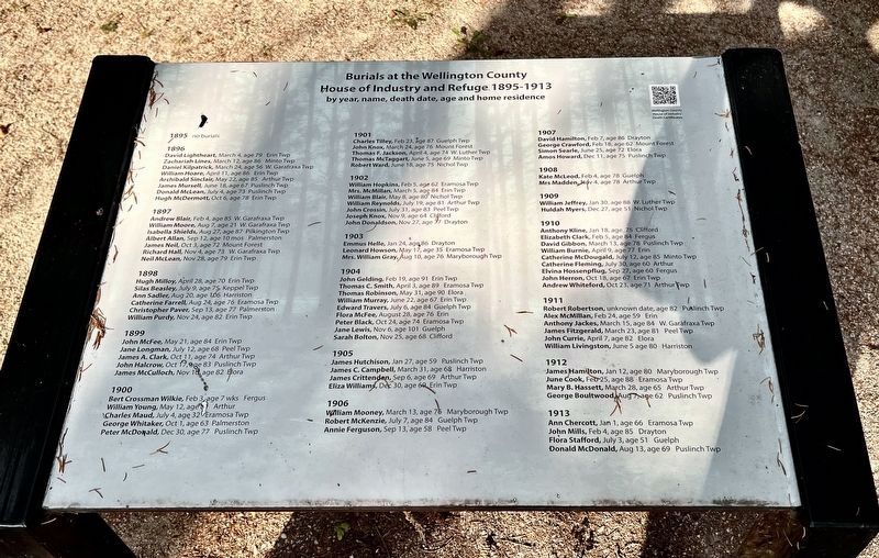
Their names, ages, death dates and the area of the County in which they lived have been placed on plaques in the cemetery.
Topics. This historical marker is listed in these topic lists: Cemeteries & Burial Sites • Charity & Public Work.
Location. 43° 41.491′ N, 80° 23.736′ W. Marker is in Centre Wellington, Ontario, in Wellington County. It can be reached from Wellington Road 18. The marker is on the steps leading to the grounds grounds of the former House of Industry and Refuge Cemetery, entered
this page online

Regionally, this marker is in the Huron-Perth-Waterloo-Wellington Area and in Southwestern Ontario. It is also in Central Canada. Globally, it is in North America, the Western Hemisphere, the Western World, and the Anglosphere. Historically, it finds itself in what was once a British colony, the Viceroyalty of New France, the Haudenosaunee (Iroquois) Confederacy, and Rupert’s Land.
Other nearby markers. At least 8 other markers are within walking distance of this marker: "A house of incurables and physical wrecks" (here, next to this marker); The Deserving Poor (here, next to this marker); The Poorhouse Cemetery (here, next to this marker); Families: the Cycle of Poverty (here, next to this marker); The Funerals (here, next to this marker); Causes of Death (a few steps from this marker); The Notorious Jane Lewis (a few steps from this marker); The Burials: Age and Gender
Photographed by Tim Boyd, October 18, 2025
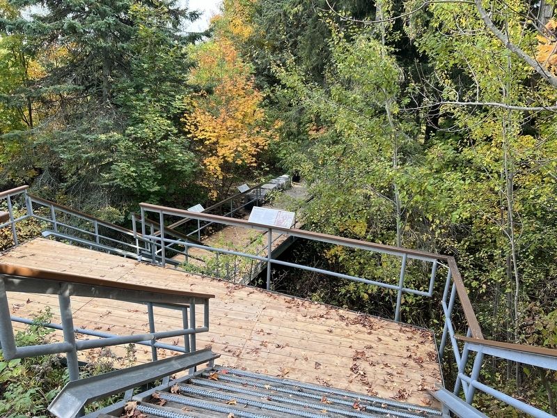
2. The Unclaimed marker
Photographed by Tim Boyd, October 18, 2025
3. Record of burials from 1877-1894
Photographed by Tim Boyd, October 18, 2025
4. Burials from 1895-1913
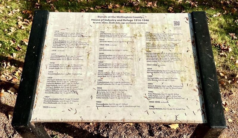
Photographed by Tim Boyd, October 18, 2025
5. Burials from 1914-1946
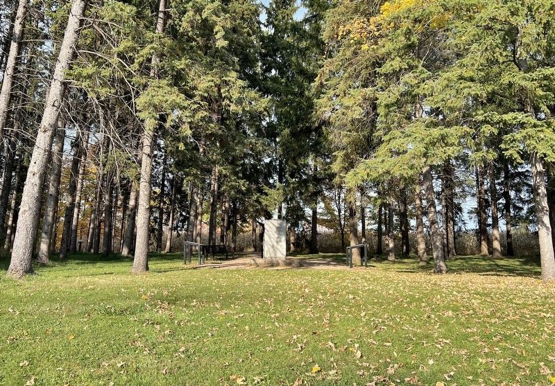
Photographed by Tim Boyd, October 18, 2025
6. Entrance to the House of Industry and Refuge cemetery from County Road 18
Credits. This page was last revised on October 23, 2025. It was originally submitted on October 23, 2025, by Tim Boyd of Hamilton, Ontario. This page has been viewed 45 times since then and 17 times this year. Photos: 1, 2, 3, 4, 5, 6. submitted on October 23, 2025, by Tim Boyd of Hamilton, Ontario. • Andrew Ruppenstein was the editor who published this page.
