Near Morristown in Belmont County, Ohio — The American Midwest (Great Lakes)
Morristown
Photographed by J. J. Prats, April 10, 2006
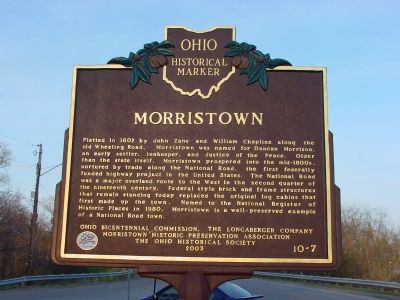
1. Morristown Marker
Platted in 1802 by John Zane and William Chapline along the old Wheeling Road. Morristown was named for Duncan Morrison, an early settler, innkeeper, and Justice of the Peace. Older than the state itself. Morristown prospered into the mid-1800s, nurtured by trade along the National Road, the first federally funded highway project in the United States. The National Road was a major overland route to the West in the second quarter of the nineteenth century. Federal style brick and frame structures that remain standing today replaced the original log cabins that first made up the town. Named to the National Register of Historic Places in 1980. Morristown is a well-preserved example of a National Road town.
Erected 2003 by Ohio Bicentennial Commission, The Longaberger Company, Morristown Historic Preservation Association, The Ohio Historical Society. (Marker Number 10-7.)
Topics and series. This historical marker is listed in these topic lists: Political Subdivisions • Roads & Vehicles. In addition, it is included in the Ohio Historical Society / The Ohio History Connection, and the The Historic National Road
this page online
Location. 40° 3.945′ N, 81° 3.767′ W. Marker is near Morristown, Ohio, in Belmont County. It is at the intersection of National Road (U.S. 40) and Old National Road, on the right when traveling west on National Road. Touch for map. Marker is in this post office area: Belmont OH 43718, United States of America. Touch for directions.

Regionally, this marker is in Ohio’s High Valley. It is also in the American Midwest, in Appalachia, and specifically in Northern Appalachia. Globally, it is in North America, the Western Hemisphere, the Western World, and the Anglosphere. Historically, it finds itself in what was once the Haudenosaunee (Iroquois) Confederacy, the territory of the Mississippian Culture, and the Northwest Territory.
Other nearby markers. At least 5 other markers are within 3 miles of this marker, measured as the crow flies: The Brick Road (within shouting distance of this marker); Morristown District WWII Roll Of Honor (about 500 feet away, measured in a direct line); Ohio Native Plants (approx. 2.6 miles away); Ohio Buckeye Tree (approx.
Photographed by J. J. Prats, April 10, 2006
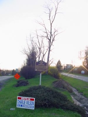
2. Morristown Marker
U.S. 40 on the left, Old National Road to Morristown on the right.
Also see . . . Historic Morristown Ohio. Morristown Historic Preservation Association website entry (Submitted on April 20, 2006.)
Photographed by Mike Wintermantel, November 2, 2014
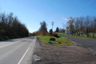
3. Morristown Marker
Descriptive stone has been placed in front of marker
Photographed by J. J. Prats, April 10, 2006
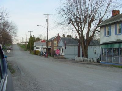
4. Morristown
Old National Road heading east. Post office is behind the stop sign.
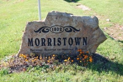
Photographed by Mike Wintermantel, November 2, 2014
5. Morristown Stone
located in front of Morristown marker
inscription
1802
Morristown
National Register of Historic Places
inscription
1802
Morristown
National Register of Historic Places
Credits. This page was last revised on August 29, 2024. It was originally submitted on April 20, 2006, by J. J. Prats of Powell, Ohio. This page has been viewed 2,862 times since then and 48 times this year. Photos: 1, 2. submitted on April 20, 2006, by J. J. Prats of Powell, Ohio. 3. submitted on November 2, 2014, by Mike Wintermantel of Pittsburgh, Pennsylvania. 4. submitted on April 20, 2006, by J. J. Prats of Powell, Ohio. 5. submitted on November 2, 2014, by Mike Wintermantel of Pittsburgh, Pennsylvania.
