
Bishop in Inyo County, California — The American West (Pacific Coastal)
Inyo County Hospital and Farm
Burial Site Memorials

Photographed by Craig Baker, October 30, 2025
1. Inyo County Hospital and Farm Marker
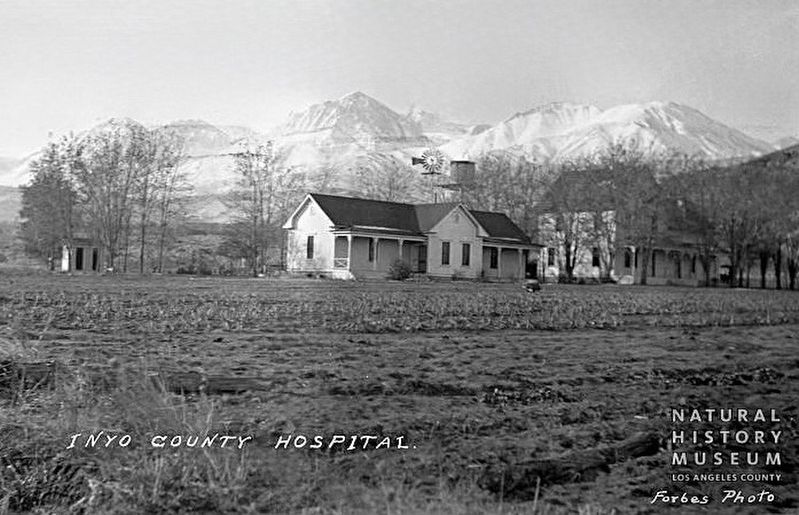
Around the 1900's, Inyo County provided a County Hospital and working farm on 80 acres. It was well established by 1920 with the Sanatorium building plus several additional residences, a hay barn, and a small milking barn which still stands today. The purpose of the farm was to help people who had fallen on hard times be self-sufficient and provide medical care. The County Farm was still in use as both a Tuberculosis Sanatorium and Home for the aged in the 1940s. The building was eventually converted into the Big Pine Care Center which was in use until 2000. The first hospital (pictured above) was destroyed by fire in 1919.
At this site was the County Hospital's cemetery where residents were buried. The original wooden grave markers are gone but not forgotten, sources for the names added here were obtained from newspaper clippings and county death certificates.
In 2022, the Big Pine Cemetery District placed permanent grave markers to acknowledge the residents' final resting place.
Erected 2022 by Big Pine Cemetery.
Topics. This historical marker is listed in this topic list:
this page online
Location. 37° 10.05′ N, 118° 17.908′ W. Marker is in Bishop, California, in Inyo County. It can be reached from Crocker Avenue half a mile west of U.S. 395, on the right when traveling west. Located in Big Pine Cemetery. Touch for map. Marker is at or near this postal address: 605 W Crocker Ave, Big Pine CA 93513, United States of America. Touch for directions.

Regionally, this marker is in California’s Sierra Nevada. It is also in the American Mountain West. Globally, it is in North America, on the Ring of Fire, in the Pacific Rim, in the Western Hemisphere, in the Western World, and in the Anglosphere. Historically, it finds itself in what was once New Spain and also Mexico’s Alta California.
Other nearby markers. At least 8 other markers are within 14 miles of this marker, measured as the crow flies: Big Pine Cemetery District (about 400 feet away, measured in a direct line); Westgaard Pass Toll Road (approx. 0.6 miles away); Big Pine Veterans Memorial (approx. 0.6 miles away); The Roosevelt Tree (approx. 0.6 miles away); Zurich Station (approx.

Photographed by Craig Baker, October 30, 2025
2. Inyo County Hospital and Farm Marker
The original location is among the trees in the distance.
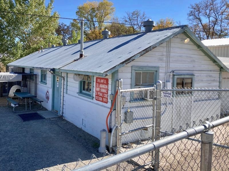
Regarding Inyo County Hospital and Farm. Many who died at the hospital were buried somewhere on the property. The exact burial spots are unknown. In 2022, the Big Pine Cemetery District placed permanent grave markers (cenotaphs) in Big Pine Cemetery to acknowledge the residents who died and were buried at the Farm Cemetery. There are over 100 people documented who passed away between 1877 and 1928 at the County Hospital/Farm Cemetery. That site is now the Inyo County Animal Shelter at 1001 County Rd, Big Pine.
Also see . . . Big Pine Cemetery District. (Submitted on October 31, 2025.)
courtesy L.A. County NHM
3. Inyo County Hospital circa 1900
The first hospital, destroyed by fire in 1919.
Photographed by Craig Baker, October 30, 2025
4. Inyo County Hospital and Farm
Original small milking barn. At today’s County Animal Shelter.
Photographed by Craig Baker, October 30, 2025
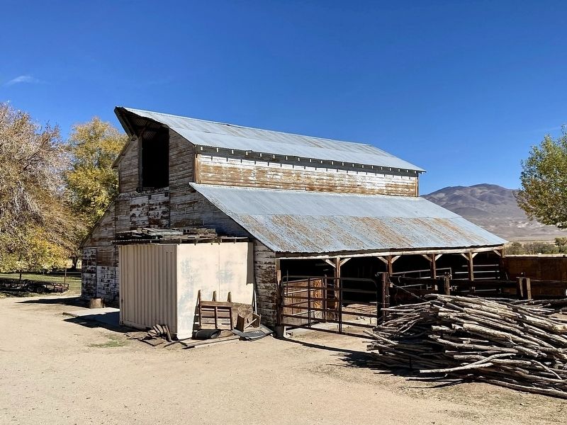
5. Inyo County Hospital and Farm
Historic barn at today’s County Animal Shelter. Rebuilt after the 1919 fire.
Credits. This page was last revised on January 29, 2026. It was originally submitted on October 28, 2025, by Craig Baker of Sylmar, California. This page has been viewed 62 times since then and 30 times this year. Photos: 1, 2, 3. submitted on October 28, 2025, by Craig Baker of Sylmar, California. 4. submitted on November 2, 2025, by Craig Baker of Sylmar, California. 5. submitted on October 31, 2025, by Craig Baker of Sylmar, California.
