Lecompton in Douglas County, Kansas — The American Midwest (Upper Plains)
The Battle of Fort Titus
Photographed by Jason Voigt, October 29, 2025
1. The Battle of Fort Titus Marker
In 1855 the new town of Lecompton became the capital of Kansas Territory. President James Buchanan appointed a governor and officials to establish government offices in Lecompton, and construction began on an elegant capitol building. In the fall of 1857, a convention met in Constitution Hall and drafted the famous Lecompton Constitution, which would have admitted Kansas as a slave state. The constitution was rejected after intense national debate and was one of the prime topics of the Lincoln-Douglas debates. The controversy contributed to the growing dispute soon to erupt in Civil War. The Lecompton Constitution failed, in part, because the antislavery party won control of the territorial legislature in the election of 1857. The new legislature met in Constitution Hall, now a National Historic landmark, and immediately began to abolish the proslavery laws. The victorious free-state leaders chose Topeka as capital when Kansas became a state in 1861.
Constitution Hall, a National Historic Landmark, still stands in Lecompton and is a State Historic Site. Part of the never-completed capitol later was rebuilt as Lane
this page online
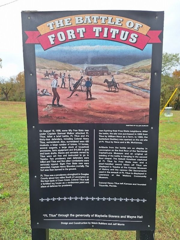
On August 16, 1856, some fifty Free State men under Captain Samuel Walker attacked Ft. Titus. After a brief battle, Ft. titus and it's thirty-four defenders, including Colonel Henry Titus, surrendered. Also, surrendered were 400 muskets, a large number of knives, 13 horses, several wagons, a large stock of household provisions, farm equipment and $10,000 in gold and bank drafts. Slaves and servants owned by Titus were set free and instructed to go to Topeka. Two proslavery men defenders were killed and Titus and five other combatants were seriously injured. Eight Free State men were wounded, Captain Henry Shombre mortally. The fort was then burned to the ground.
Ft. Titus was a proslavery stronghold in Douglas County about two miles South of Lecompton on the East bank of Coon Creek. Colonel Titus built a fortified log house as a rendezvous point and place of defense for proslavery men fighting their Free

Photographed by Jason Voigt, October 29, 2025
2. The Battle of Fort Titus Marker
Artifacts from the battle are on display in Lecompton on the first floor of the Territorial Capital/Lane Museum and an original oil painting of the battle is hanging in the second floor chapel. The Abbott Howitzer captured at Ft. Titus by Free State Men and a pearl-handled sword taken off Titus are displayed in Topeka at the Kansas Museum of History and the cannon Old Sacramento used in the assault of Ft. Titus is displayed in Lawrence at the Watkins Community Museum.
Colonel Henry Titus left Kansas and founded Titusville, Florida.
Topics. This historical marker is listed in these topic lists: African Americans • Forts and Castles • War, US Civil. A significant historical date for this entry is August 16, 1856.
Location. 39° 2.657′ N, 95° 23.487′ W. Marker is in Lecompton, Kansas, in Douglas County. It is at the intersection of East Woodson Avenue and Boone Street, on the right when traveling west on East Woodson Avenue. Touch for map.
Photographed by Jason Voigt, October 29, 2025
3. The Battle of Fort Titus Marker
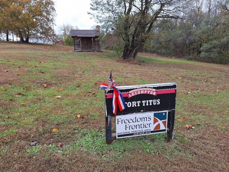
Ft. Titus is a Freedom's Frontier National Heritage Site

Regionally, this marker is in Eastern Kansas and specifically in Bleeding Kansas Border War Country. It is also in the American Midwest, in the Corn Belt, on the prairies, on the Southern Plains, and on the Santa Fe Trail Corridor. Globally, it is in North America, the Western Hemisphere, the Western World, and the Anglosphere. Historically, it finds itself in what was once the Louisiana Purchase.
Other nearby markers. At least 8 other markers are within 3 miles of this marker, measured as the crow flies: Historic Lecompton (a few steps from this marker); Resilience (within shouting distance of this marker); Lane University (within shouting distance of this marker); Lecompton Constitution Hall (approx. 0.2 miles away); Veterans Monument (approx. 0.2 miles away); Sheriff Samuel J. Jones (approx. 0.2 miles away); Democratic Headquarters (approx. 0.3 miles away); Kansa Indians (approx. 3 miles away). Touch for a list and map of all markers in Lecompton.
Also see . . . Fort Titus. From the village of Lecompton's website. More information about one of the early pre-Civil War battles (Submitted on October 31, 2025, by Jason Voigt of Glen Carbon, Illinois.)
Credits. This page was last revised on October 31, 2025. It was originally submitted on October 31, 2025, by Jason Voigt of Glen Carbon, Illinois. This page has been viewed 101 times since then and 52 times this year. Photos: 1, 2, 3. submitted on October 31, 2025, by Jason Voigt of Glen Carbon, Illinois.
