Lugert in Kiowa County, Oklahoma — The American South (West South Central)
Civilian Conservation Corps and Quartz Mountain State Park
Altus, Blair, Granite, Mangum, and Lone Wolf, Oklahoma

Photographed by James Hulse, October 27, 2025
1. Civilian Conservation Corps and Quartz Mountain State Park Marker
About 150 young men lived in tents and worked on the park under the management of the U.S. Departments of Army and Agriculture. They were paid $30 per month of which $25 was sent home. They also received housing, food, medical, and dental care as well as educational benefits.
The CCC members built roads, trails, covered shelters, picnic tables, cabins, and landscaped the park. All facilities are still in use. Quartz State Lodge is located in the center of the park.
Company 2810 left a memorial to the service of its members in the form of this beautiful park which serves countless thousands of visitors each year.
Dedicated to the members of CCC Company 2810 and the three million members who served our nation. March 26, 1988.
Erected by Oklahoma Civilian Conservation Corps Alumni Association and Oklahoma Historical Society.
Topics. This historical marker is listed in these topic lists: Charity & Public Work • Parks & Recreational Areas. A significant historical date for this entry is March 26, 1988.
Location. 34° 53.603′ N, 99° 17.909′ W. Marker is in Lugert, Oklahoma, in Kiowa County. It is on Park Road ¼ mile east of County Road 1470. The marker is located in the Quartz Mountain State Park at the group camp area. Touch for map. Marker is in this post office area: Lone Wolf OK 73655, United States of America. Touch for directions.

Regionally, this marker is in the Kiowa Tribe, in the Comanche Nation, and in Southwest Oklahoma—Great Plains Country. It is also in the American South, specifically on the prairies, and on the Southern Plains. Globally, it is in North America,
this page online
Other nearby markers. At least 8 other markers are within 15 miles of this marker, measured as the crow flies: Lugert, Oklahoma (about 500 feet away, measured in a direct line); Peace on the Plains (approx. 3.1 miles away); Granite Community Memorial (approx. 6.7 miles away); The 36th Infantry Division's 132nd Machine Gun Battalion (approx. 6.7 miles away); Welcome to Comecos Cemetery (approx. 7.1 miles away); Lake Creek (approx. 11½ miles away); Friendship / Western Cattle Trail (approx. 14.2 miles away); First Shelterbelt in the United States (approx. 14.8 miles away). Touch for a list and map of all markers in Lugert.
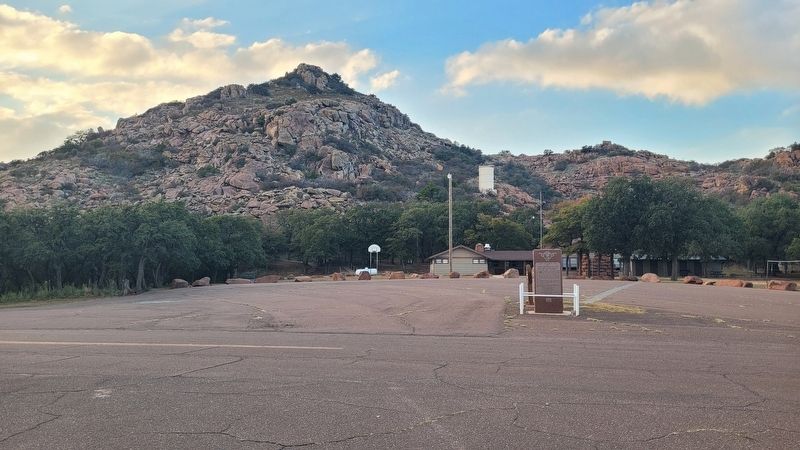
Photographed by James Hulse, October 27, 2025
2. Civilian Conservation Corps and Quartz Mountain State Park Marker
Credits. This page was last revised on November 2, 2025. It was originally submitted on November 1, 2025, by James Hulse of Medina, Texas. This page has been viewed 60 times since then and 31 times this year. Photos: 1, 2. submitted on November 2, 2025, by James Hulse of Medina, Texas.
