Solomons in Calvert County, Maryland — The American Northeast (Mid-Atlantic)
Dewey Floating Dry Dock
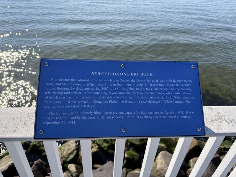
Named after the Admiral of the Navy, George Dewey, the Dewey dry dock was built in 1905 by the Maryland Steel Company at Sparrows Point in Baltimore, Maryland. At that time, it was the world's largest floating dry dock, measuring 500' by 158', weighing 16,000 tons, and capable of dry-docking a battleship and cruiser. After launching, it was immediately towed to Solomons, which offered one of the deepest natural harbors on the Atlantic coast for rigorous acceptance tests. From Solomons, the Dewey dry dock was towed to Olongapo, Philippines — a total distance of 13,089 miles. The journey took a total of 150 days.
The Dewey was deliberately blow up to prevent capture by the Japanese on April 8, 1942. It was then raised and used by the Imperial Japanese Navy until sunk again by American naval aircraft on September 21, 1944.
Topics. This historical marker is listed in these topic lists: Industry & Commerce • War, World II • Waterways & Vessels. A significant historical date for this entry is April 8, 1942.
Location. 38° 19.273′ N, 76° 27.546′ W. Marker is in Solomons, Maryland, in Calvert County. It is on Solomons Island
this page online

Regionally, this marker is in Southern Maryland. It is also in the American South, specifically in the Upper South, in the Mid-Atlantic, in the Tidewater, in the Chesapeake Bay Region, and on the Eastern Seaboard. Globally, it is in the North Atlantic Region, North America, the Western Hemisphere, the Western World, and the Anglosphere. Historically, it finds itself in what was once one of the original Thirteen Colonies and also the Antebellum South.
Other nearby markers. At least 8 other markers are within walking distance of this marker: Point Patience (here, next to this marker); Majestic Patuxent River (within shouting distance of this marker); Governor Thomas Johnson Bridge (about 300 feet away, measured in a direct line); The ESSO Fleet (about 300 feet away); Watery Grave (about 500 feet away); M. M. Davis Shipyard (about 500 feet away); Patuxent River Naval Air Station (about 500 feet away);
Credits. This page was last revised on November 2, 2025. It was originally submitted on November 2, 2025, by Devry Becker Jones of Washington, District of Columbia. This page has been viewed 46 times since then and 24 times this year. Photos: 1, 2. submitted on November 2, 2025, by Devry Becker Jones of Washington, District of Columbia.
