Tuttle in Grady County, Oklahoma — The American South (West South Central)
Run of '89 South Boundary
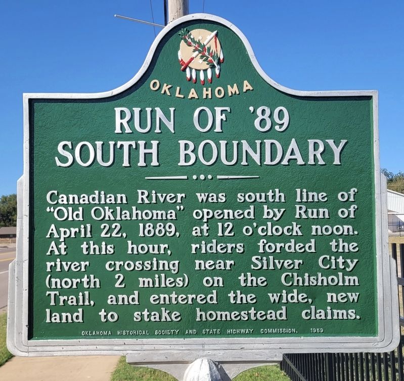
Photographed by James Hulse, October 29, 2025
1. Run of '89 South Boundary Marker
Erected 1959 by Oklahoma Historical Society and State Highway Commission.
Topics. This historical marker is listed in these topic lists: Immigration • Settlements & Settlers. A significant historical date for this entry is April 22, 1889.
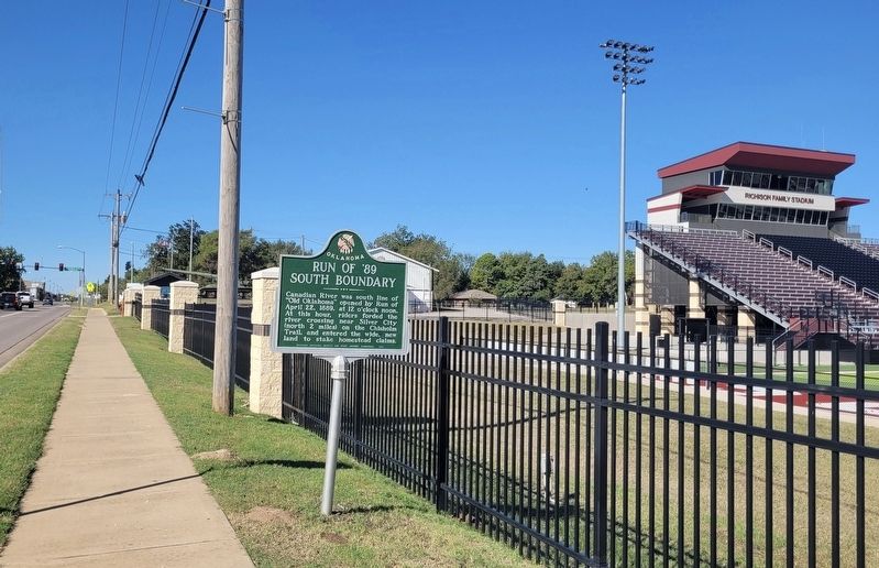
Location. 35° 17.458′ N, 97° 48.659′ W. Marker is in Tuttle, Oklahoma, in Grady County. It is at the intersection of East Main Street (State Highway 37) and SE 1st Street, on the right when traveling west on East Main Street. The marker is located south of the Tuttle Football Stadium along the highway. Touch for map. Marker is at or near this postal address: 201 E Main St, Tuttle OK 73089, United States of America. Touch for directions.

Regionally, this marker is in the Chickasaw Nation and in Greater Oklahoma City. It is also in the American South, specifically on the prairies, and on the Southern Plains. Globally, it is
this page online
Other nearby markers. At least 7 other markers are within 17 miles of this marker, measured as the crow flies: M110A2 Self-Propelled Howitzer (within shouting distance of this marker); This Boulder Marks the Chisholm Trail (about 300 feet away, measured in a direct line); Yukon Czech Hall (approx. 12.9 miles away); Yukon Facts (approx. 13.6 miles away); Sergeant First Class Tony K. Burris, USA (approx. 13.7 miles away); Lake Overholser Dam (approx. 15.8 miles away); Council Grove (approx. 16.7 miles away).
Also see . . . Land Run of 1889. The Encyclopedia of Oklahoma History and Culture
The Land Run of 1889, although not without precedent in the history of the West, began the disposal of the federal public domain in Oklahoma. The legal basis for opening the Oklahoma District, now called the Unassigned Lands, came in 1889 when, in the U.S. Congress, Illinois Rep. William Springer amended the Indian Appropriations(Submitted on November 3, 2025, by James Hulse of Medina, Texas.)Bill to authorize Pres. Benjamin Harrison to proclaim the two-million-acre region open for settlement. Under the provisions of the Homestead Act of 1862, a legal settler could claim 160 acres of public land, and those who lived on and improved the claim for five years could receive a title.Photographed by James Hulse, October 29, 20252. The view of the Run of '89 South Boundary and Marker along the street
The ink was hardly dry on Harrison's March 23, 1889, proclamation before Oklahoma settlement colonies were being formed in major U.S. cities. A multitude of impoverished farmers were not alone in their zeal to settle the Unassigned Lands, known popularly as the Oklahoma Lands. Tradesmen, professional men, common laborers, capitalists, and politicians alike looked to the cornucopia of opportunity offered by settlement of the long-withheld lands of Indian Territory. Across the nation, prospective settlers began hitching their teams to wagons and loading aboard their families and scant worldly goods. Others saddled their fastest horses or caught trains for what they considered to be the most advantageous point of entry. "It is an astonishing thing," the New York Herald observed on the eve of the opening, "that men will fight harder for $500 worth of land than they will for $10,000 in money."
Credits. This page was last revised on November 3, 2025. It was originally submitted on November 2, 2025, by James Hulse of Medina, Texas. This page has been viewed 85 times since then and 24 times this year. Photos: 1, 2. submitted on November 3, 2025, by James Hulse of Medina, Texas.
