Tuttle in Grady County, Oklahoma — The American South (West South Central)
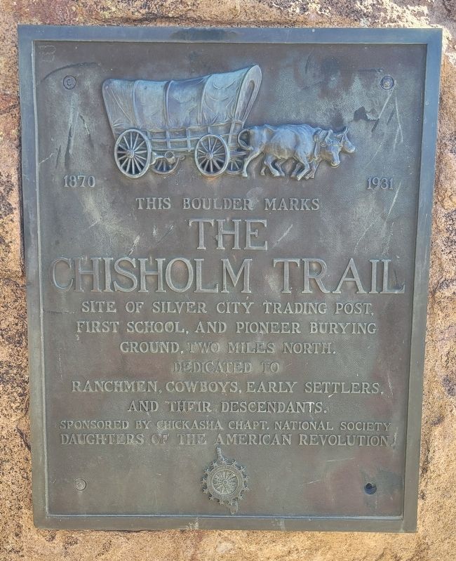
This Boulder Marks the Chisholm Trail
1870 - 1930
Photographed by James Hulse, October 29, 2025
1. This Boulder Marks the Chisholm Trail Marker
Dedicated to ranchmen, cowboys, early settlers, and their descendants.
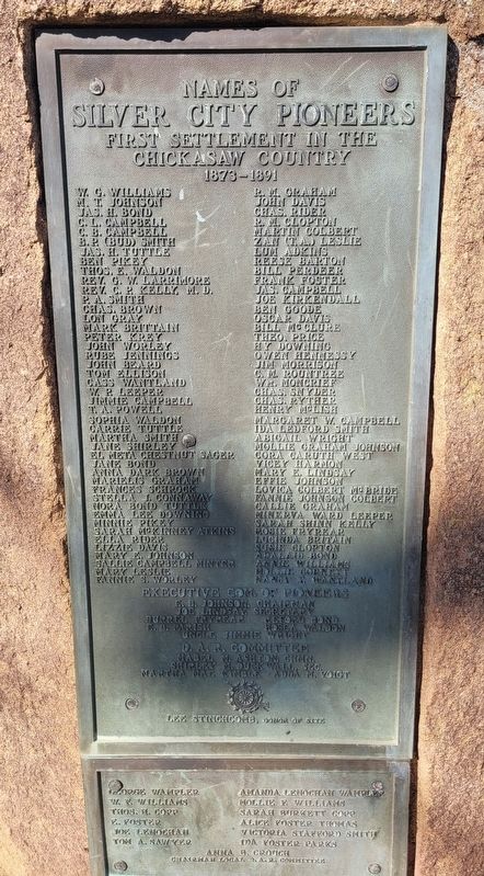
2nd Plaque
First Settlement in the Chickasaw Country 1873-1891
this page online
Executive Com. Of Pioneers
E.B. Johnson, Chairman • Joe Lindsay, Secretary • Burrel Fryreap • Reford Bond • E.B. Parish • Hosea Waldon • Uncle Jimmie Wright
D.A.R. Committee
Mabel M. Asihton, Chmn. • Shirley M. Duck Wall, Sec. • Martha Mal Kimble • Adda M. Voigt
Lee Stinchcomb, Donor of Site
Lower Part of 2nd Plaque
George Wampler • W.E. Williams • Thos. H. Copp • E. Foster • Joe Lenochan • Tom A. Sawyer • Amanda Lenochan Wampler • Mollie
Photographed by James Hulse, October 29, 2025
2. This Boulder Marks the Chisholm Trail Marker - 2nd Plaque
Erected by Chickasha Chapt. National Society Daughters of the American Revolution.
Topics and series. This historical marker is listed in these topic lists: Animals • Roads & Vehicles • Settlements & Settlers. In addition, it is included in the Daughters of the American Revolution (DAR) series list.
Location. 35° 17.462′ N, 97° 48.718′ W. Marker is in Tuttle, Oklahoma, in Grady County. It is at the intersection of East Main StReet (State Highway 37) and N Cimarron Road, on the right when traveling west on East Main StReet. The marker is located in front of the American Legion Rooker-Wallace Post 176. Touch for map. Marker is in this post office area: Tuttle OK 73089, United States of America. Touch for directions.

Regionally, this marker is in the Chickasaw Nation and in Greater Oklahoma City. It is also in the American South, specifically on the prairies, and on the Southern Plains. Globally, it is in North America, the Western Hemisphere, the Western World, and the Anglosphere. Historically, it finds itself in what was once the territory of the Mississippian Culture and also the Louisiana Purchase.
Other nearby markers. At least 7 other markers are within 17 miles of this marker, measured as the crow flies: M110A2 Self-Propelled Howitzer (a few steps from this marker); Run of '89 South Boundary (about 300 feet away, measured in a direct line); Yukon Czech Hall (approx. 12.9 miles away); Yukon Facts (approx. 13.6 miles away); Sergeant First Class Tony K. Burris, USA (approx. 13.7 miles away); Lake Overholser Dam (approx. 15.8 miles away); Council Grove (approx. 16.8 miles away).
Photographed by James Hulse, October 29, 2025
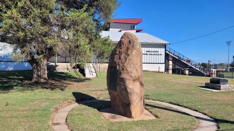
3. The Boulder and Markers
Photographed by James Hulse, October 29, 2025
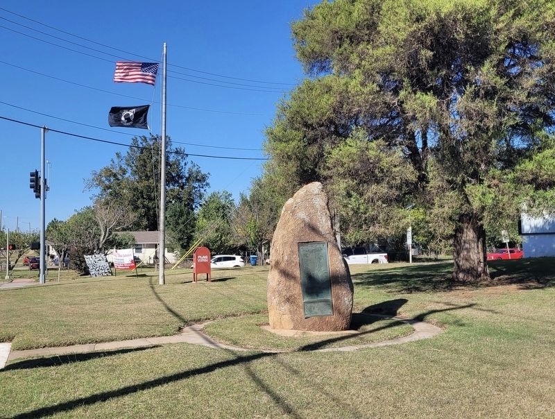
4. The view of the markers and boulder in front of the American Legion Rooker -Wallace Post 176

Photographed by James Hulse, October 29, 2025
5. The view of the marker from the street
Credits. This page was last revised on November 4, 2025. It was originally submitted on November 3, 2025, by James Hulse of Medina, Texas. This page has been viewed 95 times since then and 40 times this year. Photos: 1, 2, 3, 4, 5. submitted on November 4, 2025, by James Hulse of Medina, Texas.
