
Near Alexandria in Thayer County, Nebraska — The American Midwest (Upper Plains)
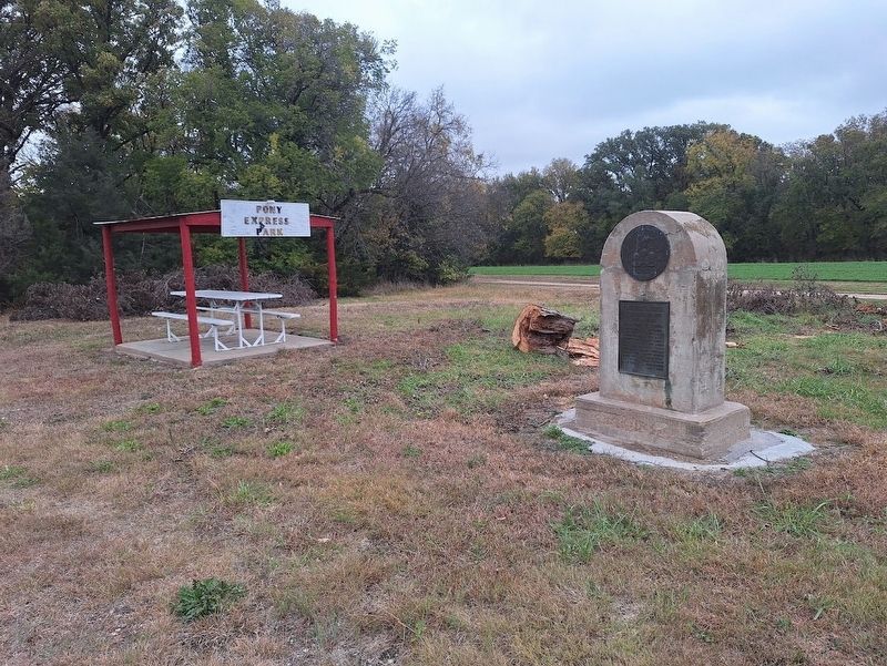
Pony Express Riders
Centennial Re-Run
| — | 1860-1960 | — |

Photographed by Jason Voigt, October 27, 2025
1. Pony Express Riders Marker
West Bound
July 20, 1960
Harry Sulz • Leonard Mussman • Raymond Kerwood • Henry Korensky • Arthur Daringer • Edward Ells • Ross W. Bruning • Marvin Kerwood • Hugo Broeder • Ray M. Johnson
East Bound
July 28, 1960
John J. Kerns • Gene M. Ells •Bill G. Lindsley •Don Lubben • Daryl L. Easley •Herman G. Houseman •Marvin Kerwood •Gerald Helget • Donald Kerwood • Raymond Kerwood • Elmer K. Wolfe
Topics and series. This historical marker is listed in this topic list: Roads & Vehicles. In addition, it is included in the Pony Express National Historic Trail series list. A significant historical date for this entry is July 20, 1960.
Location. 40° 14.11′ N, 97° 23.283′ W. Marker is near Alexandria, Nebraska, in Thayer County. It is on Nebraska Route 53 near 717 Road, on the right when traveling north. Marker is near the Big Sandy Creek bridge. Touch for map. Marker is at or near this postal address: 717 Rd, Alexandria NE 68303, United States of America. Touch for directions.

Regionally, this marker is in Nebraska’s Smoky Hills, in Eastern Nebraska and in the Republican River Valley. It is also in the American Midwest,
this page online
Other nearby markers. At least 8 other markers are within 10 miles of this marker, measured as the crow flies: Oregon Trail (approx. one mile away); Bank Building (approx. 6.4 miles away); First Free Flight of a Modern Hot-Air Balloon (approx. 6.7 miles away); Bruning Air Field Pilots Killed near Naper, Nebraska (approx. 6.7 miles away); Bruning Army Air Field (approx. 6.7 miles away); a different marker also named Oregon Trail (approx. 7.1 miles away); The Smith Limekiln and Limestone House (approx. 8.9 miles away); The Forty-Niner Trail (approx. 9.1 miles away).
Photographed by Jason Voigt, October 27, 2025
2. Pony Express Riders Marker

Photographed by Jason Voigt, October 27, 2025
3. Pony Express Riders Marker
Credits. This page was last revised on November 4, 2025. It was originally submitted on November 4, 2025, by Jason Voigt of Glen Carbon, Illinois. This page has been viewed 77 times since then and 36 times this year. Photos: 1, 2, 3. submitted on November 4, 2025, by Jason Voigt of Glen Carbon, Illinois.
