Saqarah in Badrshein, Giza Governorate, Egypt — مصر (Northeast Africa)
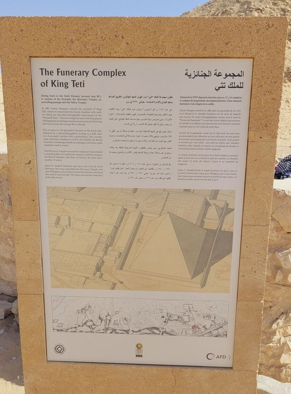
The Funerary Complex of King Teti
Photographed by James Hulse, October 8, 2024
1. The Funerary Complex of King Teti Marker
 Dating back to the Sixth Dynasty (around 2330 BC), it consists of the Pyramid, the Mortuary Temple, an ascending passage and the Valley Temple.
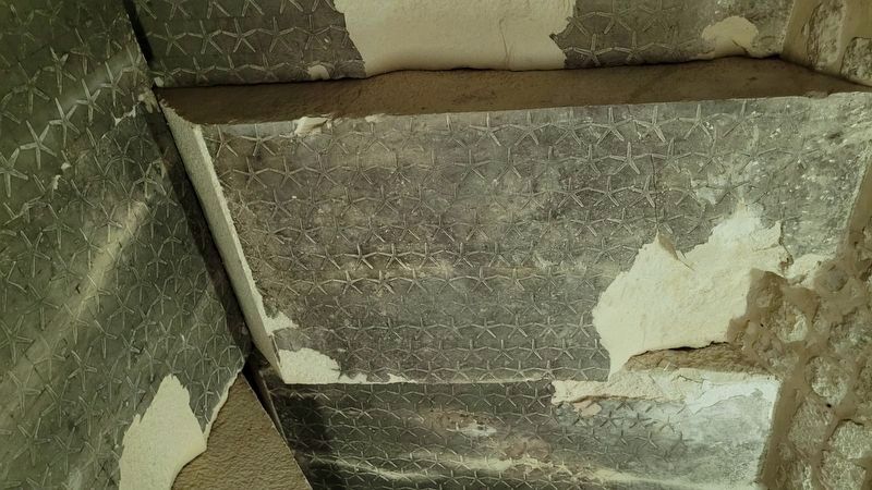
In 1881 Gaston Maspero entered the pyramid of King Teti, where he discovered the burial chamber with walls on which are inscribed hieroglyphic texts known as the "Pyramid Texts". These are religious texts with the purpose of helping the dead king towards resurrection and showing him how to join the sun god Ra in the sky.
The entrance to the pyramid is located on the north side, followed by a descending gallery leading to a hall, then to a horizontal corridor with 3 portcullises. The corridor ends with three chambers: a hall in the middle, the Burial Chamber containing a basalt sarcophagus, and three small chambers used as stores.
The Mortuary Temple was used for religious rituals related to the King after his death and contains a Hall of Columns, the Ritual Chamber (the Holy of Holies), the altar and a number of stores.
James E. Quibell (between 1905-1907) and Cecil M. Firth (between 1920-1924) unearthed the Mortuary Temple, and Jean-Philippe Lauer and Jean Sainte Fare Garnot continued the work in 1951 and 1952. The latest excavations took place from 1964 to 1970.
Datant de la VIème dynastie (environ 2330 av. J.C.), le complexe se compose de la pyramide, du temple funéraire, d'une chaussée montante et du temple de la vallée.
Gaston Maspero pénétra en 1881 dans la pyramide du roi Téti, où il découvrit la chambre funéraire sur les murs de laquelle sont inscrits les textes hiéroglyphiques connus sous le nom de "Textes des Pyramides". Ce sont des textes religieux qui ont pour but d'aider le roi défunt à la résurrection et lui montrer comment rejoindre dans le ciel le dieu du soleil Raa.
L'entrée de la pyramide, située sur le côté nord, est suivie par une descenderie qui débouche sur une salle puis sur une galerie horizontale entrecoupée par trois herses de granit. Cette galerie se termine par trois salles: une salle au milieu, une chambre funéraire dans laquelle trouve un sarcophage de basalte et trois petites pièces utilisées
this page online
Le temple funéraire servait pour les rituels religieux pratiqués après la mort du roi et contient la salle des colonnes, la chambre des rituels (le Saint des Saints), l'autel et un ensemble de magasins.
James E. Quibell fouilla le temple funéraire de 1905 à 1907 et Cecil M. Firth de 1920 à 1924. Jean-Philippe Lauer et Jean Sainte Fare Garnot poursuivèrent ensuite les fouilles de 1951 à 1952. Les dernières fouilles eurent lieu de 1964 à 1970.
المجموعة الجنائزية للملك تتي
تتكون مجموعة الملك "تتي" من الهرم المعبد الجنائزي الطريق الصاعد ومعبد الوادي الأسرة (السادسة - حوالي ۲۳۳۰ ق. م.)
في عام ۱۸۸۱ م. قام "ماسبيرو" بدخول هرم الملك "تني" حيث اكتشف حجرة الدفن بجدرانها المنقوشة بالنصوص الهيروغليفية والمعروفة بـ "متون الأهرام"، وهي نصوص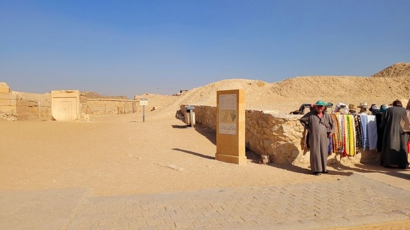 دينية الغرض منها مساعدة الملك المتوفي على البعث من جديد، وتبين له كيف يلحق بإله الشمس "رع" في السماء.
مدخل الهرم يقع في الجهة الشمالية، يليه ممر هابط ثم صالة، ثم ممر أفقي به ثلاث متاريس، وينتهي بثلاث حجرات عبارة عن صالة في المنتصف، وحجرة الدفن وبها تابوت من البازلت، وثلاث حجرات صغيرة استخدمت كمخازن
المعبد الجنائزي، وهو خاص بالطقوس الدينية المرتبطة بالملك بعد وفاته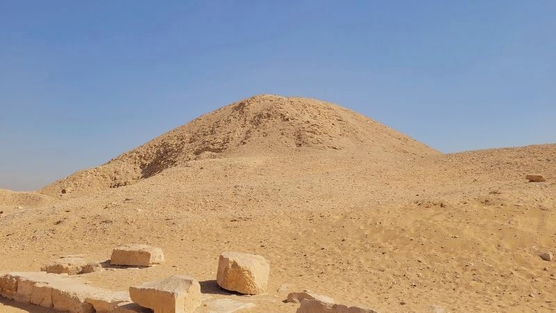 ويحتوي على صالة أعمدة وغرفة الشعائر (قدس الأقداس والمذبح ومجموعة من المخازن
وقد قام كل من "كويبل" ما بين عام ۱۹۰۵ و ۱۹۰۷م. و"فيرث" ما بين عام ۱۹۲۰ و ۱۹۴۰م. بالكشف عن المعبد، ثم واصل العمل "جان فيليب لوير" و جان سانت فار جارنو" عامي ۱۹۵۱ و ۱۹۵۲م. وقد تمت آخر أعمال التنقيب في الفترة من عام ١٩٦٤م. وحتى عام ۱۹۷۰م.
تتكون مجموعة الملك "تتي" من الهرم المعبد الجنائزي الطريق الصاعد ومعبد الوادي الأسرة (السادسة - حوالي ۲۳۳۰ ق. م.)
في عام ۱۸۸۱ م. قام "ماسبيرو" بدخول هرم الملك "تني" حيث اكتشف حجرة الدفن بجدرانها المنقوشة بالنصوص الهيروغليفية والمعروفة بـ "متون الأهرام"، وهي نصوص
Photographed by James Hulse, October 8, 2024
2. The Funerary Complex of King Teti and Marker
مدخل الهرم يقع في الجهة الشمالية، يليه ممر هابط ثم صالة، ثم ممر أفقي به ثلاث متاريس، وينتهي بثلاث حجرات عبارة عن صالة في المنتصف، وحجرة الدفن وبها تابوت من البازلت، وثلاث حجرات صغيرة استخدمت كمخازن
المعبد الجنائزي، وهو خاص بالطقوس الدينية المرتبطة بالملك بعد وفاته
Photographed by James Hulse, October 8, 2024
3. The Pyramid of King Teti
وقد قام كل من "كويبل" ما بين عام ۱۹۰۵ و ۱۹۰۷م. و"فيرث" ما بين عام ۱۹۲۰ و ۱۹۴۰م. بالكشف عن المعبد، ثم واصل العمل "جان فيليب لوير" و جان سانت فار جارنو" عامي ۱۹۵۱ و ۱۹۵۲م. وقد تمت آخر أعمال التنقيب في الفترة من عام ١٩٦٤م. وحتى عام ۱۹۷۰م.
Erected by UNESCO World Heritage.
Topics. This historical marker is listed in this topic list: Anthropology & Archaeology.
Location. 29° 52.542′ N, 31° 13.302′ E. Marker is in Saqarah, Giza Governorate, in Badrshein. It is on Pyramid of Djoser Road. Touch for map. Marker is at or near this postal address: Pyramid of Djoser Rd, Saqarah, Giza Governorate
Photographed by James Hulse, October 8, 2024
4. Star engravings on the ceiling of the burial chamber in the Pyramid of King Teti

Regionally, it is in Africa, specifically in North Africa, in the Middle East, on the Red Sea, and in a coastal Mediterranean country. Historically, it finds itself in what was once the Byzantine Empire, the Ottoman Empire, a British colony, and the Roman Empire.
Other nearby markers. At least 8 other markers are within walking distance of this marker: Tomb of Kagemni / مقبرة كاجمني (a few steps from this marker); The Tomb of Mereruka (within shouting distance of this marker); South Entrance of The Step Pyramid (approx. 0.8 kilometers away); Step Pyramid Complex (approx. 0.8 kilometers away); Enclosure Wall (approx. 0.8 kilometers away); Colonnade Entrance (approx. 0.8 kilometers away); South Court (approx. 0.9 kilometers away); The Step Pyramid / الهرم المدرج (approx. 0.9 kilometers away). Touch for a list and map of all markers in Saqarah.
Also see . . . Pyramid of Teti. Wikipedia
The pyramid of Teti is a smooth-sided pyramid situated in the pyramid field at Saqqara in Egypt which belonged to Teti, founder of the sixth dynasty of Egypt. It is the second known pyramid containing Pyramid Texts. Excavations have revealed a satellite pyramid, two pyramids of queens accompanied by cult structures, and a funerary temple. The pyramid was opened by Gaston Maspero in 1882 and the complex explored during several campaigns ranging from 1907 to 1965. It was originally called Teti's Places Are Enduring. The preservation above ground is very poor, and it now resembles a small hill. Below ground the chambers and corridors are very well preserved.(Submitted on November 6, 2025, by James Hulse of Medina, Texas.)
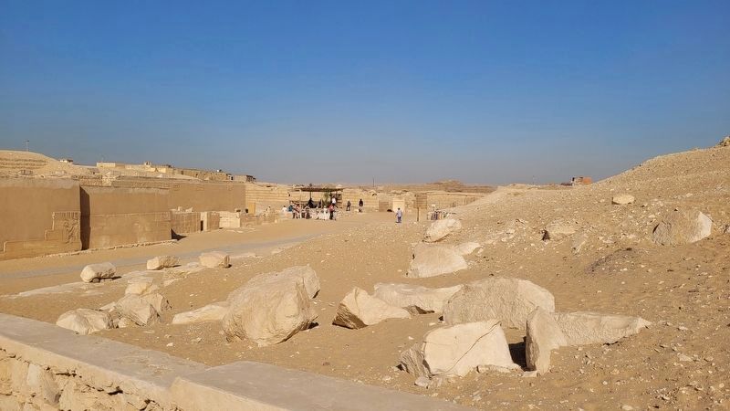
Photographed by James Hulse, October 8, 2024
5. The general view of the Funerary Complex of King Teti
The marker and pyramid are located on the right side of the walkway
Credits. This page was last revised on November 13, 2025. It was originally submitted on November 5, 2025, by James Hulse of Medina, Texas. This page has been viewed 85 times since then and 39 times this year. Photos: 1, 2, 3, 4, 5. submitted on November 6, 2025, by James Hulse of Medina, Texas.
