Saqarah in Badrshein, Giza Governorate, Egypt — مصر (Northeast Africa)
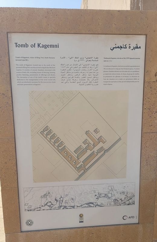
Tomb of Kagemni
⎯⎯⎯
مقبرة كاجمني
Photographed by James Hulse, October 8, 2024
1. Tomb of Kagemni / مقبرة كاجمني Mar
 Tomb of Kagemni, vizier of King Teti, Sixth Dynasty (around 2330 BC).
The tomb of Kagemni, located just to the north of the pyramid of King Teti, was discovered in 1843 by Karl Richard Lepsius. It consists of several chambers decorated with scenes of daily life, including scenes of dancing, hunting, poultry fattening, presentation of offerings and shrubs. The decoration of one of the tomb's rooms is specially dedicated to the transportation of the seven sacred oils, which are absolutely necessary for the resurrection ritual, and their presentation to Kagemni.
Tombeau de Kagemni, vizir du roi Téti, VIème dynastie (environ 2330 av. J.-C.)
Le tombeau de Kagemni, situé juste au nord de la pyramide du roi Téti, fut découvert en 1843 par Karl Richard Lepsius. Il contient plusieurs chambres décorées avec des scènes de la vie quotidienne, y compris des scènes de danse, de chasse, de gavage de volailles, de présentation des offrandes et de brousse. La décoration de l'une des chambres de la tombe est spécialement dédiée au transport des sept huiles sacrées, qui sont indispensables pour les rituels religieux.
مقبرة كاجمني
مقبرة "كاجمني" وزير الملك "تتي" - الأسرة السادسة (حوالي ۲۳۳۰ ق. م.)
تقع مقبرة "كاجمني" إلى الشمال من هرم الملك " تتي"، وقد تم الكشف عن المقبرة في عام ١٨٤٣ على يد "كارل ريتشارد لبسيوس". تتكون المقبرة من عدة حجرات زخرفت بالعديد من مناظر الحياة اليومية منها مناظر الرقص ومناظر الصيد ومناظر

Click or scan to see
this page online
تسمين الطيور وتقدمة القرابين ومناظر الأحراش. وقد خصصت زخرفة إحدى غرف المقبرة لنقل الزيوت السبع المقدسة والتي تعد ضرورية للطقوس الدينية.
مقبرة "كاجمني" وزير الملك "تتي" - الأسرة السادسة (حوالي ۲۳۳۰ ق. م.)
تقع مقبرة "كاجمني" إلى الشمال من هرم الملك " تتي"، وقد تم الكشف عن المقبرة في عام ١٨٤٣ على يد "كارل ريتشارد لبسيوس". تتكون المقبرة من عدة حجرات زخرفت بالعديد من مناظر الحياة اليومية منها مناظر الرقص ومناظر الصيد ومناظر
this page online
Erected by UNESCO World Heritage.
Topics. This historical marker is listed in this topic list: Anthropology & Archaeology. A significant historical year for this entry is 2330 BCE.
Location. 29° 52.551′ N, 31° 13.297′ E. Marker is in Saqarah, Giza Governorate, in Badrshein. It is on Pyramid of Djoser Road. Touch for map. Marker is at or near this postal address: Pyramid of Djoser Rd, Saqarah, Giza Governorate 33520-01, Egypt. Touch for directions.

Regionally, it is in Africa, specifically in North Africa, in the Middle East, on the Red Sea, and in a coastal Mediterranean country. Historically, it finds itself in what was once the Byzantine Empire, the Ottoman Empire, a British colony, and the Roman Empire.
Other nearby markers. At least 8 other markers are within walking distance of this marker: The Funerary Complex of King Teti (a few steps from this marker); The Tomb of Mereruka (within shouting distance of this marker); South Entrance of The Step Pyramid (approx. 0.8 kilometers away); Step Pyramid Complex (approx. 0.8 kilometers away); Enclosure Wall (approx. 0.8 kilometers away); Colonnade Entrance (approx. 0.8 kilometers away); South Court (approx. 0.9 kilometers away); The Step Pyramid / الهرم المدرج (approx. 0.9 kilometers away). Touch for a list and map
Photographed by James Hulse, October 8, 2024
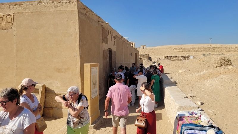
2. The entrance to the Tomb of Kagemni and Marker
Also see . . . Kagemni. Wikipedia
Kagemni (fl. c. 2345 BC) was a vizier from the early part of the reign of King Teti of the Sixth Dynasty of Egypt. Kagemni's wife Seshseshet Nubkhetnebty was a King's daughter and the daughter of Teti.(Submitted on November 6, 2025, by James Hulse of Medina, Texas.)
Photographed by James Hulse, October 8, 2024
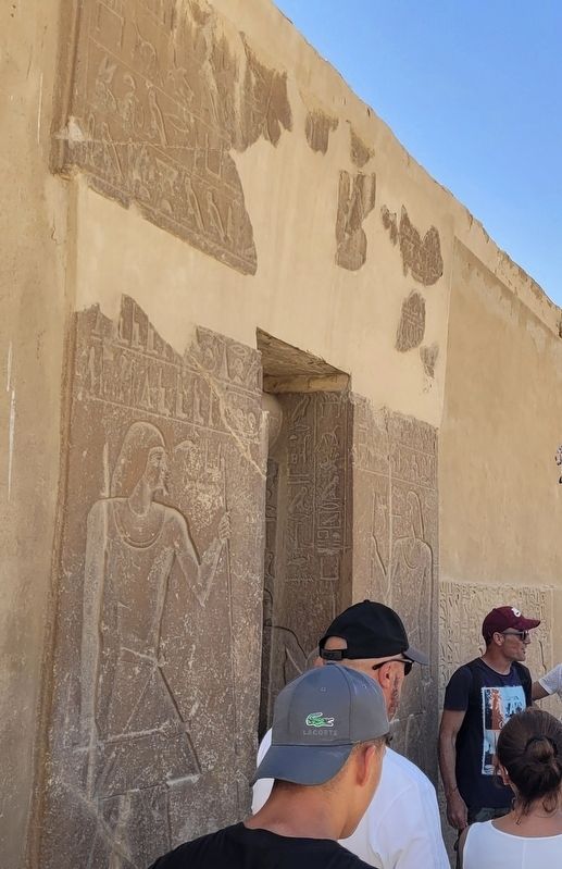
3. Artwork on the entrance to the Tomb of Kagemni
Photographed by James Hulse, October 8, 2024
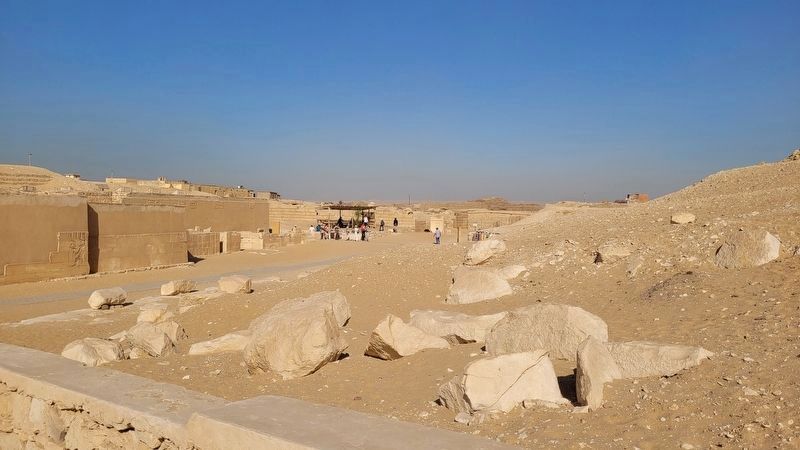
4. The wide view of the Tomb of Kagemni
The marker and tomb are located on the left side of the walkway at the end
Credits. This page was last revised on November 6, 2025. It was originally submitted on November 5, 2025, by James Hulse of Medina, Texas. This page has been viewed 129 times since then and 80 times this year. Photos: 1, 2, 3, 4. submitted on November 6, 2025, by James Hulse of Medina, Texas.
