Saqarah in Badrshein, Giza Governorate, Egypt — مصر (Northeast Africa)
Enclosure Wall
Photographed by James Hulse, October 8, 2024
1. Enclosure Wall Marker
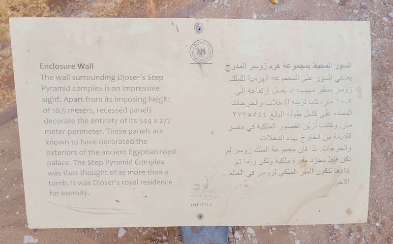
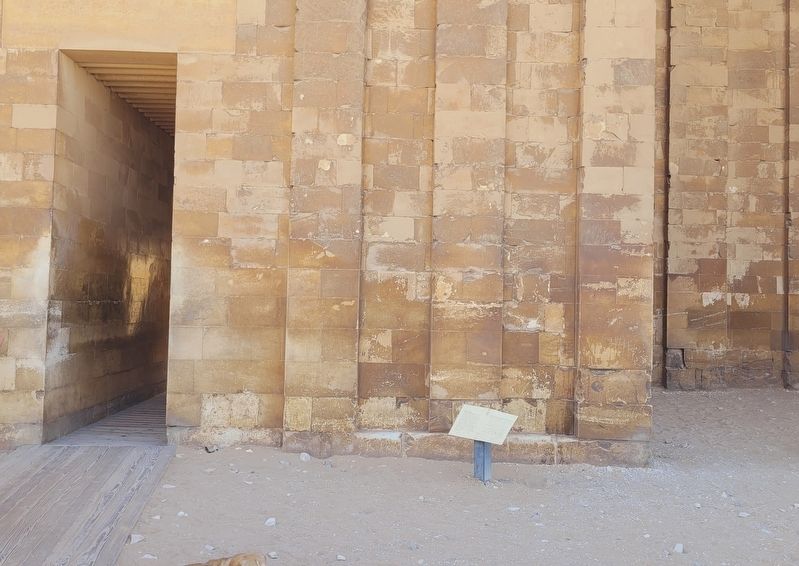
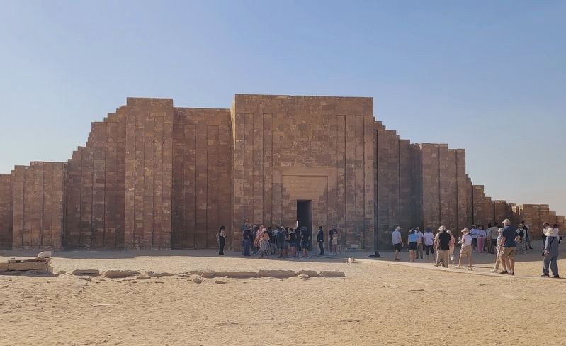
 The wall surrounding Djoser's Step Pyramid complex is an impressive sight. Apart from its imposing height of 10.5 meters, recessed panels decorate the entirety of its 544 x 277 meter perimeter. These panels are known to have decorated the exteriors of the ancient Egyptian royal palace. The Step Pyramid Complex was thus thought of as more than a tomb. It was Djoser's royal residence for eternity.
السور المحيط بمجموعة هرم زوسر المدرج يضفي السور على المجموعة الهرمية للملك زوسر منظر مهيب؛ إذ يصل ارتفاعه إلى ١٠,٥ متر ، كما

Click or scan to see
this page online
تزينه الدخلات والخرجات الممتدة على كامل طوله البالغ ٢٧٧٧٥٤٤ متر. وكانت تُزين القصور الملكية في مصر القديمة من الخارج بهذه الدخلات والخرجات. لذا فإن مجموعة الملك زوسر لم تكن فقط مجرد مقبرة ملكية ولكن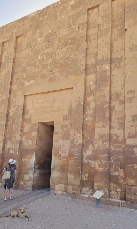 ربما تم بناءها لتكون المقر الملكي لزوسر في العالم . الآخر
this page online
Photographed by James Hulse, October 8, 2024
2. Enclosure Wall and Marker
Erected by Egyptian Ministry of Tourism & Antiquity.
Topics. This historical marker is listed in this topic list: Anthropology & Archaeology.
Location. 29° 52.146′ N, 31° 13.067′ E. Marker is in Saqarah, Giza Governorate, in Badrshein. It is on Pyramid of Djoser Road. Touch for map. Marker is at or near this postal address: Pyramid of Djoser Rd, Saqarah, Giza Governorate 33520-01, Egypt. Touch for directions.

Regionally, it is in Africa, specifically in North Africa, in the Middle East, on the Red Sea, and in a coastal Mediterranean country. Historically, it finds itself in what was once the Byzantine Empire, the Ottoman Empire, a British colony, and the Roman Empire.
Other nearby markers. At least 8 other markers are within walking distance of this marker: Colonnade Entrance (a few steps from this marker); Step Pyramid Complex (within shouting distance of this marker); South Court (about 90 meters away, measured in a direct line); The Step Pyramid / الهرم المدرج (about 90 meters away); The Southern Tomb (about 120 meters away); South Entrance of The Step Pyramid (about 210 meters away); The Tomb of Mereruka (approx. 0.8 kilometers away); The Funerary Complex of King Teti (approx. 0.8 kilometers away). Touch for a list and map of all markers in Saqarah.
Photographed by James Hulse, October 8, 2024
3. Enclosure Wall and Marker
Photographed by James Hulse, October 8, 2024
4. The view of the Enclosure Wall
The marker is located at the lower right side to the entrance passage.
Credits. This page was last revised on November 6, 2025. It was originally submitted on November 5, 2025, by James Hulse of Medina, Texas. This page has been viewed 73 times since then and 38 times this year. Photos: 1, 2, 3, 4. submitted on November 6, 2025, by James Hulse of Medina, Texas.
