Mead in Saunders County, Nebraska — The American Midwest (Upper Plains)
Atlas D Missile Site A-1

Photographed by Cosmos Mariner, September 14, 2025
1. Atlas D Missile Site A-1 Marker
During the height of the Cold War, the Soviet Union launched the world’s first artificial satellite, Sputnik I, in October 1957. A perceived “missile gap” led to the massive construction of Intercontinental Ballistic Missile (ICBM) sites in the United States in the early 1960s. The Atlas was America’s first ICBM. The 549th Strategic Missile Squadron at Offutt Air Force Base near Omaha was tasked with deploying the Atlas D at three sites: “A-1” at Mead, “A-2” at Arlington, and “A-3” at Missouri Valley, Iowa.
The sites consisted of a launch operations building, three launch and service buildings, two warhead storage magazines, and associated generating and communications facilities. The 103-foot by 133-foot launch and service buildings of reinforced concrete contained the missile bays. To launch a missile, the roof of the bay was pulled back and the 83-foot-tall, liquid-fueled rocket was raised upright. The Atlas had a range of 10,360 miles. The launch complex located east of here was completed in July 1960 and deactivated in October 1964. Today, it is a military training site for the Nebraska National Guard.
Erected 2016
this page online
Topics and series. This historical marker is listed in these topic lists: Air & Space • War, Cold. In addition, it is included in the Nebraska State Historical Society series list. A significant historical month for this entry is October 1957.
Location. 41° 11.128′ N, 96° 29.018′ W. Marker is in Mead, Nebraska, in Saunders County. It is at the intersection of County Road 10 and County Road J, on the left when traveling north on County Road 10. The marker is in a pull-out on the west side of the road. Touch for map. Marker is in this post office area: Mead NE 68041, United States of America. Touch for directions.

Regionally, this marker is in Eastern Nebraska and in Greater Lincoln. It is also in the American Midwest, in the Corn Belt, and on the prairies. Globally, it is in North America, the Western Hemisphere, the Western World, and the Anglosphere. Historically, it finds itself in what was once the Louisiana Purchase.
Other nearby markers. At least 8 other markers are within 12 miles of this marker, measured as the crow flies: A different
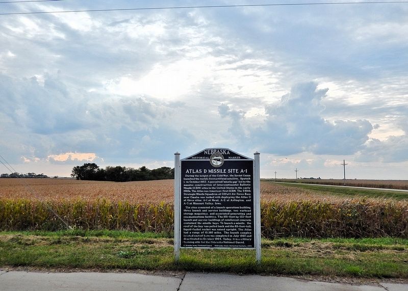
Photographed by Cosmos Mariner, September 14, 2025
2. Atlas D Missile Site A-1 Marker
Looking west from County Road 10.
More about this marker. This is one of two nearly identical Atlas D Missile Site A-1 historical markers. The other one is located 2.2 miles east on County Road J at County Road 8.
Related markers. Click here for a list of markers that are related to this marker. Atlas D Missile Site A-1
Also see . . . An Important Part of Nebraska and the Cold War Era (549th Strategic Missile Squadron).
Excerpt: The 549th SMS was based at Offutt Air Force Base in Omaha, Nebraska from 1961 thru 1965. There were 3 sites built around Omaha. These sites were manned 24 hours a day, 365 days a year during the time the Squadron was active. During the Cuban Missile Crisis, all 549th sites were at a high level of alert and were ready to launch(Submitted on November 5, 2025, by Cosmos Mariner of Cape Canaveral, Florida.)the Atlas missile should it have become necessary. The squadron was armed with the SM-65 weapon system, more commonly know as the Atlas. The 549th was an Atlas D unit which meant the missile was housed in a "coffin launcher" style complex. The missile was kept in a horizontal position. In order to launch, a large overhead door was rolled back after which the "bird" was raised to a vertical position. Once upright, the rocket was fueled with RP-1 and Liquid Oxygen after which it would then be made ready for launch. The Atlas D was equipped with a Mark IV re-entry vehicle developed by General Electric and carried a type W-38 warhead which had a yield of approximately 3.8 megatons of TNT. Developed by General Dynamics, the Atlas weapons system became a national priority during which no expense was spared in the development, testing and implementation of this first-generation ICBM system. The Atlas D rocket was also used by NASA during the early days of manned space travel and was the booster used to put John Glenn into Earth orbit.Photographed by Cosmos Mariner, September 14, 20253. Atlas D Missile Site A-1 MarkerLooking northwest along County Road 10. County Road J crosses in the background.

Credits. This page was last revised on November 6, 2025. It was originally submitted on November 5, 2025, by Cosmos Mariner of Cape Canaveral, Florida. This page has been viewed 71 times since then and 33 times this year. Photos: 1, 2, 3. submitted on November 5, 2025, by Cosmos Mariner of Cape Canaveral, Florida.
