Saqarah in Badrshein, Giza Governorate, Egypt — مصر (Northeast Africa)
South Court
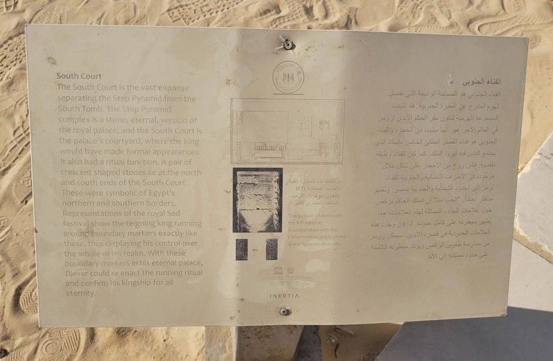
Photographed by James Hulse, October 8, 2024
1. South Court Marker
 The South Court is the vast expanse separating the Step Pyramid from the South Tomb. The Step Pyramid complex is a stone, eternal, version of the royal palace, and the South Court is the palace's courtyard, where the king would have made formal appearances. It also had a ritual function. A pair of crescent shaped stones lie at the north and south ends of the South Court. These were symbolic of Egypt's northern and southern borders. Representations of the royal Sed festival show the reigning king running around boundary markers exactly like these, thus displaying his control over the whole of his realm. With these boundary markers in his eternal palace, Djoser could re enact the running ritual and confirm his kingship for all eternity.
الفناء الجنوبي
الفناء الجنوبي . الفناء الجنوبي هو المساحة الواسعة التي تفصل الهرم المدرج عن المقبرة الجنوبية. فقد شيدت المجموعة الهرمية لتكون مقر الحكم الابدي الروسر في العالم الآخر غير انها مشيدة من الحجر، والفناء الجنوبي هو فناء

Click or scan to see
this page online
القصر الملكي الخاص بالملك الذي يجتمع الناس فيه ليروا الملك. كما كان للفناء وظيفة طقسية. فكان روح من الأحجار على شكل هلال موجودة في الأطراف الشمالية والجنوبية للفناء ترمز إلى الحدود الشمالية والجنوبية لمصر. وتظهر مناظر احتفال "الحب سد" أن الملك الحاكم يركض حول علامات الحدود المماثلة لهذه العلامات، مما يظهر سيطرته على كامل حدوده لذا فإن وجود هذه العلامات الحدودية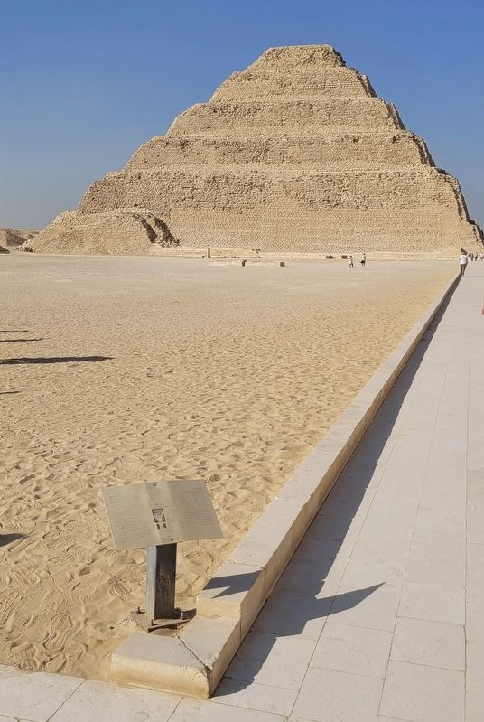 في قصره الأبدي، سيمكن زوسر من ممارسة طقوس الركض ويؤكد سيطرته الكاملة على حدود مملكته إلى الأبد.
الفناء الجنوبي . الفناء الجنوبي هو المساحة الواسعة التي تفصل الهرم المدرج عن المقبرة الجنوبية. فقد شيدت المجموعة الهرمية لتكون مقر الحكم الابدي الروسر في العالم الآخر غير انها مشيدة من الحجر، والفناء الجنوبي هو فناء
this page online
Photographed by James Hulse, October 8, 2024
2. The South Court Marker in front of the Step Pyramid
Erected by Egyptian Ministry of Tourism & Antiquity.
Topics. This historical marker is listed in this topic list: Anthropology & Archaeology.
Location. 29° 52.151′ N, 31° 13.017′ E. Marker is in Saqarah, Giza Governorate, in Badrshein. It is on Pyramid of Djoser Road. Touch for map. Marker is at or near this postal address: Pyramid of Djoser Rd, Saqarah, Giza Governorate 33520-01, Egypt. Touch for directions.

Regionally, it is in Africa, specifically in North Africa, in the Middle East, on the Red Sea, and in a coastal Mediterranean country. Historically, it finds itself in what was once the Byzantine Empire, the Ottoman Empire, a British colony, and the Roman Empire.
Other nearby markers. At least 8 other markers are within walking distance of this marker: The Step Pyramid / الهرم المدرج (a few steps from this marker); The Southern Tomb (within shouting distance of this marker); Colonnade Entrance (within shouting distance of this marker); Enclosure Wall (about 90 meters away, measured in a direct line); Step Pyramid Complex (about 120 meters away); South Entrance of The Step Pyramid (about 150 meters away); The Tomb of Mereruka (approx. 0.8 kilometers away); The Funerary Complex of King Teti (approx. 0.9 kilometers away). Touch for a list and map of all markers in Saqarah.
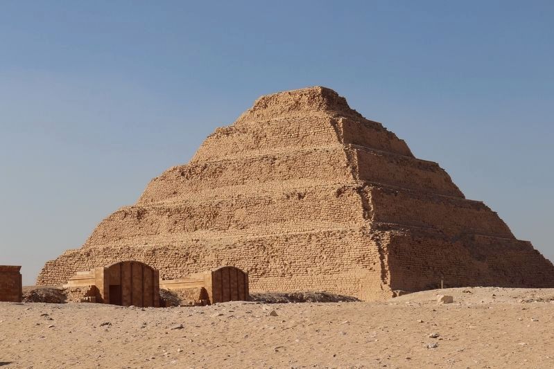
Photographed by James Hulse, October 8, 2024
3. The Step Pyramid
Credits. This page was last revised on November 6, 2025. It was originally submitted on November 5, 2025, by James Hulse of Medina, Texas. This page has been viewed 54 times since then and 21 times this year. Photos: 1, 2, 3. submitted on November 6, 2025, by James Hulse of Medina, Texas.
