Al Omraneya in Nazlet El-Semman in Al Haram, Giza Governorate, Egypt — مصر (Northeast Africa)
Khafre's Valley Temple
Photographed by James Hulse, October 9, 2024
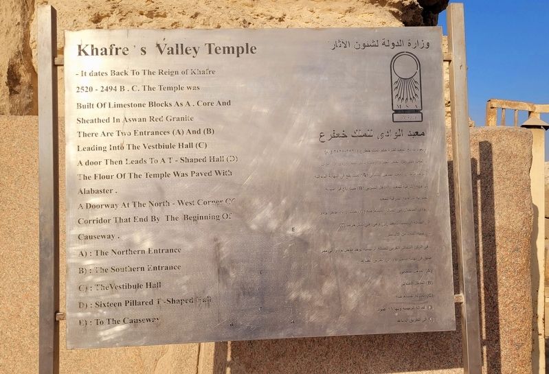
1. Khafre's Valley Temple Marker
 - It dates Back To The Reign of Khafre 2520-2494 Β.C. The Temple was Built Of Limestone Blocks As A. Core And Sheathed In Aswan Red Granite.
There Are Two Entrances (A) And (B)
Leading Into The Vestbiule Hall (C)
A door Then Leads To A T-Shaped Hall (D)
The Flour Of The Temple Was Paved With Alabaster.
A Doorway At The North - West Corner Of Corridor That End By The Beginning Of Causeway.
A): The Northern Entrance
B): The Southern Entrance
C): The Vestibule Hall
D): Sixteen Pillared T-Shaped Hall
E): To The Causeway
Arabic:
معبد الوادى للملك خعفرع
يعود تاريخ المعبد الفترة حكم الملك خعفرع (٢٥٢٠-٢٤٠٤ وم) المعيد مبنى من الحجر الجيرى ومجلد بالجرانيت الوردي من أسوان - يوجد مدخلان للمعيد المدخل الشمالي (A) حيث يقع في النهاية الله الية للواجهة الشرقية للمعيد والمدخل الجنوبي (B) حيث يقع في النهاية الجنوبية الله الجهة الشرقية للمعيد يودى المدخلان إلى الصالة المستعرضة (C) حيث أون بما مدخل بودي إلى الصالة الرئيسية للمعيد (D) وهي على شكل حرف (E) ارضية السعيد من الألباستر في الركن الشمالي الغربي للصالة الرئيسية يوجد مدخل يؤدى إلى ممر ضيق في نهاية مدخل يدوى إلى الطريق الصاعد
(A) المدخل الشمالي (B) المدخل الجنوبي (C) الصالة المستعرضة (D) الصالة الرئيسة وبها

Click or scan to see
this page online
١٦ عمود
(E) إلى الطريق الصاعد
يعود تاريخ المعبد الفترة حكم الملك خعفرع (٢٥٢٠-٢٤٠٤ وم) المعيد مبنى من الحجر الجيرى ومجلد بالجرانيت الوردي من أسوان - يوجد مدخلان للمعيد المدخل الشمالي (A) حيث يقع في النهاية الله الية للواجهة الشرقية للمعيد والمدخل الجنوبي (B) حيث يقع في النهاية الجنوبية الله الجهة الشرقية للمعيد يودى المدخلان إلى الصالة المستعرضة (C) حيث أون بما مدخل بودي إلى الصالة الرئيسية للمعيد (D) وهي على شكل حرف (E) ارضية السعيد من الألباستر في الركن الشمالي الغربي للصالة الرئيسية يوجد مدخل يؤدى إلى ممر ضيق في نهاية مدخل يدوى إلى الطريق الصاعد
(A) المدخل الشمالي (B) المدخل الجنوبي (C) الصالة المستعرضة (D) الصالة الرئيسة وبها
this page online
Erected by Ministry of State for Antiquities Affairs.
Topics. This historical marker is listed in this topic list: Anthropology & Archaeology. A significant historical year for this entry is 2520 BCE.
Location. 29° 58.492′ N, 31° 8.313′ E. Marker is in Nazlet El-Semman, Giza Governorate, in Al Haram. It is in Al Omraneya. It is on Al Haram. Touch for map. Marker is in this post office area: Nazlet El-Semman, Giza Governorate 35122-01, Egypt. Touch for directions.

Regionally, it is in Africa, specifically in North Africa, in the Middle East, on the Red Sea, and in a coastal Mediterranean country. Historically, it finds itself in what was once the Byzantine Empire, the Ottoman Empire, a British colony, and the Roman Empire.
Other nearby markers. At least 8 other markers are within 14 kilometers of this marker, measured as the crow flies: The Tomb of Mereruka (approx. 13.6 kilometers away); Tomb of Kagemni / مقبرة كاجمني (approx. 13.6 kilometers away); The Funerary Complex of King Teti (approx. 13.6 kilometers away); South Entrance of The Step Pyramid (approx. 13.8 kilometers away); The Southern Tomb (approx. 14 kilometers away); The Step Pyramid / الهرم المدرج (approx. 14 kilometers away); South Court (approx. 14 kilometers away); Colonnade Entrance (approx. 14 kilometers away).
Photographed by James Hulse, October 9, 2024
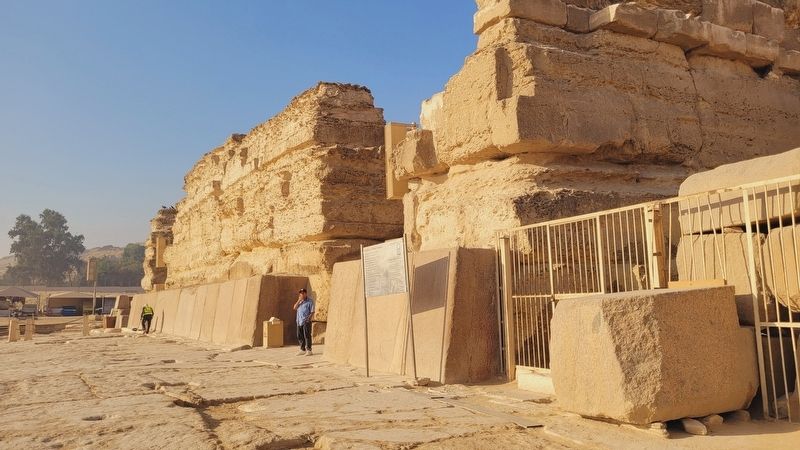
2. The view of Khafre's Valley Temple and Marker
Photographed by James Hulse, October 9, 2024
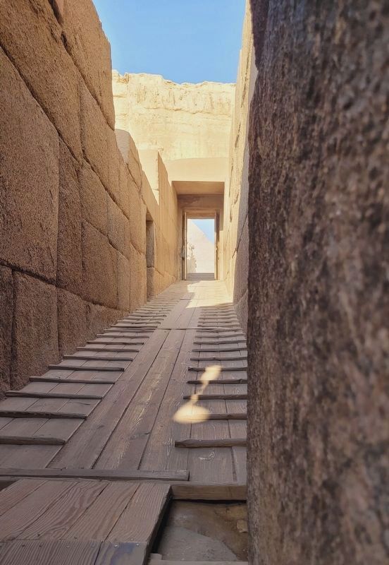
3. The pathway that leads to Khafre's Pyramid and causeway
Photographed by James Hulse, October 9, 2024
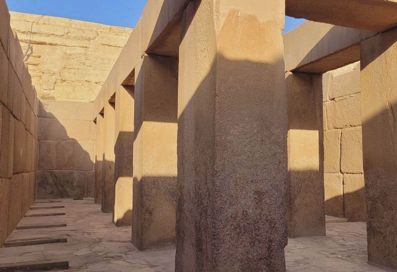
4. The view of the interior hall of Khafre's Valley Temple
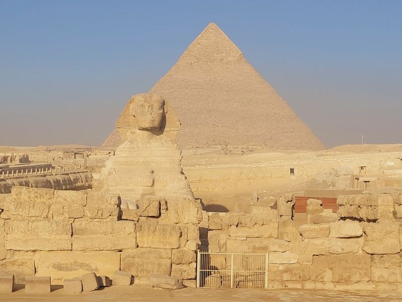
Photographed by James Hulse, October 9, 2024
5. The Great Sphinx of Giza and Khafre's Pyramid
Credits. This page was last revised on November 7, 2025. It was originally submitted on November 5, 2025, by James Hulse of Medina, Texas. This page has been viewed 73 times since then and 35 times this year. Photos: 1, 2, 3, 4, 5. submitted on November 7, 2025, by James Hulse of Medina, Texas.
