Mit-Rahineh in Badrshein, Giza Governorate, Egypt — مصر (Northeast Africa)
Excavations at Kom El-Fakhry
Photographed by James Hulse, October 8, 2024
1. Excavations at Kom El-Fakhry Marker
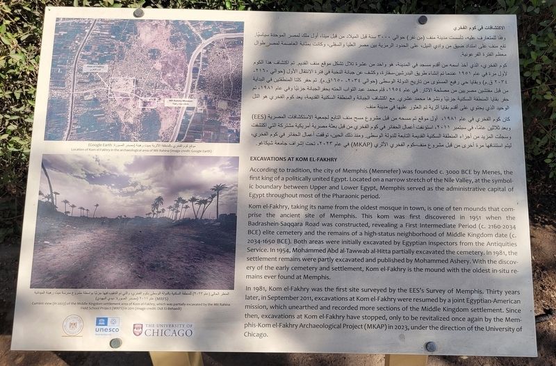
 According to tradition, the city of Memphis (Mennefer) was founded c. 3000 BCE by Menes, the first king of a politically united Egypt. Located on a narrow stretch of the Nile Valley, at the symbolic boundary between Upper and Lower Egypt, Memphis served as the administrative capital of Egypt throughout most of the Pharaonic period.
Kom el-Fakhry, taking its name from the oldest mosque in town, is one of ten mounds that comprise the ancient site of Memphis. This kom was first discovered in 1951 when the Badrashein-Saqqara Road was constructed, revealing a First Intermediate Period (c. 2160-2034 BCE) elite cemetery and the remains of a high-status neighborhood of Middle Kingdom date (c. 2034-1650 BCE). Both areas were initially excavated by Egyptian inspectors from the Antiquities Service. In 1954, Mohammed Abd al-Tawwab al-Hitta partially excavated the cemetery. In 1981, the settlement remains were partly excavated and published by Mohammed Ashery. With the discovery of the early cemetery and settlement, Kom el-Fakhry is the mound with the oldest in-situ remains ever found at Memphis.
In 1981, Kom el-Fakhry was the first site surveyed by the EES's Survey of Memphis. Thirty years later, in September 2011, excavations at Kom el-Fakhry were resumed by a joint Egyptian-American mission, which unearthed and recorded more sections of the Middle Kingdom settlement. Since then, excavations at Kom el-Fakhry have stopped, only to be revitalized once again by the Mem-phis-Kom el-Fakhry Archaeological Project (MKAP) in 2023, under the direction of the University of Chicago.
Location of Kom el-Fakhry in the archaeological area of Mit Rahina (image credit: Google Earth)
Current view (in 2023) of the Middle Kingdom settlement area of Kom el-Fakhry, which was partially excavated by the Mit Rahina Field School Project (MRFS) in 2011 (image credit: Didi El-Behaedi)
الاكتشافات في كوم الفخري
وفقًا للمتعارف عليه، تأسست مدينة منف من نفر) حوالي ۳۰۰۰ سنة قبل الميلاد من قبل مينا، أول ملك لمصر الموحدة سياسيًا. تقع منف على امتداد ضيق من وادي النيل، على الحدود الرمزية بين مصر العليا والسفلى، وكانت بمثابة العاصمة لمصر طوال معظم الفترة الفرعونية.
كوم الفخري، الذي أخذ اسمه من أقدم مسجد في المدينة، هو واحد من عشرة تلال تشكل موقع منف القديم. تم اكتشاف هذا الكوم لأول مرة في عام ١٩٥١ عندما تم إنشاء طريق البدرشين - سقارة، وكشف عن جبانة النخبة في فترة الانتقال الأول (حوالي ٢١٦٠ -٢٠٣٤ (ق.م) وبقايا حي رفيع المستوى من تاريخ الدولة الوسطى ( حوالي ۲۰۳٤ - ١٦٥٠ ق.م) . تم حفر كلتا المنطقتين في البداية من قبل مفتشين مصريين من مصلحة

Click or scan to see
this page online
الآثار. في عام ١٩٥٤ ، قام محمد عبد التواب الحته بحفر الجبانة جزئيًا وفي عام ١٩٨١ ، تم حفر بقايا المنطقة السكنية جزئيًا ونشرها محمد عشري مع اكتشاف الجبانة والمنطقة السكنية القديمة، يعد كوم الفخري هو التل الوحيد الذي يحتوي على أقدم بقايا آثرية تم العثور عليها في مدينة منف.
كان كوم الفخري في عام ۱۹۸۱ ، أول موقع تم مسحه من قبل مشروع مسح منف التابع لجمعية الاستكشافات المصرية (EES) وبعد ثلاثين عامًا، في سبتمبر ۲۰۱۱ ، استؤنفت أعمال الحفائر في كوم الفخري من قبل بعثة مصرية أمريكية مشتركة التي اكتشفت وسجلت المزيد من أجزاء المنطقة السكنية القديمة التابعة للدولة الوسطى. ومنذ ذلك الحين، توقفت أعمال الحفائر في كوم الفخري ليتم استئنافها مرة أخرى من قبل مشروع منف - كوم الفخري الأثري (MKAP) في عام ۲۰۲۳ ، تحت إشراف جامعة شيكاغو.
موقع كوم الفخري بالمنطقة الأثرية بميت رهينة مصدر الصورة: Google
المنظر الحالي (عام ۲۰۲۳) للمنطقة السكنية بالدولة الوسطى بكوم الفخري، والتي تم التنقيب فيها جزئيًا بواسطة مشروع مدرسة ميت رهينة الميدانية (MRFS) عام (۲۰۱۱ مصدر الصورة ديدي البهيدي
وفقًا للمتعارف عليه، تأسست مدينة منف من نفر) حوالي ۳۰۰۰ سنة قبل الميلاد من قبل مينا، أول ملك لمصر الموحدة سياسيًا. تقع منف على امتداد ضيق من وادي النيل، على الحدود الرمزية بين مصر العليا والسفلى، وكانت بمثابة العاصمة لمصر طوال معظم الفترة الفرعونية.
كوم الفخري، الذي أخذ اسمه من أقدم مسجد في المدينة، هو واحد من عشرة تلال تشكل موقع منف القديم. تم اكتشاف هذا الكوم لأول مرة في عام ١٩٥١ عندما تم إنشاء طريق البدرشين - سقارة، وكشف عن جبانة النخبة في فترة الانتقال الأول (حوالي ٢١٦٠ -٢٠٣٤ (ق.م) وبقايا حي رفيع المستوى من تاريخ الدولة الوسطى ( حوالي ۲۰۳٤ - ١٦٥٠ ق.م) . تم حفر كلتا المنطقتين في البداية من قبل مفتشين مصريين من مصلحة
this page online
كان كوم الفخري في عام ۱۹۸۱ ، أول موقع تم مسحه من قبل مشروع مسح منف التابع لجمعية الاستكشافات المصرية (EES) وبعد ثلاثين عامًا، في سبتمبر ۲۰۱۱ ، استؤنفت أعمال الحفائر في كوم الفخري من قبل بعثة مصرية أمريكية مشتركة التي اكتشفت وسجلت المزيد من أجزاء المنطقة السكنية القديمة التابعة للدولة الوسطى. ومنذ ذلك الحين، توقفت أعمال الحفائر في كوم الفخري ليتم استئنافها مرة أخرى من قبل مشروع منف - كوم الفخري الأثري (MKAP) في عام ۲۰۲۳ ، تحت إشراف جامعة شيكاغو.
موقع كوم الفخري بالمنطقة الأثرية بميت رهينة مصدر الصورة: Google
المنظر الحالي (عام ۲۰۲۳) للمنطقة السكنية بالدولة الوسطى بكوم الفخري، والتي تم التنقيب فيها جزئيًا بواسطة مشروع مدرسة ميت رهينة الميدانية (MRFS) عام (۲۰۱۱ مصدر الصورة ديدي البهيدي
Erected by UNESCO, The University of Chicago and Ministry of Tourism & Antiquity.
Topics. This historical
Photographed by James Hulse, October 8, 2024
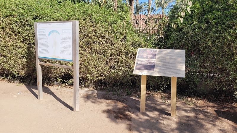
2. Excavations at Kom El-Fakhry Marker (right side)
Location. 29° 50.977′ N, 31° 15.263′ E. Marker is in Mit-Rahineh, Giza Governorate, in Badrshein. It is on Tariaq Bedon Esm half a kilometer east of Mariotia Road. The marker is located on the grounds of the Ruins of Memphis archaeological site. Touch for map. Marker is at or near this postal address: Tariaq Bedon Esm, Mit-Rahineh, Giza Governorate 33649-32, Egypt. Touch for directions.

Regionally, it is in Africa, specifically in North Africa, in the Middle East, on the Red Sea, and in a coastal Mediterranean country. Historically, it finds itself in what was once the Byzantine Empire, the Ottoman Empire, a British colony, and the Roman Empire.
Other nearby markers. At least 8 other markers are within 5 kilometers of this marker, measured as the crow flies: Memphis (here, next to this marker); Apries Stela (within shouting distance of this marker); Step Pyramid Complex (approx. 4.1 kilometers away); Enclosure Wall (approx. 4.2 kilometers away); Colonnade Entrance (approx. 4.2 kilometers away); South Court (approx. 4.2 kilometers away); The Step Pyramid / الهرم المدرج (approx. 4.2 kilometers away); The Southern Tomb (approx. 4.2 kilometers away). Touch for a list and map of all markers in Mit-Rahineh.
Photographed by James Hulse, October 8, 2024
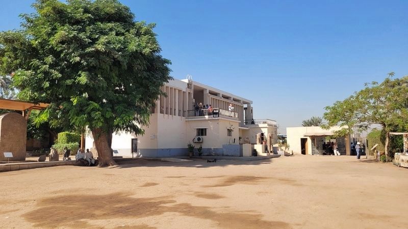
3. The wide view of the Marker at the entrance
The marker is located at the far right in the photo.
Photographed by James Hulse, October 8, 2024
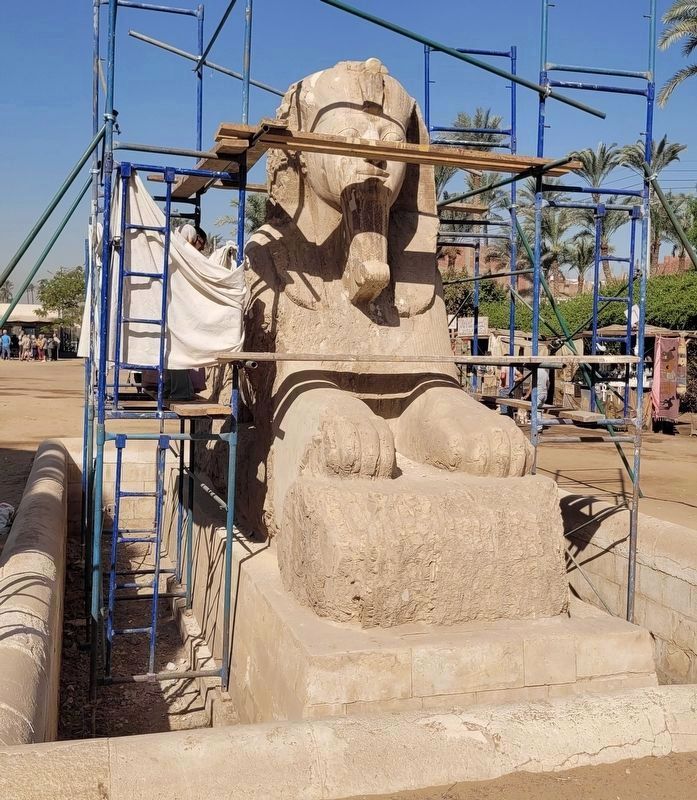
4. Sphinx of Memphis
Photographed by James Hulse, October 8, 2024
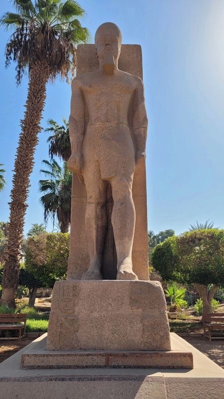
5. Ramses II Red Granite Statue
Photographed by James Hulse, October 8, 2024
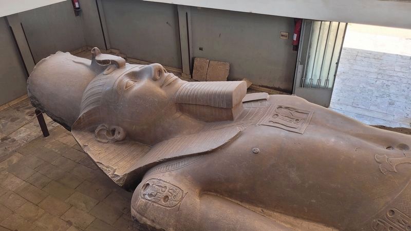
6. Colossal Statue of Ramses II in open air museum
Credits. This page was last revised on November 7, 2025. It was originally submitted on November 6, 2025, by James Hulse of Medina, Texas. This page has been viewed 75 times since then and 58 times this year. Photos: 1, 2, 3, 4, 5, 6. submitted on November 7, 2025, by James Hulse of Medina, Texas.
