Springfield in Clark County, Ohio — The American Midwest (Great Lakes)
Clark County Revolutionary War Memorial
Photographed by William Fischer, Jr., March 5, 2010
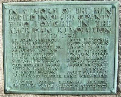
1. Clark County Revolutionary War Memorial Marker
buried in Clark County
who fought in the
American Revolution
1775 - 1783
Lt. John Bancroft • Jacob Ellsworth
William McIntire • Frederick Brown
Samuel Lippincott Sr. • James Kelly
Corneilus Toland • Isaac Davisson
Lt. Jesse Christy • Benjamin Bridge
Elijah Beardsley • John Kellar
Merryfield Vicory • George McCleace
Capt. Richard Bacon • Jacob Ebersole
Stephen Harriman • ____ Farnum
Lt. Henry Dawson • James Galloway
John Craig • George Lane • Mely Baker
Erected 1912 by Lagonda Chapter, Daughters of the American Revolution.
Topics and series. This historical marker and memorial is listed in these topic lists: Cemeteries & Burial Sites • Military • Patriots & Patriotism • Settlements & Settlers • War, US Revolutionary. In addition, it is included in the Daughters of the American Revolution (DAR) series list. A significant historical year for this entry is 1775.
Location. 39° 56.086′ N, 83° 49.225′ W. Marker is in Springfield, Ohio, in Clark County. It can be reached from W. McCreight Avenue. Marker is in the southern part of Section C of Ferncliff Cemetery & Arboretum,
this page online

Regionally, this marker and memorial is in the Dayton Metro and in the Miami Valley. It is also in the American Midwest and in the Corn Belt. Globally, it is in North America, the Western Hemisphere, the Western World, and the Anglosphere. Historically, it finds itself in what was once the Haudenosaunee (Iroquois) Confederacy, the territory of the Mississippian Culture, and the Northwest Territory.
Other nearby markers. At least 8 other markers are within walking distance of this marker: Jeremiah Warder and Ann Aston Warder (about 300 feet away, measured in a direct line); Oliver Smith Kelly (about 500 feet away); John Ludlow (about 600 feet away); William Whiteley (about 600 feet away); John Dick (about 600 feet away); James Leffel (about 800 feet away); Union Soldiers Monument (approx. 0.2 miles away); United States Colored Troops
Photographed by William Fischer, Jr., March 5, 2010
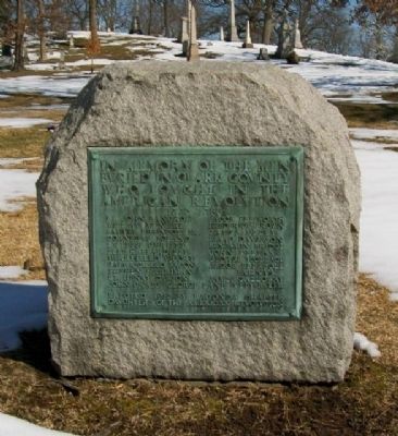
2. Clark County Revolutionary War Memorial
Also see . . . Ferncliff Cemetery & Arboretum. (Submitted on March 19, 2010, by William Fischer, Jr. of Reynoldsburg, Ohio.)
Photographed by William Fischer, Jr., March 5, 2010
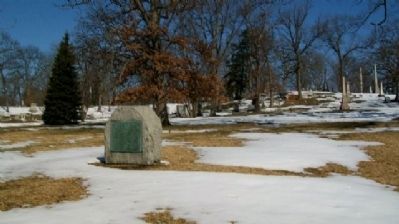
3. Clark County Revolutionary War Memorial
Credits. This page was last revised on June 16, 2016. It was originally submitted on March 19, 2010, by William Fischer, Jr. of Reynoldsburg, Ohio. This page has been viewed 1,858 times since then and 83 times this year. Photos: 1, 2, 3. submitted on March 19, 2010, by William Fischer, Jr. of Reynoldsburg, Ohio.
