Saqarah in Badrshein, Giza Governorate, Egypt — مصر (Northeast Africa)
Colonnade Entrance
Photographed by James Hulse, October 8, 2024
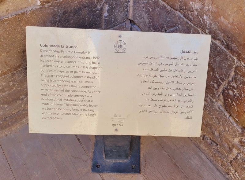
1. Colonnade Entrance Marker
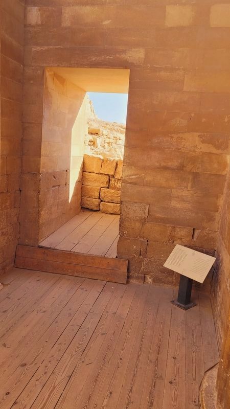
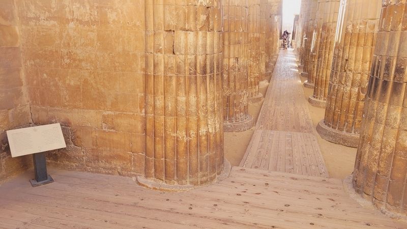
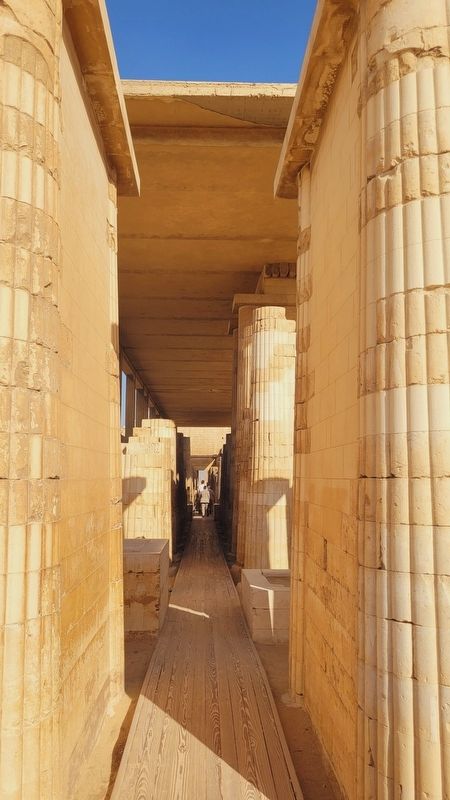
 Djoser's Step Pyramid Complex is accessed via a colonnade entrance near its south eastern corner. This long hall is flanked by stone columns in the shape of bundles of papyrus or palm branches. These are engaged columns: instead of being free standing, each column is supported by a wall that is connected with the wall of the colonnade. At either end of the colonnade entrance is a nonfunctional imitation door that is made of stone. Their immovable leaves are built to be open, forever inviting visitors to enter and admire the king's eternal palace.
بهو المدخل
يتم الدخول إلى مجموعة الملك زوسر من خلال بهو المدخل الموجود في الركن الجنوبي الغربي. وعلى كل من جانبي المدخل يقف صف من الأساطين على شكل حزمة من نبات البردي أو سعف النخيل، ويعتمد كل أسطون على جدار جانبي يصل بينه وبين أحد الجدارين الجانبيين. وفي الجدارين الشرقي والغربي لبهو المدخل تم بناء مدخل من الحجر على هيئة باب مفتوح على مصراعية كأنه يدعوا الزوار للدخول إلى المقر الأبدى للملك.
يتم الدخول إلى مجموعة الملك زوسر من خلال بهو المدخل الموجود في الركن الجنوبي الغربي. وعلى كل من جانبي المدخل يقف صف من الأساطين على شكل حزمة من نبات البردي أو سعف النخيل، ويعتمد كل أسطون على جدار جانبي يصل بينه وبين أحد الجدارين الجانبيين. وفي الجدارين الشرقي والغربي لبهو المدخل تم بناء مدخل من الحجر على هيئة باب مفتوح على مصراعية كأنه يدعوا الزوار للدخول إلى المقر الأبدى للملك.
Erected by Ministry of Tourism & Antiquity.
Topics. This historical marker is listed in this topic list: Anthropology & Archaeology.
Location. 29° 52.147′ N, 31° 13.06′ E. Marker is in Saqarah, Giza Governorate, in Badrshein. It is on Pyramid of Djoser Road. The marker is located at the entrance to the Step Pyramid. Touch for map. Marker is at or near this postal address: Pyramid of Djoser Rd, Saqarah, Giza Governorate 33520-01, Egypt. Touch for directions.

Regionally, it is in Africa, specifically in North Africa, in the Middle East, on the Red Sea, and in a coastal Mediterranean country. Historically, it finds itself in what was once the Byzantine Empire, the Ottoman Empire, a British colony, and the Roman Empire.
Other nearby markers. At least 8 other markers are within walking distance of this marker: Enclosure Wall (a few steps from this marker); Step Pyramid Complex (within shouting distance of this marker); South Court (within shouting distance of this marker); The Step Pyramid / الهرم المدرج (about 90 meters away, measured in a direct line); The Southern Tomb (about 120 meters away); South Entrance of The Step Pyramid
this page online
Photographed by James Hulse, October 8, 2024
2. Colonnade Entrance Marker
Photographed by James Hulse, October 8, 2024
3. Colonnade Entrance and Marker
Photographed by James Hulse, October 8, 2024
4. The path through the Colonnades
Credits. This page was last revised on November 8, 2025. It was originally submitted on November 6, 2025, by James Hulse of Medina, Texas. This page has been viewed 62 times since then and 34 times this year. Photos: 1, 2, 3, 4. submitted on November 8, 2025, by James Hulse of Medina, Texas.
