Brampton in Peel Region, Ontario — Central Canada (North America)
Gage Park
Photographed by Tim Boyd, November 2, 2025
1. Gage Park Marker
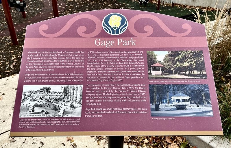
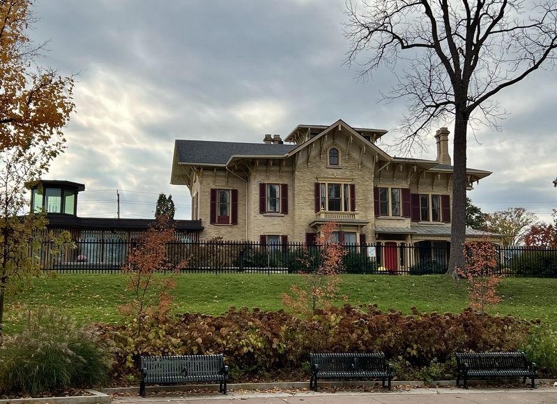
Originally, the park served as the front lawn of the Alderlea estate, the Italianate mansion built circa 1867 for Kenneth Chisholm, who was the son-in-law of John Elliott, a founding father of Brampton.
In 1902, a large portion of the Alderlea estate was severed, and the Town of Brampton purchased 2.4 acres (0.97 hectares) from the Chisholms. That same year, William J. Gage purchased 3.25 acres (1.32 hectares) of the Elliott estate that stood immediately to the north of Alderlea. Gage then donated 1.7 acres (0.69 hectares) of the property to the town with a condition that the land remains available to citizens as a public park or arboretum. Brampton residents who generously supported the need for a park collected
this page online
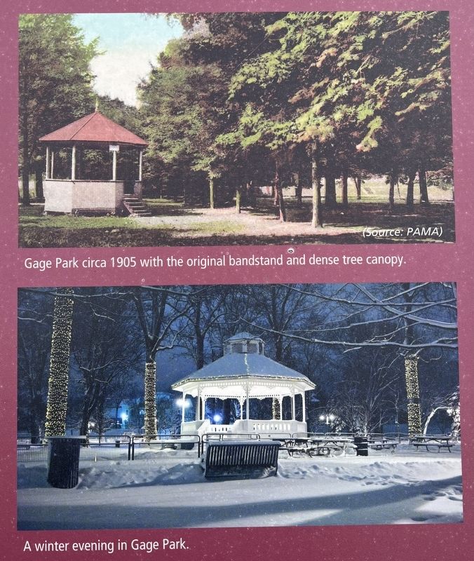
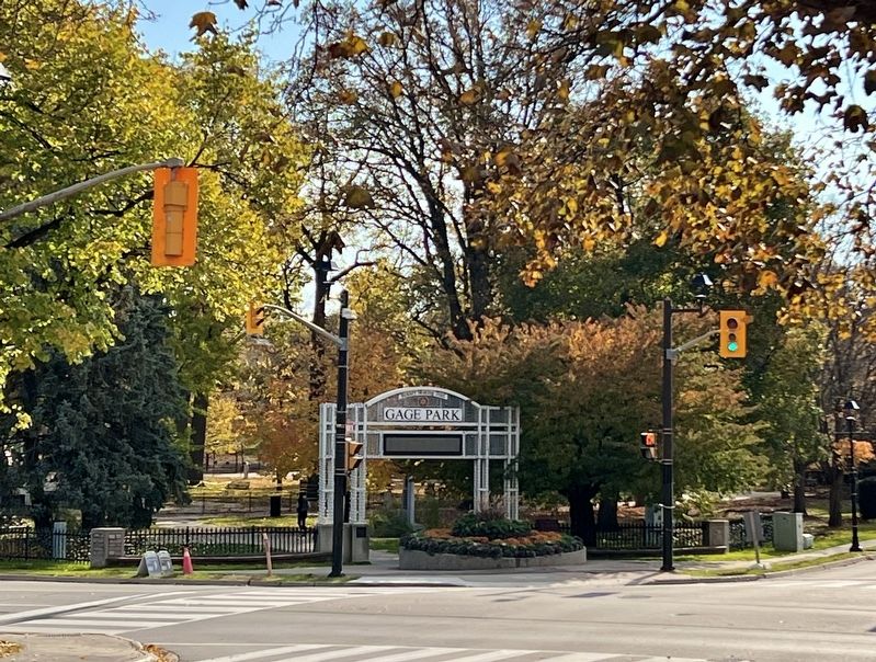
The centrepiece of Gage Park is the bandstand. A wading pool was added by the Kinsmen Club in 1955. In 1971, the Flower Fountain was presented by the Benson & Hedges Tobacco Company. Queen Elizabeth planted a tree in the park in 1973. The Rotary Club of Brampton's long-standing contributions to the park include the swings, skating trail, and entrance trellis with digital sign.
Gage Park serves as a multi-functional amenity space, and is an iconic and cherished landmark of Brampton that attracts visitors from near and far.
Topics. This historical marker is listed in this topic list: Parks & Recreational Areas. A significant historical year for this entry is 1902.
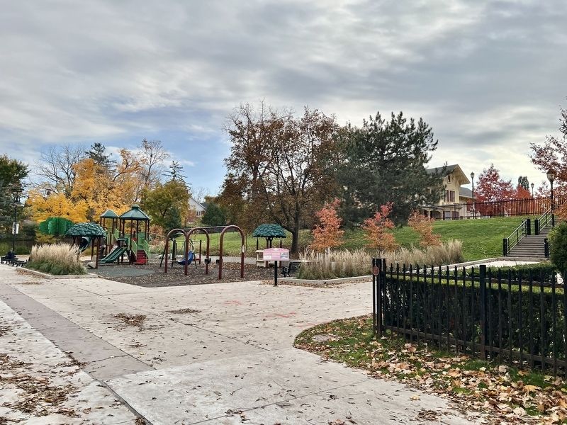
Location. 43° 41.002′ N, 79° 45.513′ W. Marker is in Brampton, Ontario, in Peel Region. It can be reached from Wellington Street West. The marker is in Gage Park near the children’s playground, accessible by foot approx. 70 metres from the Wellington Street West entrance, or approx. 50 metres down the steps from the Alderlea Estate parking
Photographed by Tim Boyd, November 2, 2025
2. Gage Park Marker

Regionally, this marker is in Greater Toronto, specifically on the Golden Horseshoe, and in the Toronto Metropolitan Area. It is also in Central Canada. Globally, it is in North America, on the Great Lakes, in the Western Hemisphere, in the Western World, and in the Anglosphere. Historically, it finds itself in what was once a British colony, the Viceroyalty of New France, the Haudenosaunee (Iroquois) Confederacy, and Rupert’s Land.
Other nearby markers. At least 8 other markers are within walking distance of this marker: Gage Park Bandstand (about 90 meters away, measured in a direct line); Sir William James Gage (about 120 meters away); Brampton Cenotaph (about 120 meters away); The Etobicoke Creek (about 150 meters away); St. Paul’s United Church (about 210 meters away); William Perkins Bull, K.C., LL.D. / William Perkins Bull, C.R., LL.D. (approx. 0.2 kilometers away); The Armstrong House (approx. 0.3 kilometers away); 20th Regiment Halton Rifles/ 36th Peel Regiment (approx. 0.4 kilometers away). Touch for a list and map

3. Gage Park marker illustration and caption detail (left)
Another marker is no longer nearby. Peel County Court House / Le Palais De Justice Du Comté de Peel (was about 180 meters away but has been confirmed missing).
Photographed by Tim Boyd, November 2, 2025
4. Gage Park marker photos and captions detail (right)
Photographed by Tim Boyd, November 2, 2025
5. Alderlea House, 2025
Photographed by Tim Boyd, November 2, 2025
6. Gage Park entrance at Main St. S and Wellington St. W, 2025
Credits. This page was last revised on November 7, 2025. It was originally submitted on November 7, 2025, by Tim Boyd of Hamilton, Ontario. This page has been viewed 55 times since then and 23 times this year. Photos: 1, 2, 3, 4, 5, 6. submitted on November 7, 2025, by Tim Boyd of Hamilton, Ontario. • Andrew Ruppenstein was the editor who published this page.
