Brampton in Peel Region, Ontario — Central Canada (North America)
Gage Park Bandstand
Photographed by Tim Boyd, November 2, 2025
1. Gage Park Bandstand Marker
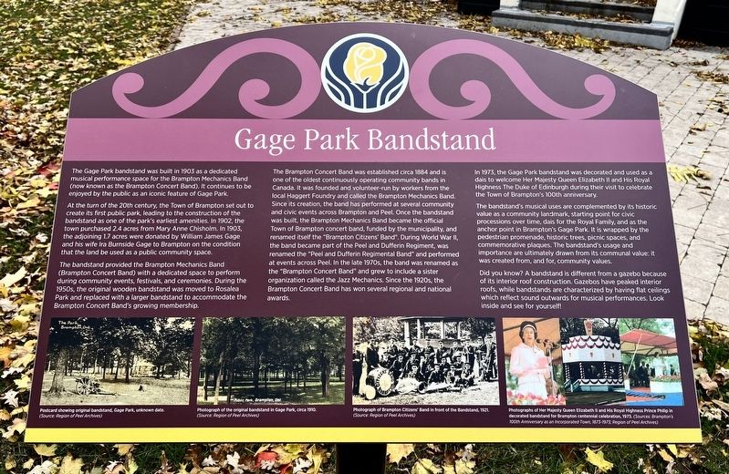
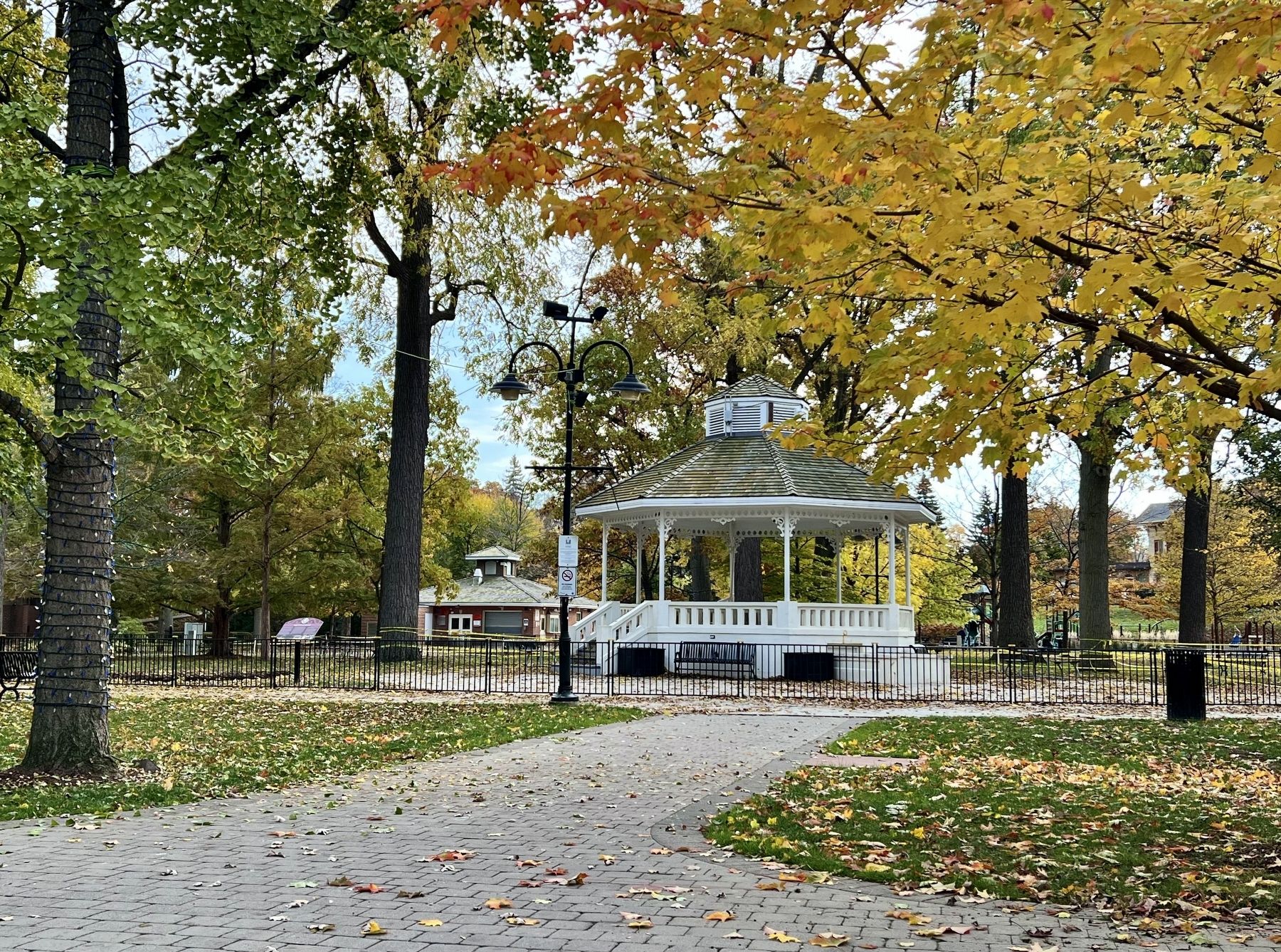
At the turn of the 20th century, the Town of Brampton set out to create its first public park, leading to the construction of the bandstand as one of the park's earliest amenities. In 1902, the town purchased 2.4 acres from Mary Anne Chisholm. In 1903, the adjoining 1.7 acres were donated by William James Gage and his wife Ira Burnside Gage to Brampton on the condition that the land be used as a public community space.
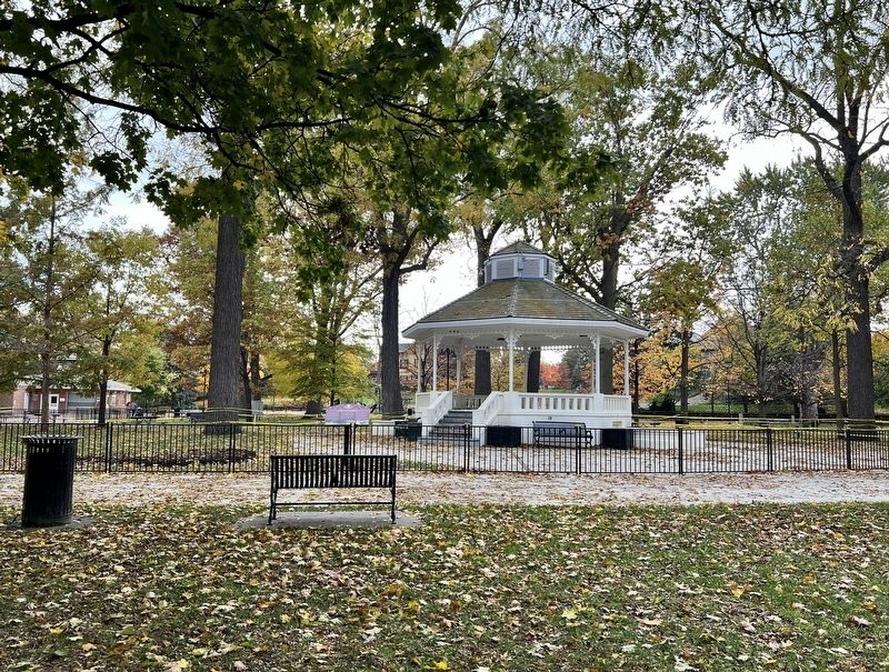
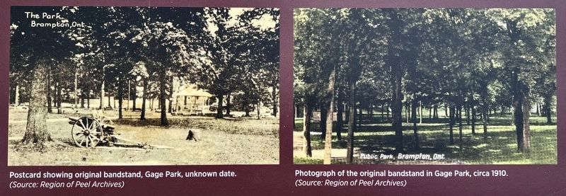
The bandstand provided the Brampton Mechanics Band (Brampton Concert Band) with a dedicated space to perform during community events, festivals, and ceremonies. During the 1950s, the original wooden bandstand was moved to Rosalea Park and replaced with a larger bandstand to accommodate the Brampton Concert Band's growing membership.
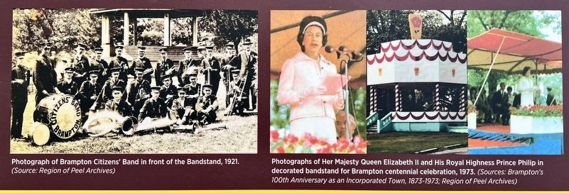
The Brampton Concert Band was established circa 1884 and is one of the oldest continuously operating community bands in Canada. It was founded
this page online
In 1973, the Gage Park bandstand was decorated and used as a dais to welcome Her Majesty Queen Elizabeth II and His Royal Highness The Duke of Edinburgh during their visit to celebrate the Town of Brampton's 100th anniversary.
The bandstand's musical uses are complemented by its historic value as a community landmark, starting point for civic processions
Photographed by Tim Boyd, November 2, 2025
2. Gage Park Bandstand Marker
Did you know? A bandstand is different from a gazebo because of its interior roof construction. Gazebos have peaked interior roofs, while bandstands are characterized by having flat ceilings which reflect sound outwards for musical performances. Look inside and see for yourself!
Topics. This historical marker is listed in these topic lists: Arts, Letters, Music • Parks & Recreational Areas. A significant historical year for this entry is 1903.
Location. 43° 41.043′ N, 79° 45.492′ W. Marker is in Brampton, Ontario, in Peel Region. It can be reached from Main Street South. The marker is in Gage Park, accessible by foot approx. 60 metres from the entrance to the park at Main Street South and Wellington Street West. Touch for map. Marker is at or near this postal address: 45 Main Street S, Brampton ON L6W 1Y1, Canada.
3. Gage Park Bandstand marker photos and captions detail (left)

Regionally, this marker is in Greater Toronto, specifically on the Golden Horseshoe, and in the Toronto Metropolitan Area. It is also in Central Canada. Globally, it is in North America, on the Great Lakes, in the Western Hemisphere, in the Western World, and in the Anglosphere. Historically, it finds itself in what was once a British colony, the Viceroyalty of New France, the Haudenosaunee (Iroquois) Confederacy, and Rupert’s Land.
Other nearby markers. At least 8 other markers are within walking distance of this marker: Sir William James Gage (within shouting distance of this marker); Brampton Cenotaph (within shouting distance of this marker); Gage Park (about 90 meters away, measured in a direct line); The Etobicoke Creek (about 90 meters away); St. Paul’s United Church (about 150 meters away); William Perkins Bull, K.C., LL.D. / William Perkins Bull, C.R., LL.D. (about 150 meters away); The Armstrong House (approx. 0.3 kilometers away); 20th Regiment Halton Rifles/ 36th Peel Regiment (approx. 0.3 kilometers away). Touch for a list and map of all markers in Brampton.
Another marker is
4. Gage Park Bandstand marker photos and captions detail (right)
Photographed by Tim Boyd, November 2, 2025
5. Gage Park Bandstand and marker
Credits. This page was last revised on November 7, 2025. It was originally submitted on November 7, 2025, by Tim Boyd of Hamilton, Ontario. This page has been viewed 65 times since then and 43 times this year. Photos: 1, 2, 3, 4, 5. submitted on November 7, 2025, by Tim Boyd of Hamilton, Ontario. • Andrew Ruppenstein was the editor who published this page.
