Luxor, Luxor Governorate, Egypt — مصر (Northeast Africa)
Courtyard of the Third Pylon
⎯⎯⎯
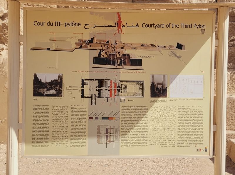
Cour du IIIᵉᵐᵉ Pylône
فناء الصرح
Photographed by James Hulse, October 10, 2024
1. Courtyard of the Third Pylon / Cour du IIIᵉᵐᵉ Pylône Marker
 State of the courtyard of the Fourth Pylon before Amenhotep III.
The Fourth Pylon, initiated by Thutmosis I, marks the entrance to the Amun sanctuary known as Ipet-Sout. The courtyard in front of the pylon is situated at the junction of the two perpendicular processional axes, the main east-west axis and the secondary north-south one. Up until the reorgranisation of this courtyard by Amenhotep III, this area had already undergone major changes. Thutmosis II first of all created his festival courtyard in this area for consecrating offerings arriving from all over Egypt. Thutmosis IV then carried out the next set of major changes, adding a large gold covered porch built against the Fourth Pylon and a double row of pillars all around the courtyard. The courtyard finally contained three pairs of obelisks along the main temple axis, built in turn by Thutmosis I, Thutmosis II / Hatshepsut and then Thutmosis III. Several barque chapels also occupy this portico courtyard built by Amenhotep Tutmosis III, Thutmosis IV or Amenhotep II, the latter curiously situated between the two obelisks, as can be seen in the Open Air Museum.
The Third Pylon of Amenho-tep III. Amenhotep III completely reorganised the festival courtyard adding the Third Pylon as a new monumental entrance. The architecture of the temple at this period is clearly represented in the tomb of Neferhotep (TT33) at Gournah, showing the wooden flag-poles that adorned the façade, the Third Pylon with Thutmosis IV's golden porch in front of the Fourth Pylon, and the lone pair of Thutmosis I obelisks. The decoration of the north mole of the eastern face of the Third Pylon depicts the navigation of the sacred barque of Amun, the Ouserhat. The pylon itself is filled with a multitude of blocks from dismantled monuments. All of them were extracted in 1920. The barque chapels of Senusret I, Amenhotep I, Hatshepsut, Thutmosis III, Thutmosis IV and Amenhotep II are rebuilt in the Open air Museum.
Captions
(Photo #1) General view of the Third Pylon during restoration by Henri Chevrier. © CREETK, Chevrier 1, 1930-1950
(Photo #2) View of the Fourth Pylon from the main axis : in the background, the Ptolemaic gate of the casing wall of the obelisk before its collapse in 1865. © CFEETK, Devéría Th., 1859
(Photo #3) Scene in the tomb of Neferhotep (reign of Amenhotep II) representing Kanak (TT49). © in Garis D., The tomb of Neferhotep at Theber, 1973.
Le parvis du IVe pylône avant Amenhotep III. Entrepris par Thoutmosis ler, le IVe pylône marque l'accès au sanctuaire d'Amon appelé Ipet-sout. La cour qui s'étend devant le pylône est placée à la croisée de deux voies - la Xville dynastie et jusqu'aux réamenage perpendiculaires: l'axe principal estouest, et l'axe secondaire nordsud. Tout au long de ments d'Amenhotep III, cet espace a connu de multiples transformations. Thoutmosis II fait d'abord construire en calcaire une "cour des fêtes", destinée à la consécration des offrandes. Cette cour est ensuite transformée sous Thoutmosis IV, qui fait élever un grand porche doré adossé à la porte du IVe pylône, ainsi qu'une double rangée de piliers. Le parvis est orné de trois paires d'obélisques au nom de Thoutmosis Ier, Thoutmosis II /Hatshepsout et Thoutmosis III, élevées sur l'axe principal du temple. Plusieurs reposoirs de barque en calcite furent successivement construits sur ce parvis par Amenhotep Ier, Thoutmosis III puis Thoutmosis IV alors qu'Amenhotep II fit curieusement encastrer une chapelle entre deux obélisques. Ces monuments en calcite sont reconstruits au Musée en Plein Air.
Le IIIᵉᵐᵉ pylône d'Amenhotep III. Amenhotep III entreprit un réaménagement total de la « cour des fêtes », lui ajoutant une nouvelle entrée monumentale, le IIIᵉᵐᵉ pylône. L'aspect du temple à cette période est représenté dans la tombe de Neferhotep à Gournah: on y voit notamment les mâts en bois qui ornaient la façade, le IVᵉᵐᵉ pylône contre lequel s'appuie le porche doré de Thoutmosis IV, mais une seule paire d'obélisques, au nom de Thoutmosis Iᵉʳ. Le décor de la face orientale du môle nord du IIIᵉᵐᵉ pylône représente la navigation de la barque sacrée d'Amon, l'Ouserhat. Le remplissage du pylône était constitué des innombrables blocs provenant de monuments démantelés, et qui furent extraits dans la première moitié du 20ᵉᵐᵉ siècle. Les chapelles de Sésostris Iᵉʳ, Amenhotep Iᵉʳ, Hatshepsout, Thoutmosis III, Thoutmosis IV et Amenhotep II sont reconstruites dans le musée en plein air avec les cours de Thoutmosis II et Thoutmosis IV.
فناء الصرح
شرع تحتمس الأول في تشييد الصرح الرابع الذي يحدد مدخل معبد آمون المعروف بـ «اپت-سوت». يقع الفناء الممتد أمام الصرح في نقطة تقاطع محورين متعامدين ألا وهما المحور الرئيسي شرق غرب، والمحور الفرعي شمال - جنوب. وعلى إمتداد عهد الأسرة الثامنة عشرة وحتى التعديلات التي أدخلها أمنحتب الثالث، تعرض هذا المكان للعديد من التغيرات. إذ استخدم تحتمس الثاني أولا الحجر الجيري في تشييد «فناء احتفالات وتخصيصه لتكريس النذور والقرابين. ثم قام تحتمس الرابع بتعديل هذا الفناء وبناء مدخل ضخم مطلي بالذهب بإسم تحتمس الأول وتحتمس وملصق ببوابة الصرح الرابع، بالإضافة إلى صفين من الأعمدة. كما إزدانت الساحة بثلاثة أزواج من المسلات الثاني/حتشبسوت وتحتمس الثالث. ونصبت هذه المسلات على المحور الرئيسي للمعبد. وعلى التوالي شيد كل من أمنحتب الأول وتحتمس الثالث ثم تحتمس الرابع

Click or scan to see
this page online
مقاصير عديدة من الكالسيت لإستراحة المركب؛ بينما أدمج أمنحتب الثاني مقصورة بين مسلتين بصورة غريبة. وقد أعيد تشييد هذه الأبنية من الكالسيت داخل المتحف المفتوح.
أدخل أمنحتب الثالث تعديلاً شاملاً على «فناء الإحتفالات»، مضيفا إليه مدخلاً جديداً شامخا، ألا وهو الصرحالثالث. وقد صُوَرَت هيئة المعبد في ذلك الحين داخل مقبرة نفرحتب في القرنة. إذ نرى على وجه الخصوص الصواري الخشبية التي كانت تزين الواجهة، والصرح الرابع الذي يستند عليه مدخل أمنحتب الرابع المذهب، وزوجا واحدا من المسلات بإسم تحتمس الأول. كما تُصور نقوش الواجهة الشرقية للبرج الشمالي للصرح الثالث إبحار زورق آمون المقدس المعروف بإسم «أوسرحات». وكانت حشوة الصرح تحتوي على ما لا يحصى من الكتل الحجرية الناجمة عن الأبنية التي تم تفكيكها، والتي جرى إستخراجها خلال النصف الأول من القرن العشرين. ومن ثمّ أعيد تشييد مقاصير كل من سنوسرت الأول وأمنحتب الأول وحتشبسوت وتحتمس الثالث وتحتمس الرابع وأمنحتب الثاني داخل المتحف المفتوح، علاوة على أفنية تحتمس الثاني وتحتمس الرابع.
شرع تحتمس الأول في تشييد الصرح الرابع الذي يحدد مدخل معبد آمون المعروف بـ «اپت-سوت». يقع الفناء الممتد أمام الصرح في نقطة تقاطع محورين متعامدين ألا وهما المحور الرئيسي شرق غرب، والمحور الفرعي شمال - جنوب. وعلى إمتداد عهد الأسرة الثامنة عشرة وحتى التعديلات التي أدخلها أمنحتب الثالث، تعرض هذا المكان للعديد من التغيرات. إذ استخدم تحتمس الثاني أولا الحجر الجيري في تشييد «فناء احتفالات وتخصيصه لتكريس النذور والقرابين. ثم قام تحتمس الرابع بتعديل هذا الفناء وبناء مدخل ضخم مطلي بالذهب بإسم تحتمس الأول وتحتمس وملصق ببوابة الصرح الرابع، بالإضافة إلى صفين من الأعمدة. كما إزدانت الساحة بثلاثة أزواج من المسلات الثاني/حتشبسوت وتحتمس الثالث. ونصبت هذه المسلات على المحور الرئيسي للمعبد. وعلى التوالي شيد كل من أمنحتب الأول وتحتمس الثالث ثم تحتمس الرابع
this page online
أدخل أمنحتب الثالث تعديلاً شاملاً على «فناء الإحتفالات»، مضيفا إليه مدخلاً جديداً شامخا، ألا وهو الصرحالثالث. وقد صُوَرَت هيئة المعبد في ذلك الحين داخل مقبرة نفرحتب في القرنة. إذ نرى على وجه الخصوص الصواري الخشبية التي كانت تزين الواجهة، والصرح الرابع الذي يستند عليه مدخل أمنحتب الرابع المذهب، وزوجا واحدا من المسلات بإسم تحتمس الأول. كما تُصور نقوش الواجهة الشرقية للبرج الشمالي للصرح الثالث إبحار زورق آمون المقدس المعروف بإسم «أوسرحات». وكانت حشوة الصرح تحتوي على ما لا يحصى من الكتل الحجرية الناجمة عن الأبنية التي تم تفكيكها، والتي جرى إستخراجها خلال النصف الأول من القرن العشرين. ومن ثمّ أعيد تشييد مقاصير كل من سنوسرت الأول وأمنحتب الأول وحتشبسوت وتحتمس الثالث وتحتمس الرابع وأمنحتب الثاني داخل المتحف المفتوح، علاوة على أفنية تحتمس الثاني وتحتمس الرابع.
Erected by Ministry of Tourism & Antiquity.
Topics. This historical marker is listed in this topic list: Anthropology & Archaeology. A significant historical year for this entry is 1920.
Location. 25° 43.108′ N, 32° 39.49′ E. Marker is in Luxor, Luxor Governorate. It is on Tariaq Bedon Esm just east of Fondok Al Nile Helton. The marker is located on the grounds of the Karnak archaeological site. Touch for map. Marker is at or near this postal address: Tariaq Bedon Esm, Luxor, Luxor Governorate 13630-67, Egypt. Touch for directions.

Regionally, it is in Africa, specifically in North Africa, in the Middle East, on the Red Sea, and in a coastal Mediterranean country. Historically, it finds itself in what was once the Byzantine Empire, the Ottoman Empire, a British colony, and the Roman Empire.
Other nearby markers. At least 8 other markers are within 3 kilometers of this marker, measured as the crow flies: Wadjyt / Ouadjyt (within shouting distance of this marker); The Two Obelisques Of Queen Hatshepsut (within shouting distance of this marker); Hypostyle Hall / Salle Hypostyle (within shouting distance of this marker); Cachette courtyard / Cour de la cachette (within shouting distance of this marker); Sacred Lake / Lac sacré (about 120 meters away, measured in a direct line); Great Forecourt / Grande Cour (about 150 meters away); Temple of Khonsu / معبد خونسو (approx. 0.4 kilometers away); Ancient Luxor / مدينة الاقصر (approx. 2.7 kilometers away). Touch for a list and map of all markers in Luxor.
Photographed by James Hulse, October 10, 2024
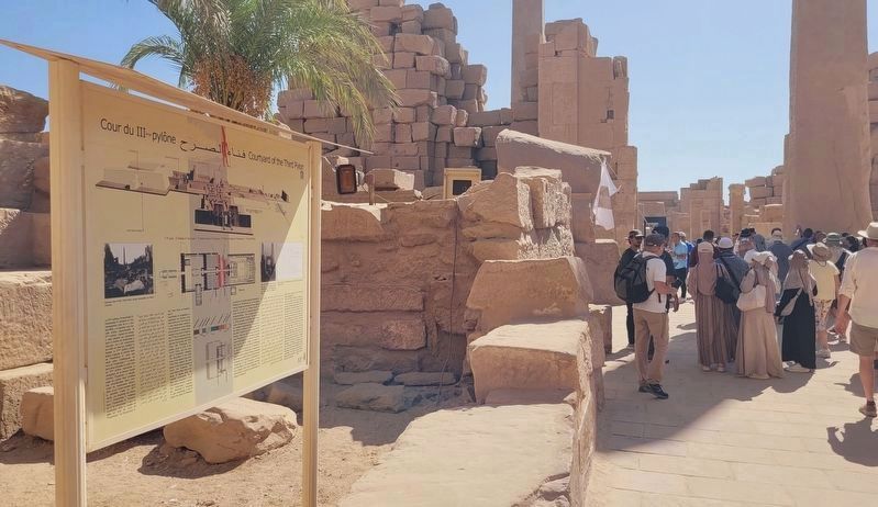
2. The view of the marker in the Courtyard of the Third Pylon
The bottom section of the Thutmosis I obelisk is located at the far right in the photo.
Photographed by James Hulse, October 10, 2024
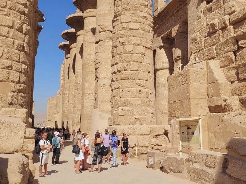
3. The marker is located next to the Third Pylon
The Hypostyle Hall is located in the background of the photo.
Photographed by James Hulse, October 10, 2024
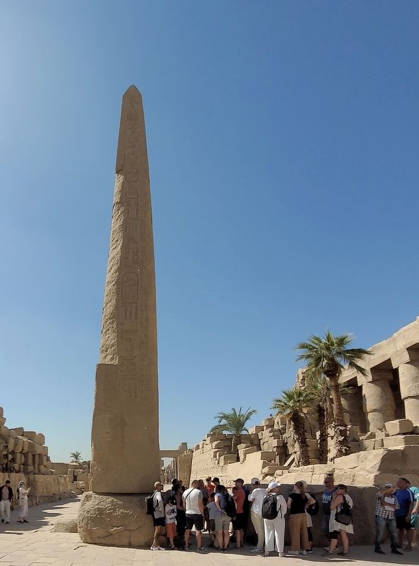
4. The view of the Thutmosis I Obelisk in the Courtyard of the Third Pylon
Credits. This page was last revised on August 23, 2026. It was originally submitted on November 7, 2025, by James Hulse of Medina, Texas. This page has been viewed 75 times since then and 43 times this year. Photos: 1, 2, 3, 4. submitted on November 10, 2025, by James Hulse of Medina, Texas.
