Papillion in Sarpy County, Nebraska — The American Midwest (Upper Plains)
A History of Devastating Floods

Photographed by Cosmos Mariner, September 15, 2025
1. A History of Devastating Floods Marker
On May 20, 1903, torrential rain caused the Papio Creek to overflow its banks, submerging much of Papillion. Many of the town's plank sidewalks were washed away. The flour mill was also pulled off its foundation and left sitting in the middle of Washington Street. The Papillion Times, located in the basement of the A.W. Clarke Building, sustained heavy water damage. Members of the community joined together to help pump water out of the offices. Unfortunately, many of the newspaper's archives were lost. Less than a week after the first flood, another smaller flood struck Papillion. This flood was less devastating, but it added to the damage and greatly impeded local clean-up efforts that were still underway from the first flood.
Another devastating flood hit on June 5, 1917. Heavy rains and violent winds caused an unexpected rise in the Papio Creek waters. No residents lost their lives due to the swift actions of locals; however, there were huge material losses and damages during the event.
On August 2, 1959, hail and high winds ripped through town. The next day was followed by upwards of 10 inches of heavy rain, causing
this page online
The Flood of 1964
The worst flood in Papillion's history occurred on June 16, 1964. Large hail, ferocious winds, and several inches of rain caused the creek's waters to come all the way to the front steps of the new high school, which was on the east side of South Washington (currently the Papillion Middle School). The rapid rise of Papio Creek caught most businesses

Courtesy Sarpy County Museum
2. Marker detail: Papillion experienced a number of devastating floods
Erected by Historic Downtown Papillion Walking Tour. (Marker Number 14.)
Topics. This historical marker is listed in these topic lists: Disasters • Waterways & Vessels. A significant historical date for this entry is June 16, 1964.
Location. 41° 9.378′ N, 96° 2.586′ W. Marker is in Papillion, Nebraska, in Sarpy County. It is at the intersection of South Washington Street and West First Street, on the left when traveling north on South Washington Street. The marker is located along the sidewalk at the northeast corner of First Street Plaza. Touch for map. Marker is at or near this postal address: 102 South Washington Street, Papillion NE 68046, United States of America. Touch for directions.

Regionally, this marker is

Courtesy Papillion Area Historical Society & Jim Miller
3. Marker detail: Flooding significantly affected the Papio Creek Bridge
The basic board span bridge was first taken out by flooding in 1899. Pictured are residents on the timber bridge, which replaced the original bridge in 1899. In 1922, this was replaced with a concrete bridge. In 1959, a storm caused the bridge to collapse. A temporary crossing structure was built until a new bridge opened in 1961.
Other nearby markers. At least 8 other markers are within walking distance of this marker: Flourishing Papillion Businesses (within shouting distance of this marker); Evolution of Washington Street Businesses (within shouting distance of this marker); Sander House & Golden Rule (within shouting distance of this marker); Thriving Papillion Businesses (about 400 feet away, measured in a direct line); Papillion's First Jail & The Sander's Store (about 400 feet away); Booming Businesses in the Early 1900s (about 400 feet away); County Seat & Papillion's First Courthouse (about 400 feet away); Papillion Boy Scouts Cabin (about 400 feet away). Touch for a list and map of all markers in Papillion.
Related markers. Click here for a list of markers that are related to this marker. Historic Downtown Papillion Walking
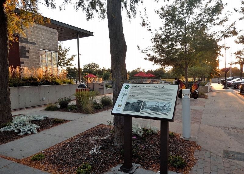
Photographed by Cosmos Mariner, September 15, 2025
4. A History of Devastating Floods Marker
Looking west from South Washington Street. First Street Plaza is in the background.
Also see . . . Unprecedented Damage (Papio Missouri River Natural Resources District).
Excerpt: The flood in 1964 took 7 lives and left an underprepared Omaha metro in devastation. On June 16 and 17 in 1964, seven people lost their lives and millions of dollars in personal property losses occurred. Ninety-five trailer homes were swept more than half a mile downstream by torrential flooding in the Millard area. During that storm, eight inches of rain falling for three hours on Hell Creek flowing down from Boys Town into the West Papio Creek created a roaring torrent of water 50 feet wide with waves five feet high. In its wake, houses were moved off their foundations and garages were destroyed.(Submitted on November 12, 2025, by Cosmos Mariner of Cape Canaveral, Florida.)
After the flood of 1964, the Papio NRD went to work – building dams and dynamic flood mitigation systems throughout the District to reduce the risk of flooding and mitigate the considerable loss of life and property during future flood events. In the Papillion area, levee and channel improvement projects certainly proved themselves, especially in 2019.
Credits. This page was last revised on November 14, 2025. It was originally submitted on November 8, 2025, by Cosmos Mariner of Cape Canaveral, Florida. This page has been viewed 148 times since then and 105 times this year. Photos: 1. submitted on November 11, 2025, by Cosmos Mariner of Cape Canaveral, Florida. 2, 3, 4. submitted on November 12, 2025, by Cosmos Mariner of Cape Canaveral, Florida.
